Kavel 480
480
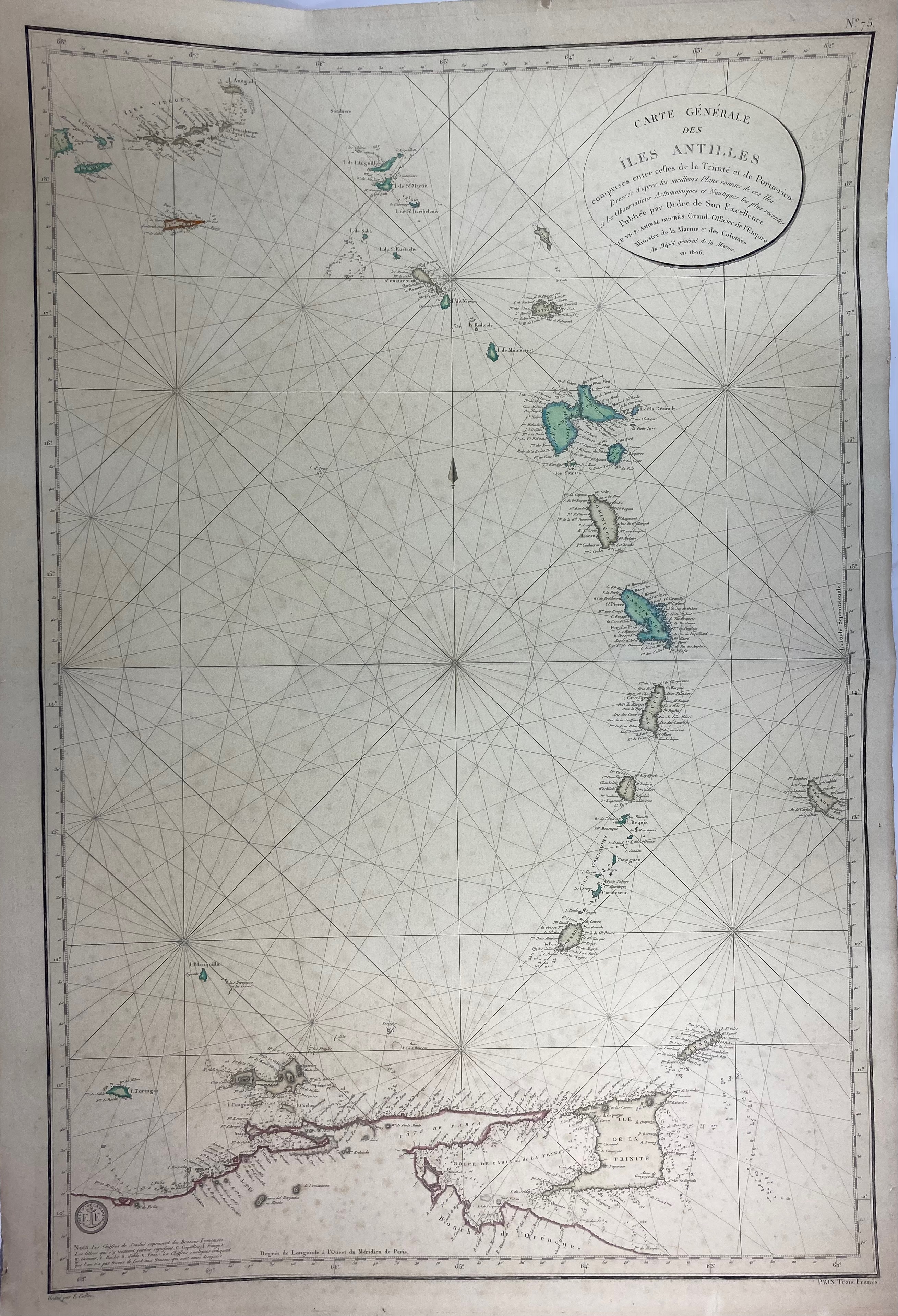
SOUTH AMERICA -- CARIBBEAN -- "CARTE GÉNÉRALE DES ÎLES ANTILLES comprises entre celles de la Trinité et de Porto-rico". (Paris), Ministre de la Marine et des Colonies, 1806 (later issue?). Very detailed cold. engr. chart of the Antilles by E. Collin. 920 x 620 mm. (A bit age-toned/foxed, but in good condition).
€ 150
uitslag € 120
Terug