Kavel 479
479
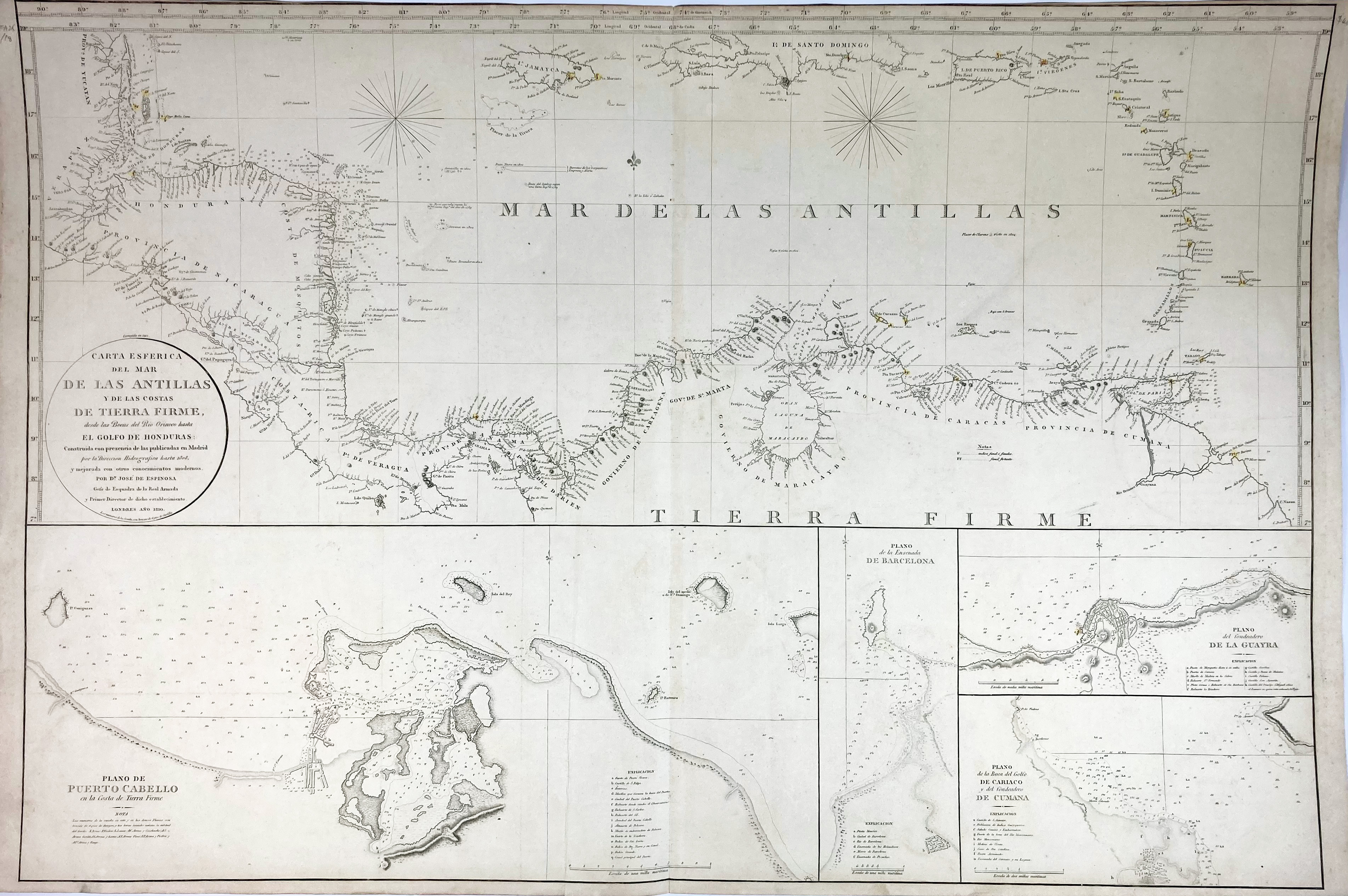
SOUTH AMERICA -- CARIBBEAN -- "CARTA ESFERICA DEL MAR DE LAS ANTILLAS y de las Costas de Tierra Firme, Desde las Bocas del Rio Orinoco Hasta el Golfo de Honduras (…). Construida (…) por la Direccion de Hidrografica hasta 1808, (…) por J. de Espinosa". London, 1810. Plain engr. coastal chart. 650 x 980 mm. (A bit age-toned, but in good condition).
This large scale chart depicts the coastlines surrounding the Caribbean Sea, from Belize to Venezuela, including the Caribbean islands from Jamaica through the Lesser Antilles. Below the map are insets of 4 Venezuelan ports: Puerto Cabello, Barcelona, La Guaira, and Cumana.€ 200
uitslag € 160
Terug