Kavel 383
383
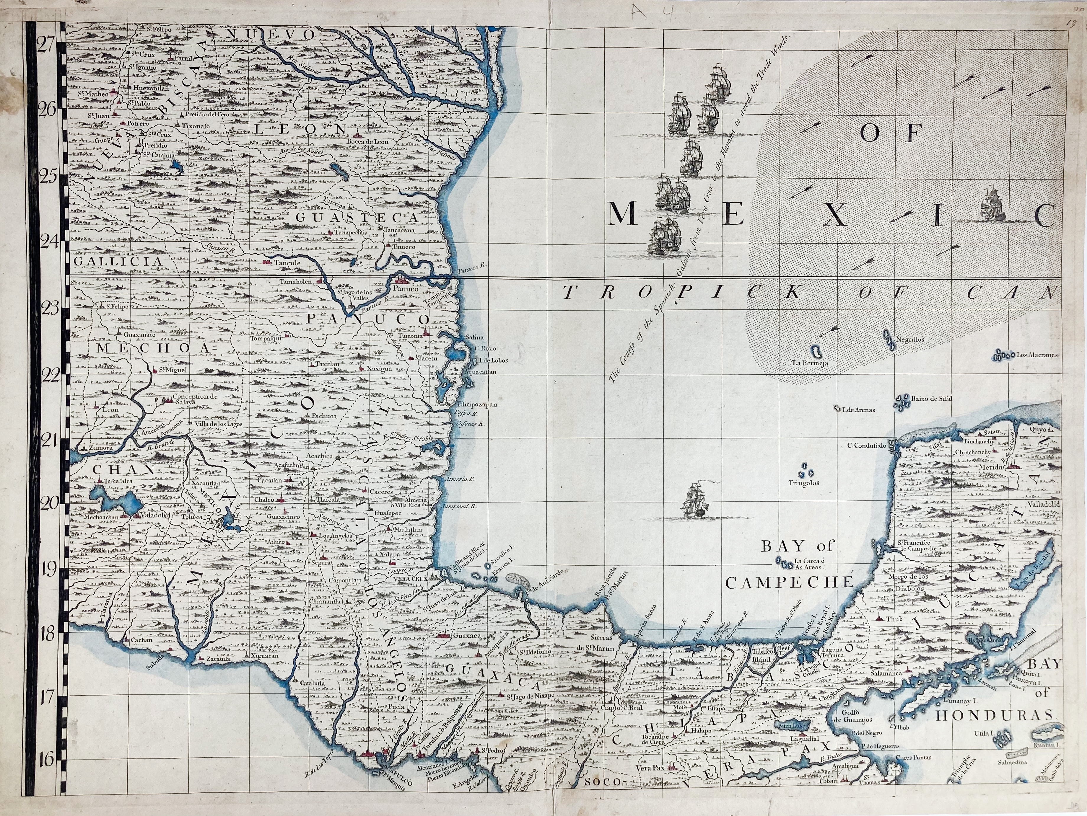
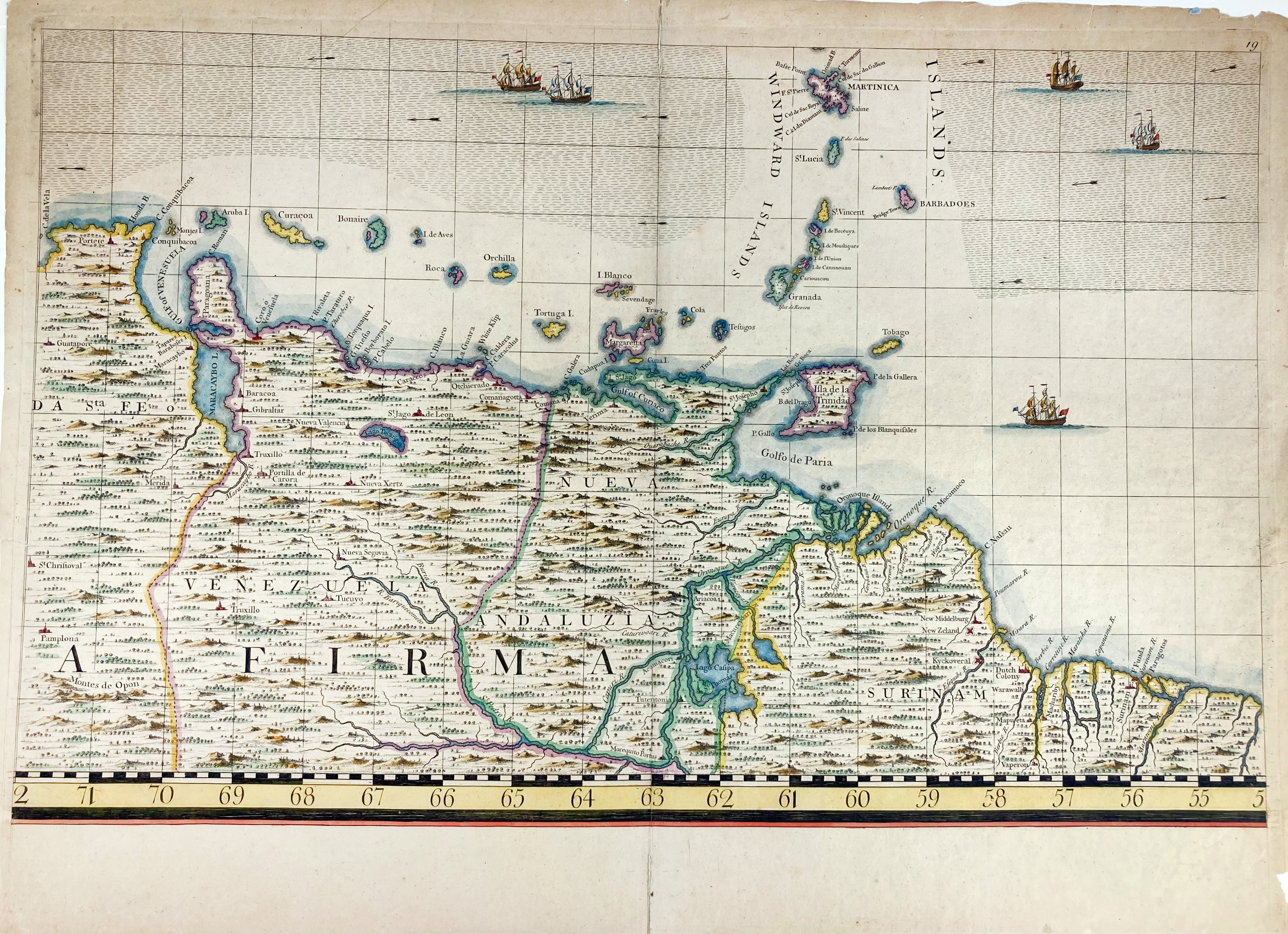
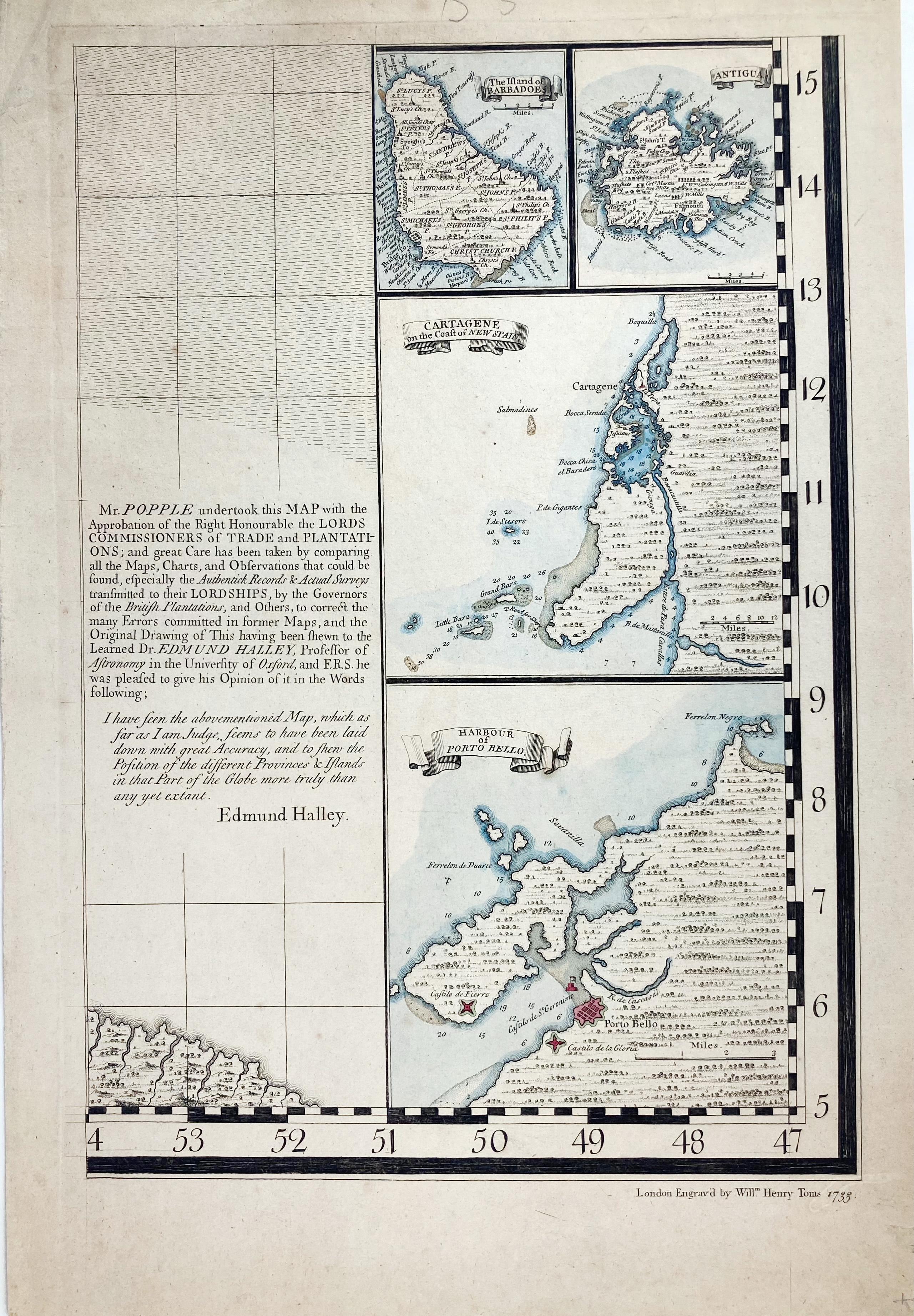
AMERICA -- POPPLE -- ("MAP OF THE BRITISH EMPIRE in America with the French and Spanish Settlements Adjacent Therto, A"). London, W.H. Toms, 1733. 3 engr. maps (of 20) by H. Popple, cold. by hand. c. 700 x 505 (2x) and 500 x 315 mm. (Colouring of the maps is different, section 19 w. some marginal wear & tear (not affecting the image)).
Probably all from the 2nd edition (first 1732) of this "(…) largest and best map of America" (Sabin 64140). Present are sections 13, 19 and 20 of this enormous wall map. Section 20 w. inset maps of Barbados, Antigua, Cartagene and the Harbour of Porto Bello. - Rumsey 2874.015; 2874.021 & 2874.022.€ 300
uitslag € 500
Terug