Kavel 494
494
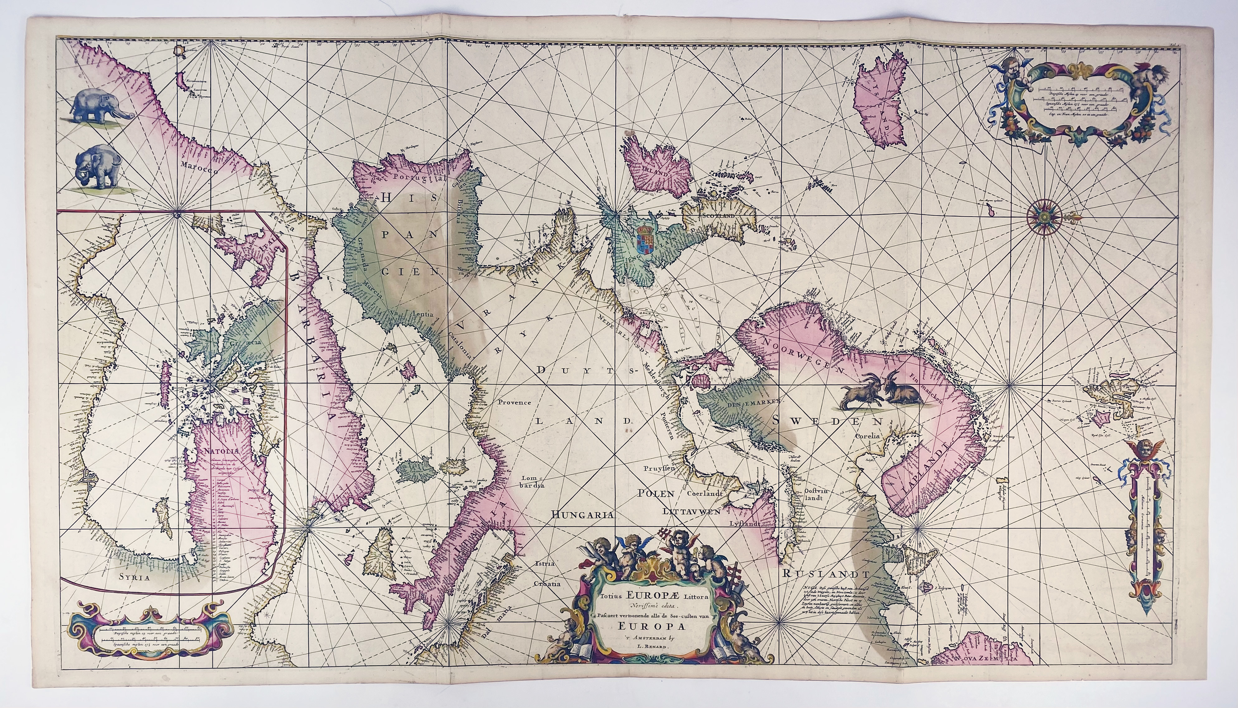
SEA CHARTS -- "TOTIUS EUROPAE LITTORA novissime adita. Pascaert vertoonende alle de See-custen van Europa". Amst., L. Renard, (c. 1715). Large cont. handcold. engr. map on 2 joined sheets. W. compass rose and 3 cartouches. 490 x 885 mm. (Sl. age-toned).
Portolan-style sea chart with west at the top. It covers the Atlantic coastlines from northwest Africa to Greenland, the Mediterranean, and the North Sea; thus covering from Iceland to Nova Zemla and from Spitzbergen to Morocco. Inset at left is a continuation chart of the Eastern Mediterranean that covers the interior of northern Africa. Printed after the chart by F. de Wit (1675), for Renard's "Atlas de la Navigation et du Commerce" (1715). - Koeman IV, Ren 1.€ 1200
uitslag € 1600
Terug