Kavel 489
489
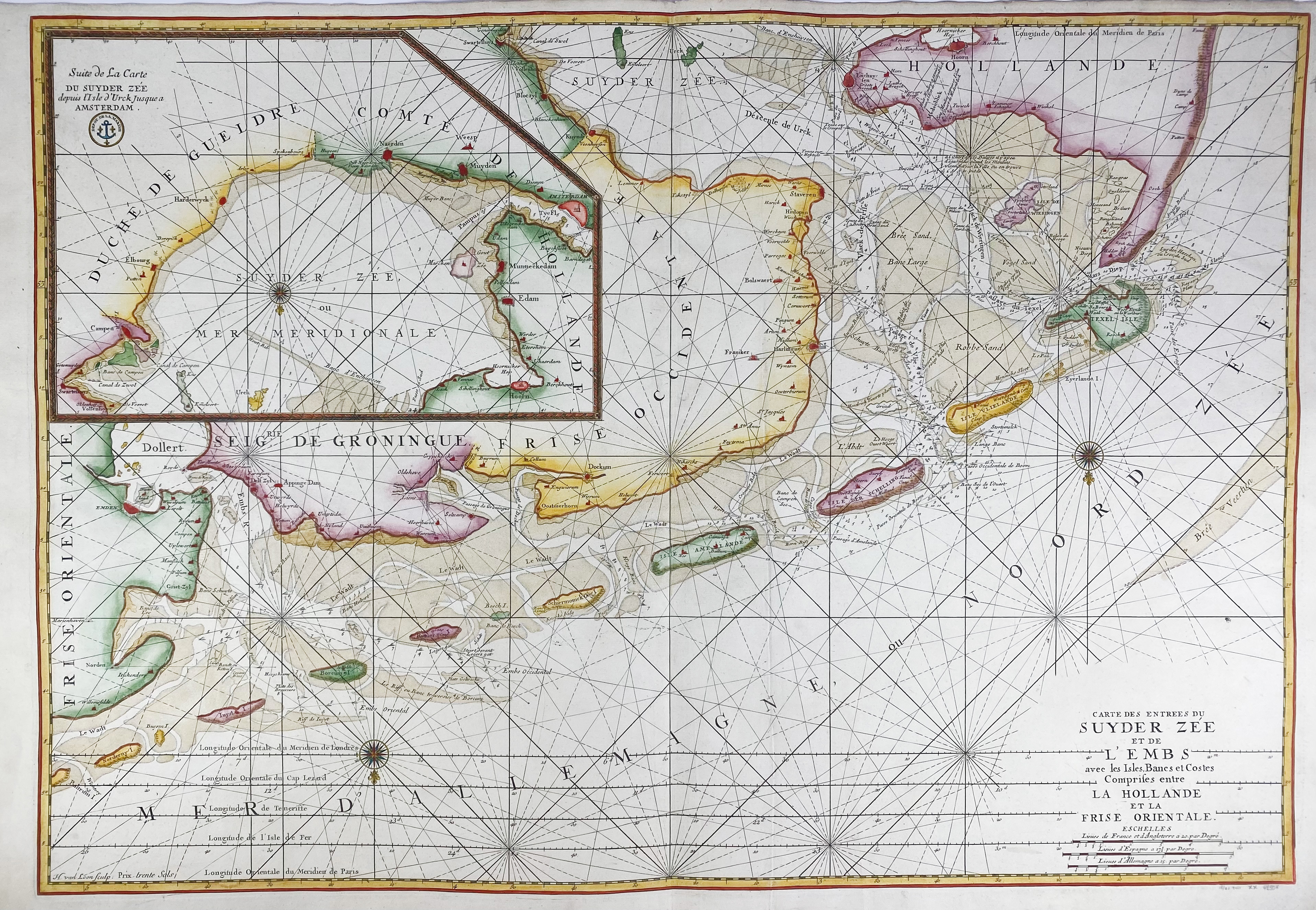
SEA CHARTS -- "CARTE DES ENTRÉES du Suyder-Zee et de l'Embs avec les Isles, Bancs et Costes Comprises entre la Hollande et la Frise Orientale". Paris, Dépôt des Cartes et Plans de la Marine, (c. 1760). Engr. chart by H. v. Loon on 2 sheets in fine cont. colouring. 610 x 880 mm.
Very large nautical chart depicting the coasts of German Frisia, Groningen, Friesland and North Holland, including the Northern part and the entrance to the Zuiderzee (IJsselmeer), as seen from the North. With three compass roses and an inset map of the Southern part of the Zuiderzee. Taken from 'Le Neptune François, ou Atlas Nouveau des Cartes Marines'. - Cf. Koeman IV, 423-4.€ 400
uitslag € 320
Terug