Kavel 380
380
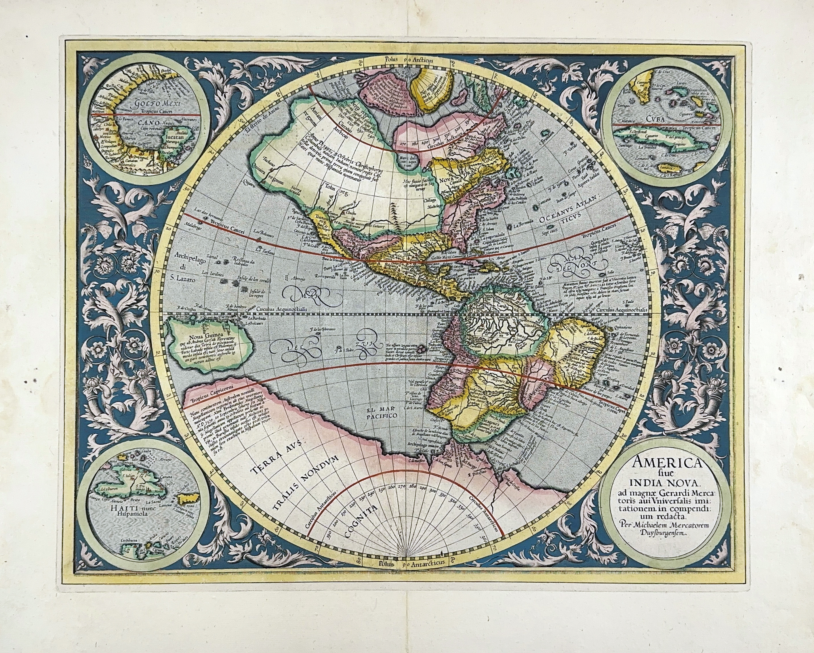
AMERICA -- "AMERICA SIVE INDIA NOVA". (Duisburg, Mercator Heirs, 1595). Engr. circular map of the western hemisphere in beautiful handcolouring, surrounded by 3 inset circular maps of Cuba, Haiti and the Gulf of Mexico in each corner, the title set in the fourth. 370 x 460 mm. (Professionally remargined).
The only printed map known by Michael Mercator, grandson of Gerard. Very rare early edition of the map, with no text on v°, only "America", a decorated cartouche and "E". - Koeman Me12 (1595B); V.d. Krogt I, 9000:1A (1:011/012); Burden, The Mapping of America, 87 (1595 E): "A few of the most famous theories are still present: a large inland lake in Canada, two of the four islands of the North Pole, a bulge to the west coast of South America and the large southern continent. It does not show any knowledge of the English in Virginia, which is possibly a reflection of their failure by then. A large St. Lawrence River is shown originating half way across the continent (…)".€ 1500
uitslag € 2000
Terug