Kavel 462
462
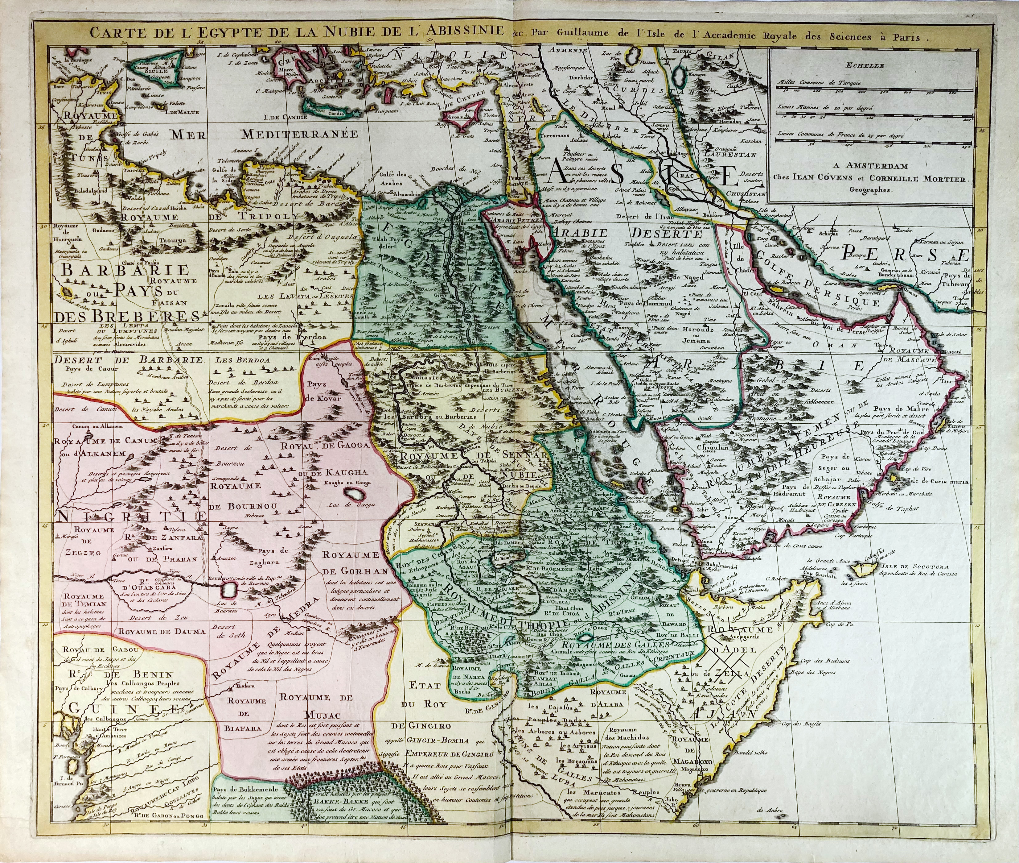
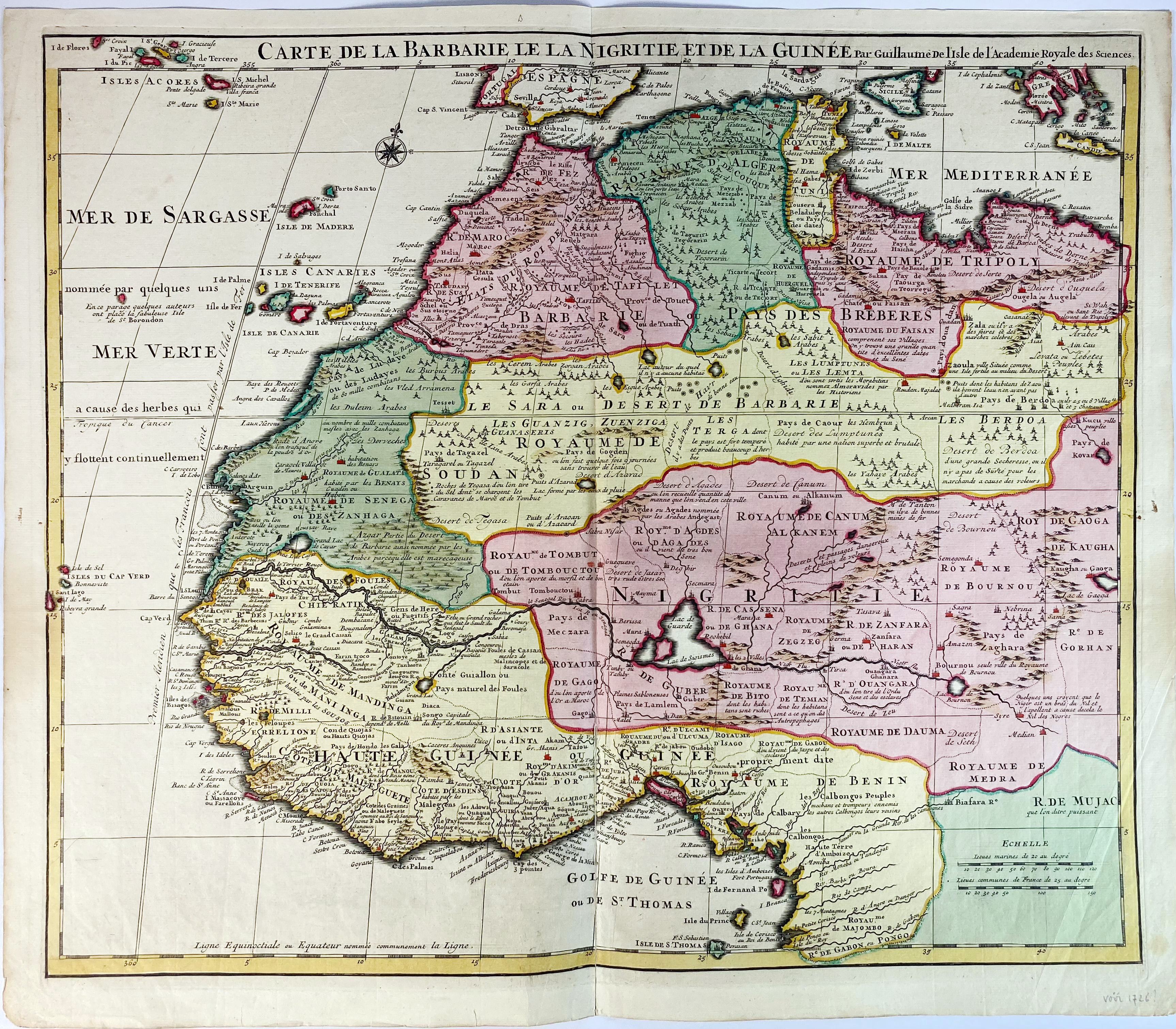
AFRICA -- "CARTE de l'EGYPTE de la Nubie de l'Abissinie &c. (…)." Amst., J. Covens & C. Mortier, (n.d., ±1710). Engr. map in cont. colouring, of a large part of the Eastern part of North Africa, Arabia and the Mediterranean Sea after G. de l'Isle. 510 x 595 mm. -- Added: "CARTE DE LA BARBARIE, le la Nigritie et de la Guinée". (Paris, ±1707). Engr. map in cont. colouring, of a large part of the Eastern part of North Africa and the Mediterranean Sea after G. de l'Isle. 500 x 577 mm. (Lower part central fold reinforced on v°, but in v.g. condition). -- (2).
€ 180
uitslag € 160
Terug