Kavel 1111
1111
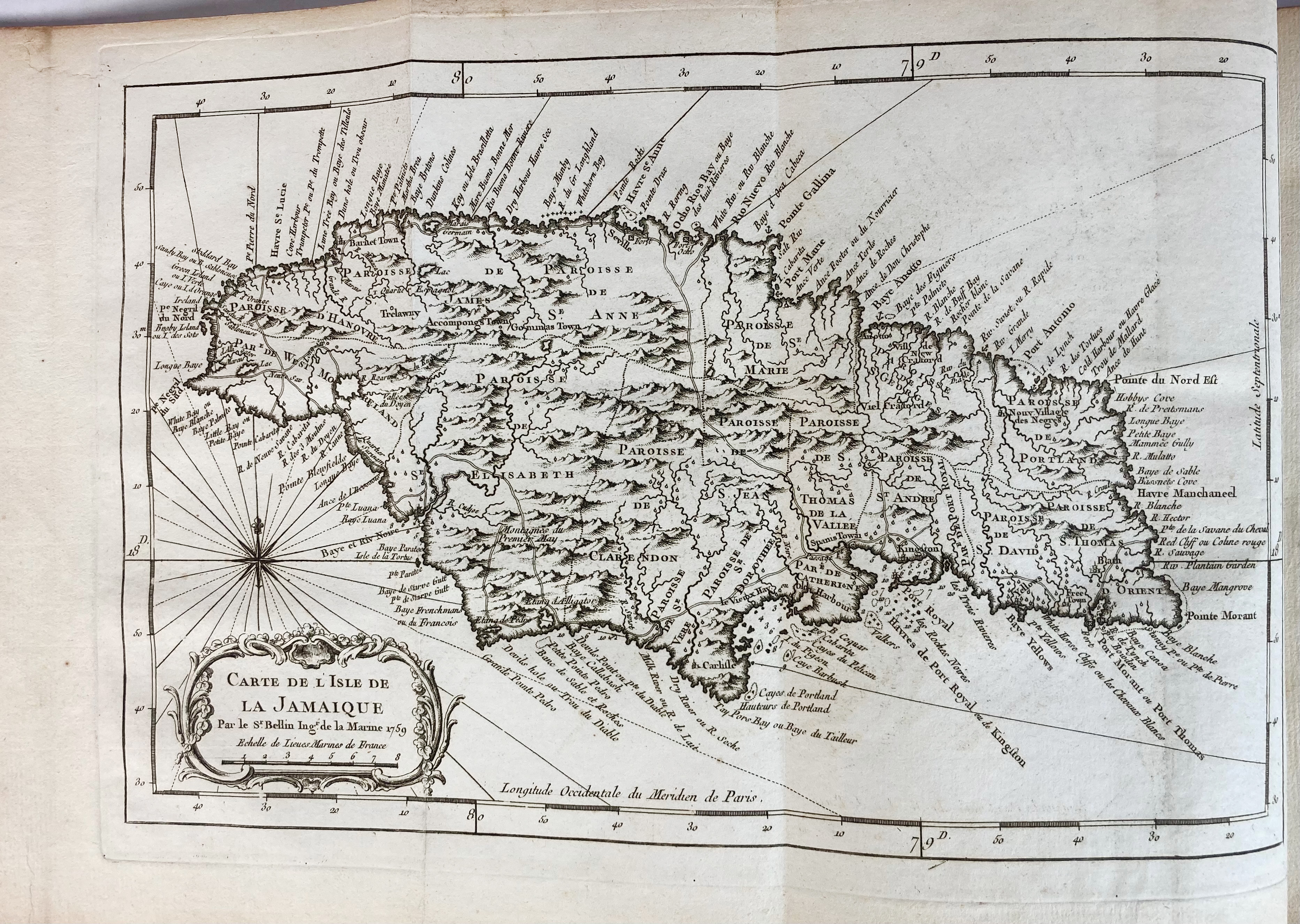
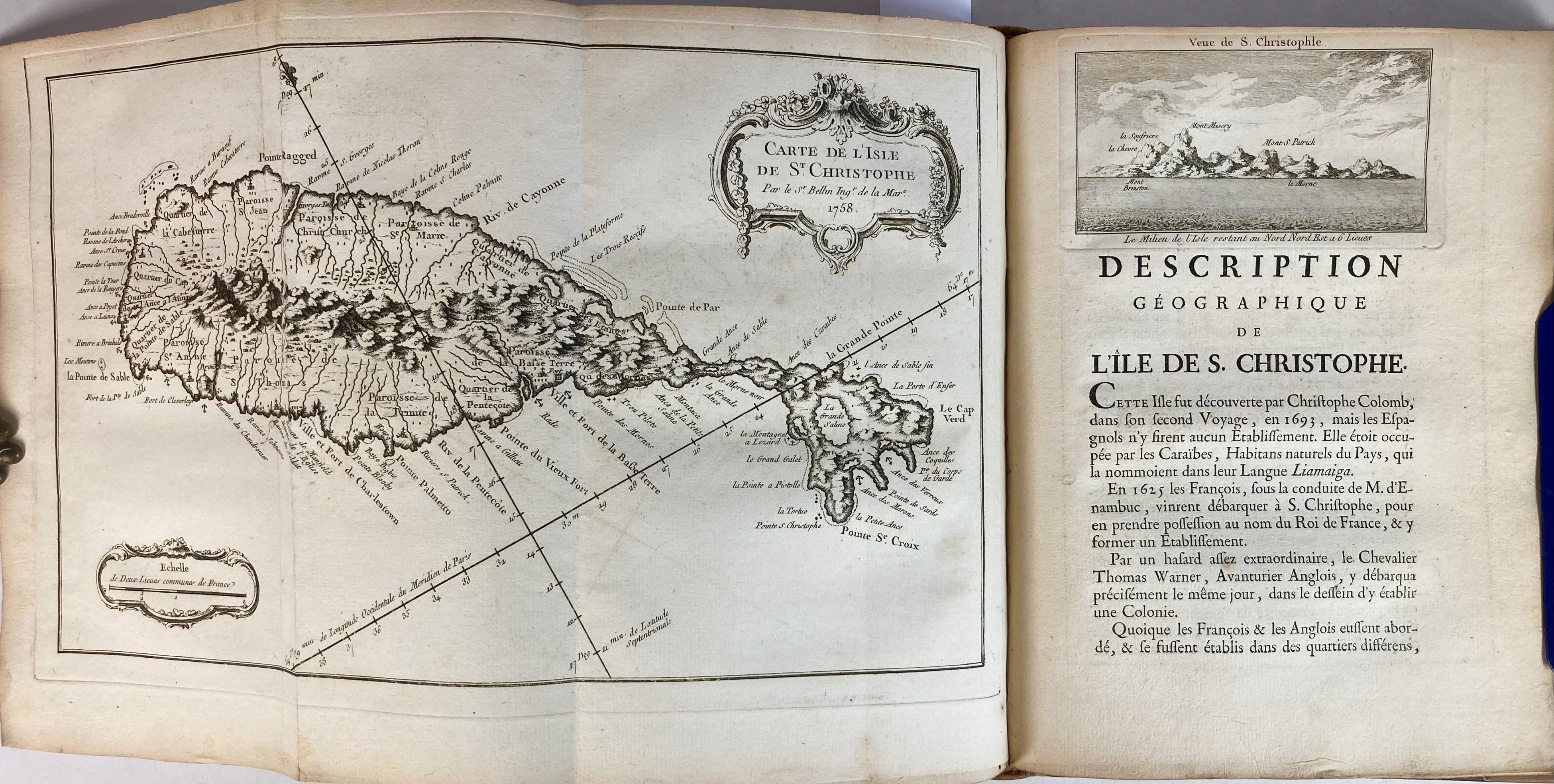
SOUTH AMERICA -- ANTILLES -- (BELLIN, J.-N.). Description géographique des isles Antilles possedées par les Anglois. Scavoir La Jamaique, La Barbade, Antigue, Montserrat, S. Christophle, Nieves, l'Anguille, et les Vierges Isles Lucayes et Bermudes. (Paris, Didot, 1758). xii, 171 pp. W. engr. title by P.P. Choffard, 13 engr. maps (8 fold. and 3 full-p engr. cold. by hand), 10 engr. in text (of which 9 fine coastal profiles). 4°. Mod. hcf. w. marbled paper sides. (Slightly browned, but a v.g. copy).
The maps - all made after surveys of Bellin himself - depict i.a. the Gulf of Mexico, Jamaica, Virgin Islands, Bermuda archipelago, etc. - First edition. Sabin 4553.€ 1200
uitslag € 950
Terug