Kavel 1023
1023
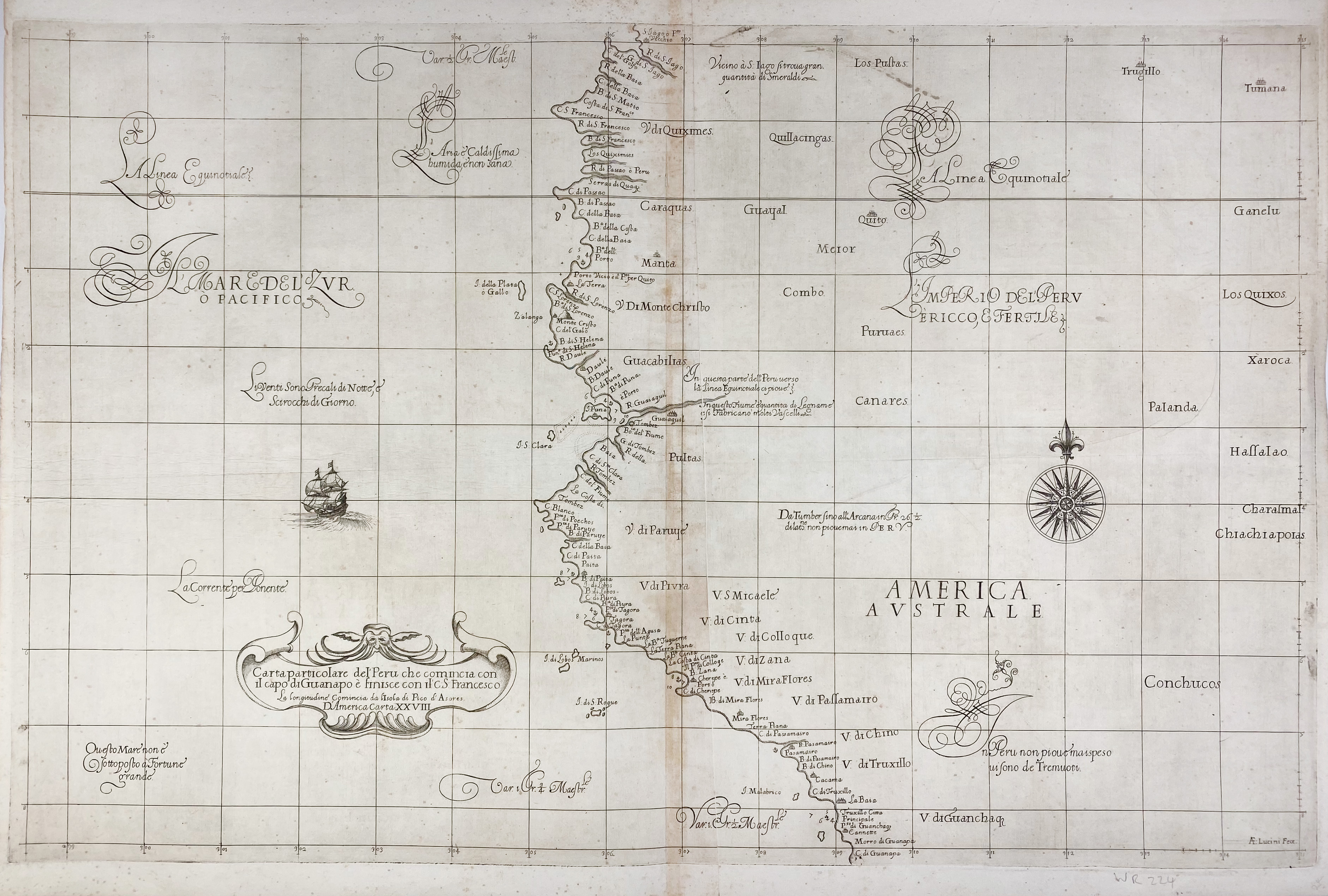
SOUTH AMERICA -- PERU -- "CARTA PARTICOLARE del'Peru che comincia con il capo di Guanapo e finisce con il C:S: Francesco". (Florence, 1646). Plain engr. chart by R. Dudley, on 2 joined sheets. 485 x 755 mm. (A few sm. repairs on v°, a bit browned along the joint, some light foxing).
An elegant sea chart of the coastline of Ecuador and northern Peru, extending just south of Trujillo. Numerous place names are shown along the coast, as well as anchorages, soundings, and shoals. The equator is featured prominently towards the top of the chart, and Quito is depicted inland. The chart is embellished with Dudley's trademark calligraphic style, a strapwork title cartouche, a large compass rose, and a sailing ship. First state.€ 260
uitslag € 850
Terug