Kavel 417
417
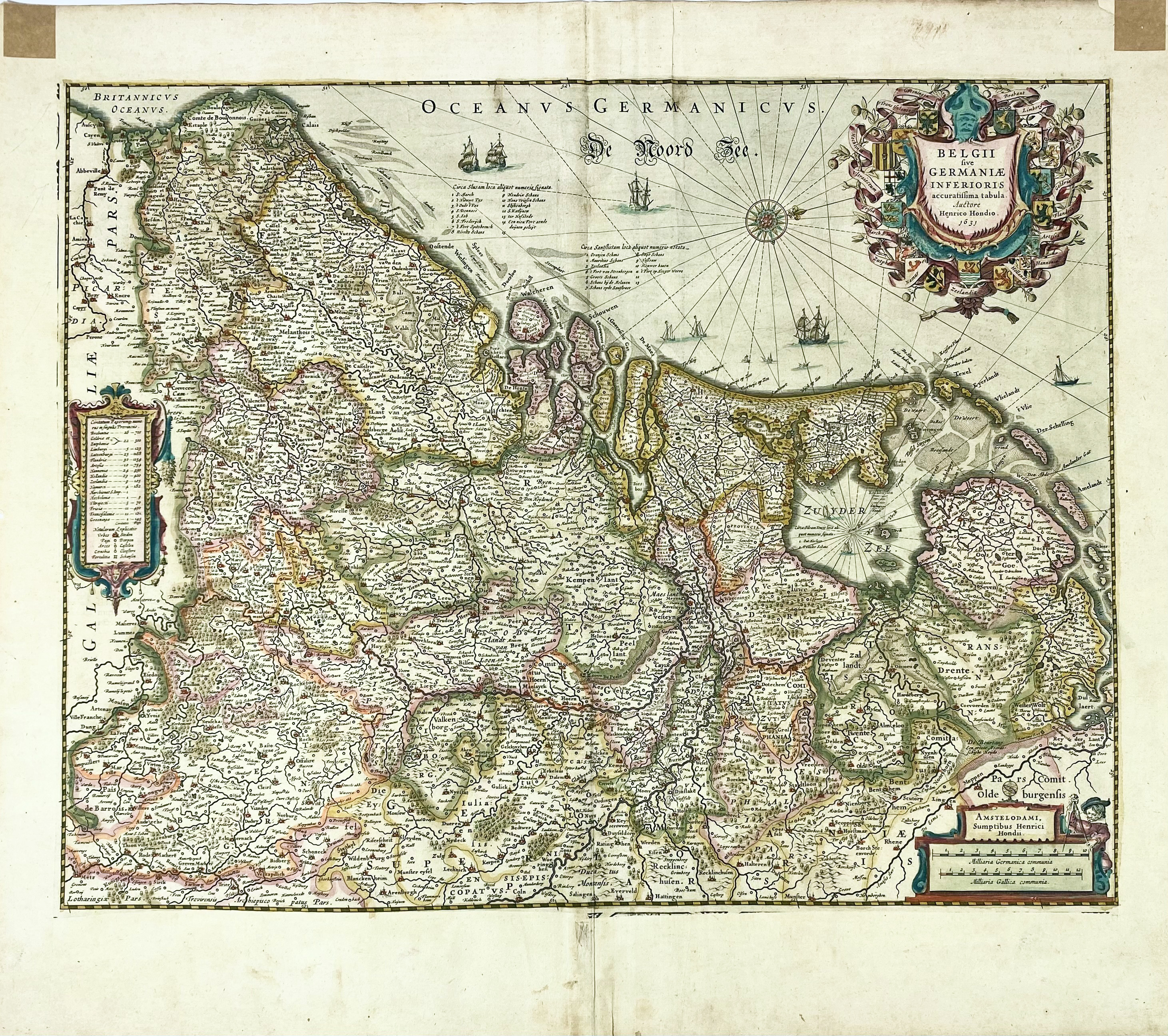
LOW COUNTRIES -- "BELGII SIVE GERMANIAE INFERIORIS, accuratissima tabula". Amst., H. Hondius, 1631 (dated in the plate). Engr. handcold. map, w. 3 cartouches, ships and a compass rose. 390 x 505 mm. (Remnants of hinges in upper margin, a few sm. marg. rep./stains, sl. browned).
Latin text on v°. Van der Krogt 3000:1C; Van der Heijden 92, the 2nd state (of 4), with the ornamental borders of the 1st state masked.€ 200
uitslag € 200
Terug