Kavel 610
610
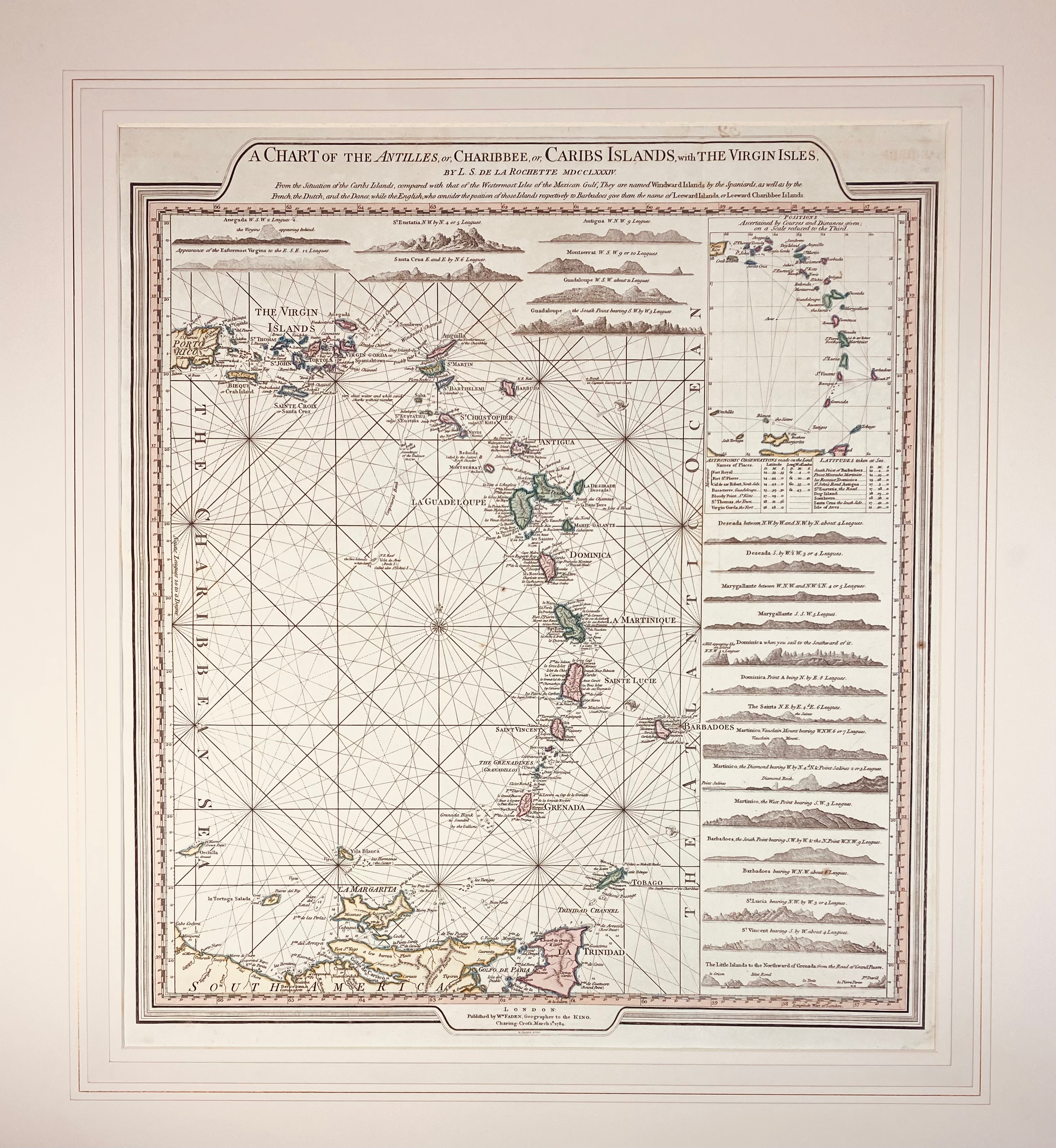
SOUTH AMERICA -- CARIBBEAN -- "A CHART OF THE ANTILLES, or, Charibbee, or, Caribs Islands, with the Virgin Isles". By L.S. de la Rochette. Lond., W. Faden, 1784. Engr. sea chart in cont. col. 535 x 485 mm. Hinged to mount & under passepartout. (Apart from a few (foxing) spots in good condition).
Detailed sea chart alongside profile views of the Antilles, from the Virgin Islands and Puerto Rico in the North, to Trinidad in the South.€ 280
uitslag € 450
Terug