Kavel 609
609
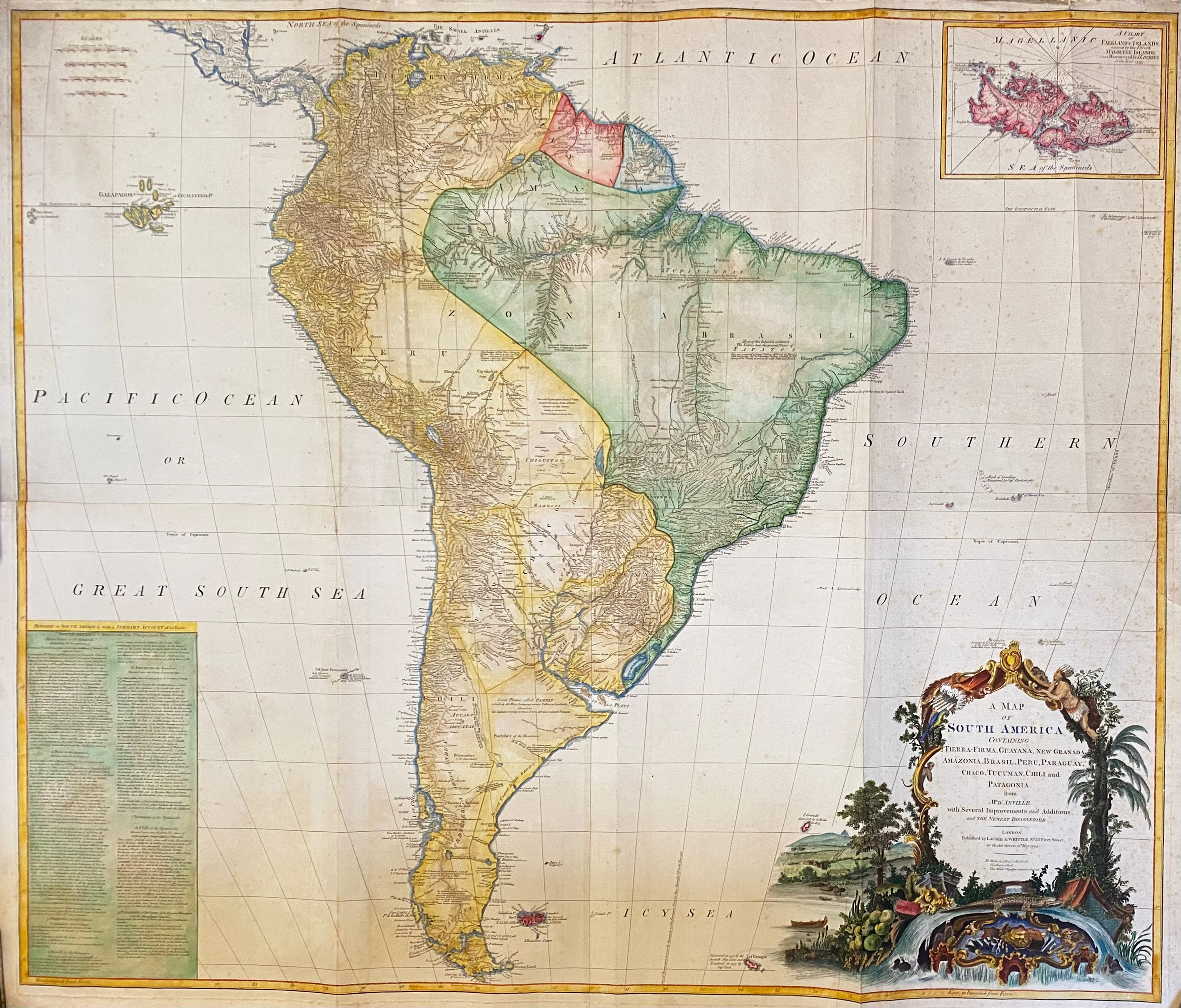
SOUTH AMERICA -- "A MAP OF SOUTH AMERICA containing Tierra-Firma, Guayana, New Granada Amazonia, Brasil, Peru, Paraguay, Chaco, Tucuman, Chili and Patagonia. From Mr. D'Anville". Lond., Laurie & Whittle, 1794. Engr. map with inset chart of the Falkland's Islands, large decorative cartouche in the lower right corner, in cont. handcolouring, on 4 conjoined plates. Total size: 1040 x 1220 mm. (Margins a bit creased, a few small rep. on v°, upper margin a bit dustsoiled on the right side, 1 blind stamp in right margin, sl. foxed/browned in places).
Large wall map, published in Kitchen's General Atlas.€ 600
uitslag € 0
Terug