Kavel 935
935
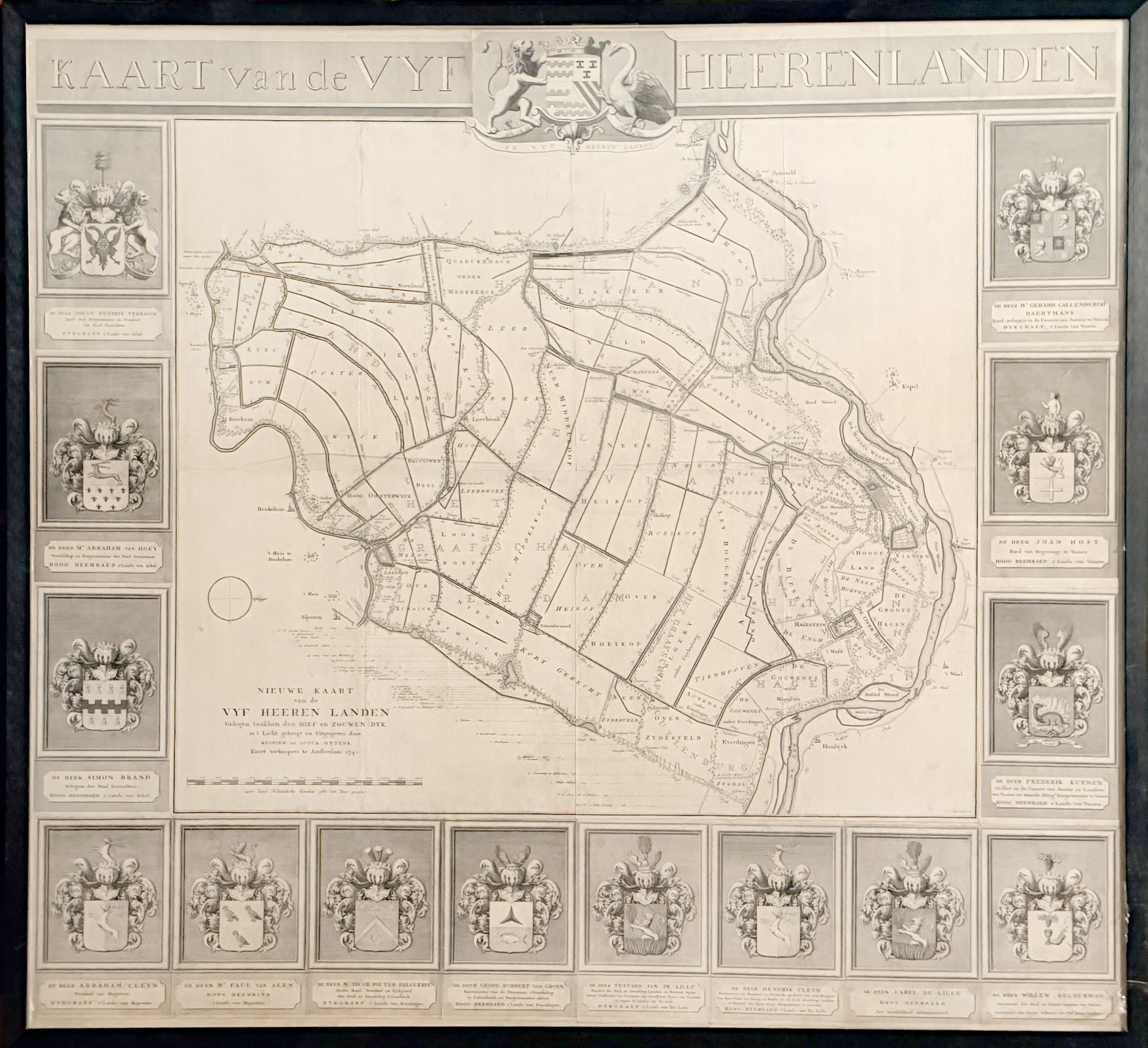
LOW COUNTRIES -- UTRECHT -- "NIEUWE KAART VAN DE VYF HEEREN LANDEN Gelegen tusschen den Dief en Zouwen Dyk, (…)". Amst., R. & J. Ottens, 1741. Plain engr. wall map, consisting of 4 conjoined sheets, and 17 surrounding plates, of which 14 represent family crests of members of the polder board and 3 a general title and coat of arms of Vijfheerenlanden. Framed. (Laid down on mount, tear in image visible in upper right quadrant, but in good condition).
Topographical wall map of the Vijfheerenlanden, a Dutch (polder) district south of Utrecht and the river Lek. The area is bordered by the Lek at the right, the river Linge at the left, the Diefdijk at the bottom and the Zouwendijk at the top, and includes the cities Vianen and Leerdam, and the towns and villages Ameide, Oosterwijk, Leerbroek, Lexmond, Nieuwland and Everdingen. First state. - Donkersloot-De Vrij 809; Fockema Andrae, Geschiedenis der kartografie van Nederland, p.72; Koeman, handleiding 184. - NB Can only be picked up or sent via our courier service.€ 900
uitslag € 600
Terug