Kavel 934
934
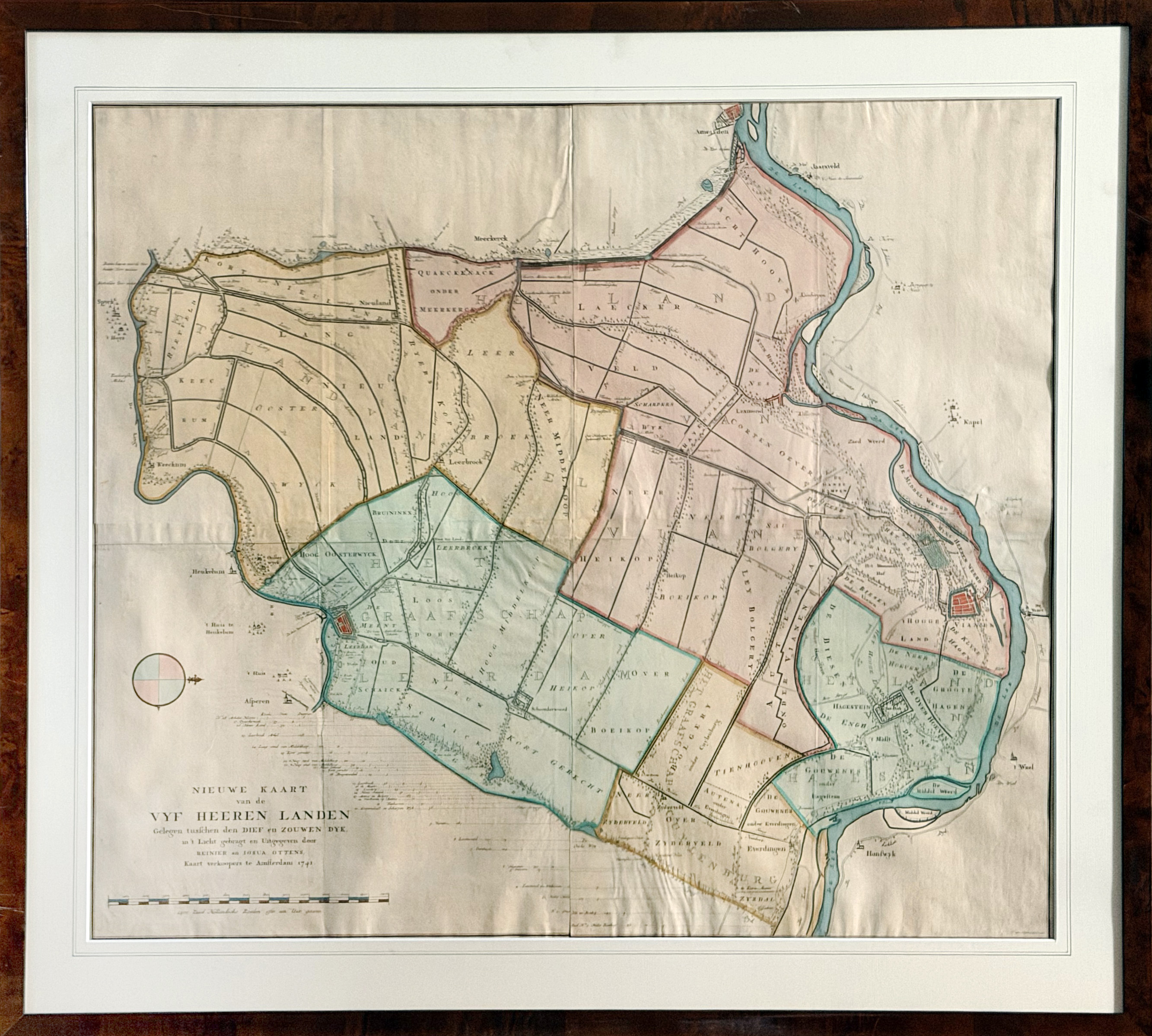
LOW COUNTRIES -- UTRECHT -- "NIEUWE KAART VAN DE VYF HEEREN LANDEN Gelegen tusschen den Dief en Zouwen Dyk, (…)". Amst., R. & J. Ottens, 1741. Engr. wall map, consisting of 4 conjoined sheets, in cont. handcolouring. 860 x 970 mm. In modern walnut wood imitation frame, glazed and under passepartout. (Not inspected out of frame, but seemingly not attached to any mount).
Topographical wall map of the Vijfheerenlanden, a Dutch (polder) district south of Utrecht and the river Lek. The area is bordered by the Lek at the right, the river Linge at the left, the Diefdijk at the bottom and the Zouwendijk at the top, and includes the cities Vianen and Leerdam, and the towns and villages Ameide, Oosterwijk, Leerbroek, Lexmond, Nieuwland and Everdingen. First state and a very good copy. - Donkersloot-De Vrij 809; Fockema Andrae, Geschiedenis der kartografie van Nederland, p.72; Koeman, handleiding 184. - NB Can only be picked up or sent via our courier service.€ 900
uitslag € 0
Terug