Kavel 503
503
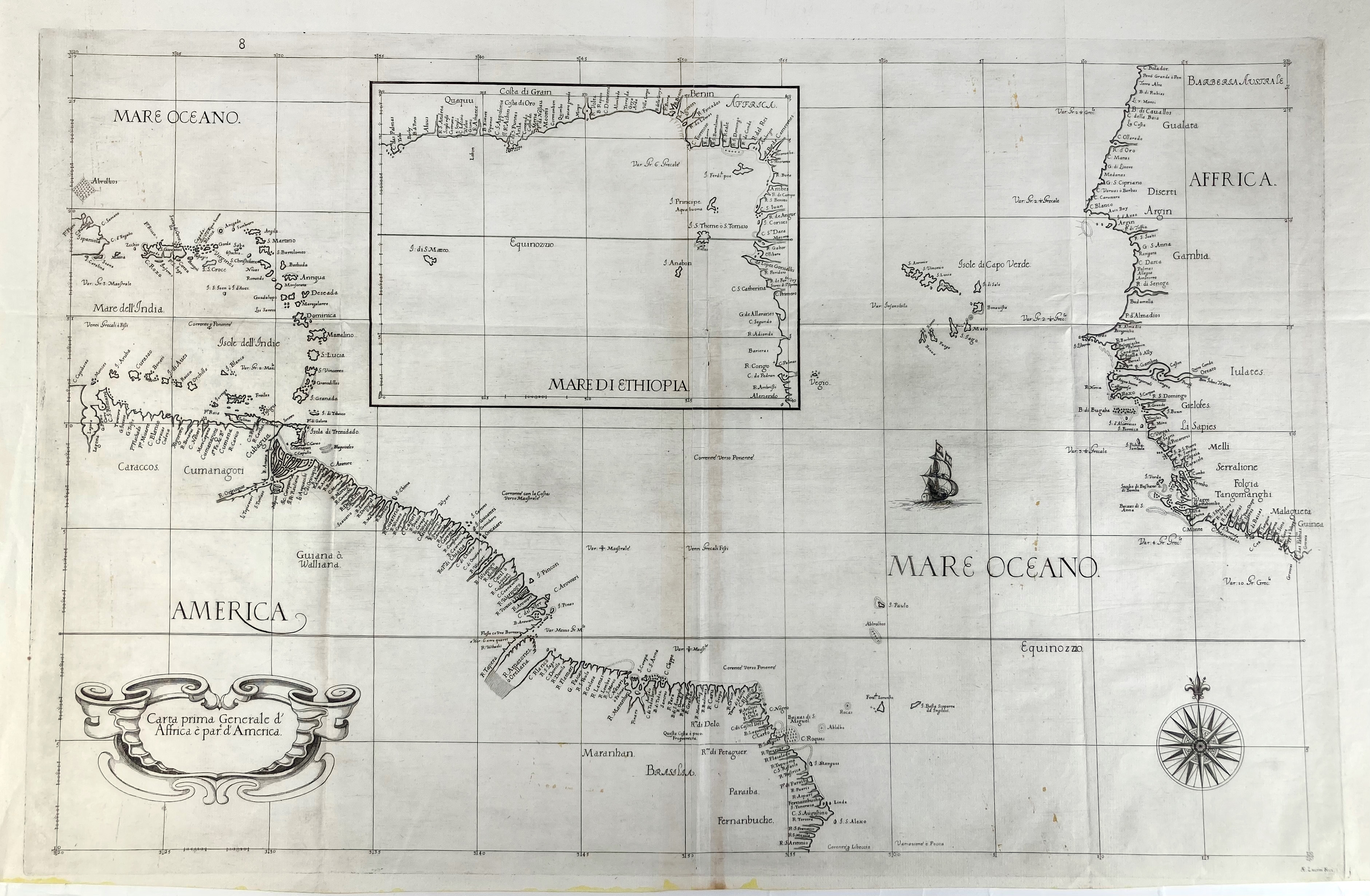
SOUTH AMERICA -- DUDLEY -- "CARTA PRIMA GENERALE d'Affrica è par d'America". (Florence, Francesco Onofri, c. 1646-47). Engr. chart after Robert Dudley by Anton Francesco Lucini, w. inset map of 'Mare di Ethiopia'. 475 x 735 mm. (W. 1 central vertical fold; in v.g. condition).
This first state map of the 'North Atlantic Ocean', including parts of the coastlines of Africa and South America, was compiled and published by Robert Dudley (1574-1649) in 'Dell Arcano del Mare' (secrets of the sea), a seminal 1646-47 six-volume atlas of navigation. - See also previous catalogue entry.€ 400
uitslag € 1100
Terug