Kavel 485
485
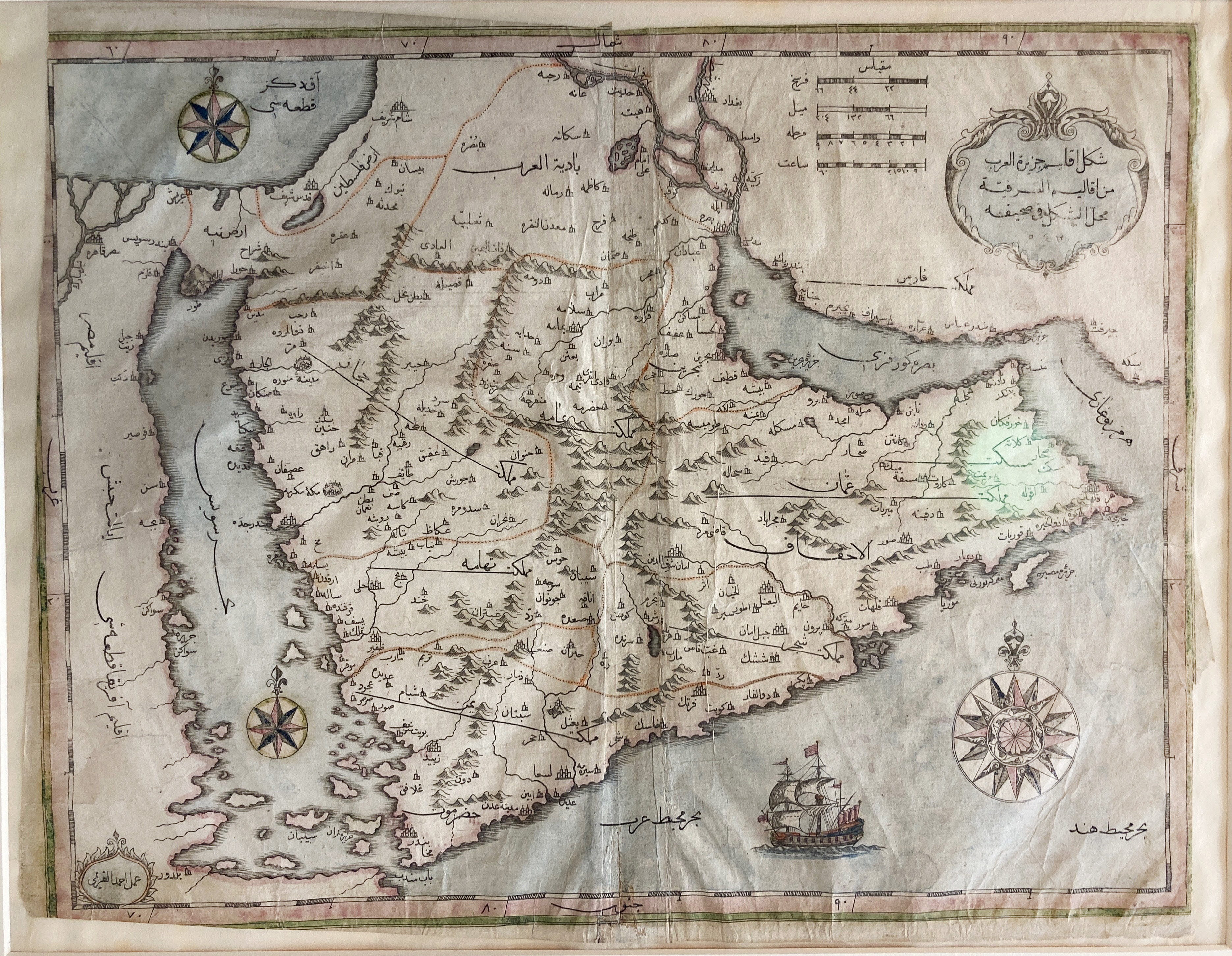
MIDDLE EAST -- ("MAP OF THE ARABIAN PENINSULA"). N.pl., n.d. (early 19th c.). Printed map on paper w. 2 compass roses, a ship in full sail and a title cartouche, cold. by hand. Title and all geographical indications in the Ottoman Turkish language, 'signed' Ali al-Qari (scribe?, cartographer?, copyist?) in lower left corner. Framed, glazed and under passepartout. (Margins short/los of margin in places, map surface slightly rumpled, uninspected out of frame).
€ 300
uitslag € 4000
Terug