Kavel 445
445
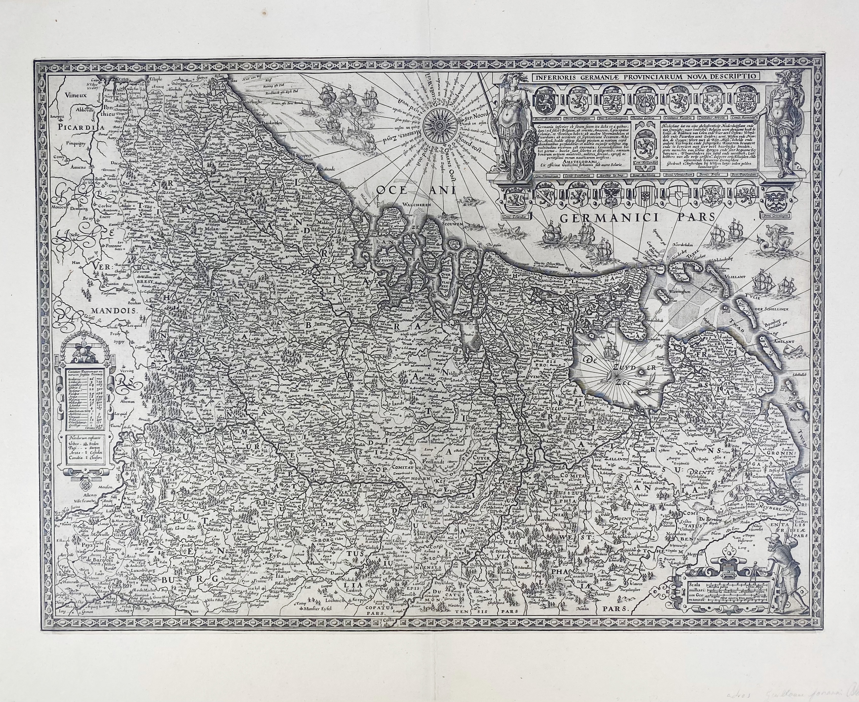
LOW COUNTRIES -- "INFERIORIS Germaniæ Provinciarum nova descriptio". Amst., W.J. Blaeu, (c. 1604). Plain engr. map, west at the top. W. compass rose, vessels, sea monsters, and a beautiful cartouche w. emblematic arms of the XVII Provinces. 415 x 567 mm. (Professionally remargined).
Very rare and decorative map of the XVII Provinces. One of the first maps published by the famous Dutch publisher Willem Jansz. Blaeu. The map is strongly influenced by Filips Galle's wall map of ca. 1578, known by Vrients' re-issue of 1605. Third state (of 4), without date. - In excellent condition. Van der Heijden 59/3; Schilder II, 166-67.€ 1200
uitslag € 1600
Terug