Kavel 406
406
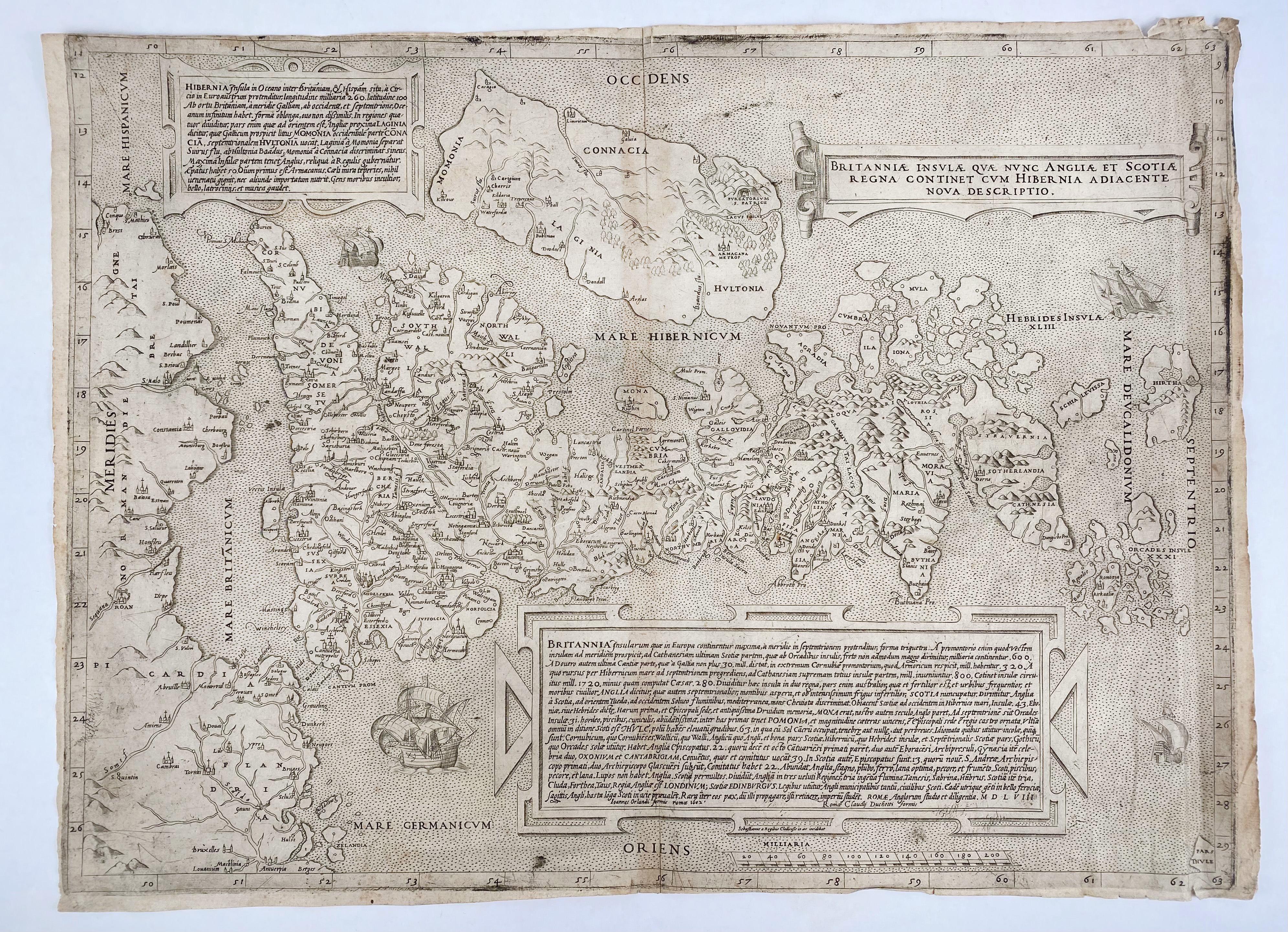
GREAT BRITAIN -- "BRITANNIAE INSULAE quae nunc Angliae et Scotiae regna continet cum Hibernia adiacente nova descriptio". Roma, G. Orlandi, 1602. Engr. map with the Sebastiano de Re da Chioggia imprint, orientated to the west with Ireland in the north, two panels with Latin text describe Ireland and Britain and a third one containing the title. 397 x 543 mm. (Margins cut short, in upper left margin touching the plate edge, margins a bit frayed in places and w. sm. tears, sl. browned/dust-soiled).
Reissue by Giovanni Orlandi of the 1558 map, which itself is a close copy of the first separately printed map of the whole of the British Isles produced in 1546 by George Lily. Its overall scale is reduced by about a third from the 1546 state. - Cf. Tooley nrs. 268 & 271 (1546 and 1558).€ 700
uitslag € 13000
Terug