Kavel 558
558
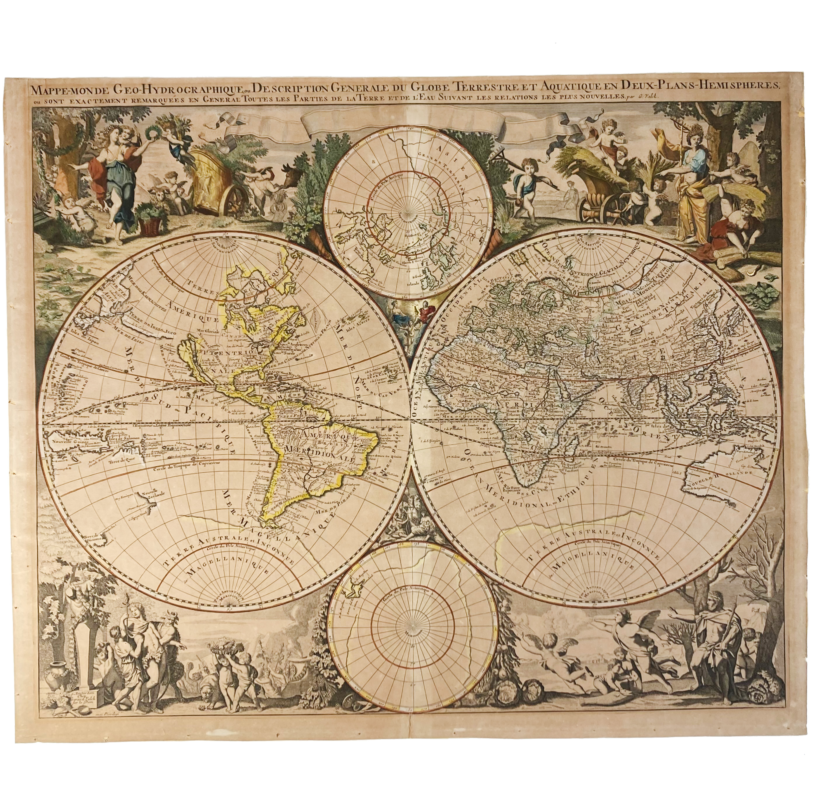
WORLD MAP -- "MAPPE-MONDE Geo-Hydrographique, ou Description Generale du Globe Terrestre et Aquatique en Deux-Plans-Hemispheres". Amst., G. Valck, n.d. (after 1687). Engr. map of the world, partly cold. by hand. 475 x 620 mm. (Severely browned, colouring faded, traces of former framing on v°).
NB W. caption above the image and not in the banner as this map also occurs. - Cf. Koeman III, p. 137. - Sold w.a.f., not subject to return.€ 600
uitslag € 1700
Terug