Kavel 555
555
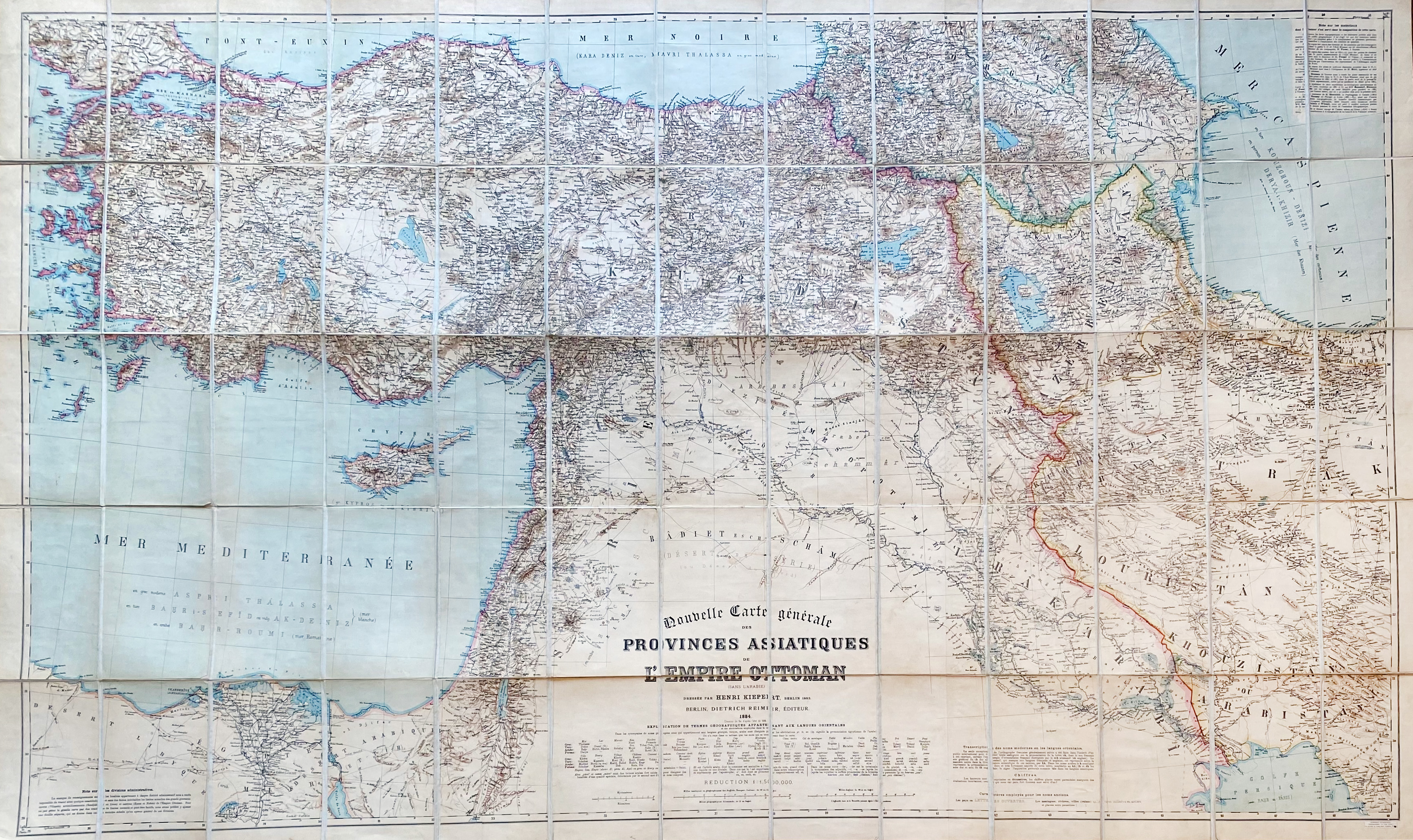
TURKEY -- "NOUVELLE CARTE générale des provinces Asiatiques de l'Empire Ottoman (sans L’Arabie). Berlin, Dietrich Reimer, 1884 (Chemins de fer d'après l'état de 1899). Lithogr. cold. map of Turkey, the Levant, and other parts of the Middle East by H. Kiepert. Laid down on linen, dissected in 24 sections. 1018 x 1718 mm. Stored in or. cloth-covered slipcase with paper label of Edward Stanford. (Slipcase a bit worn, lower left corner of map creased, sl. browned in places).
€ 300
uitslag € 280
Terug