Kavel 550
550
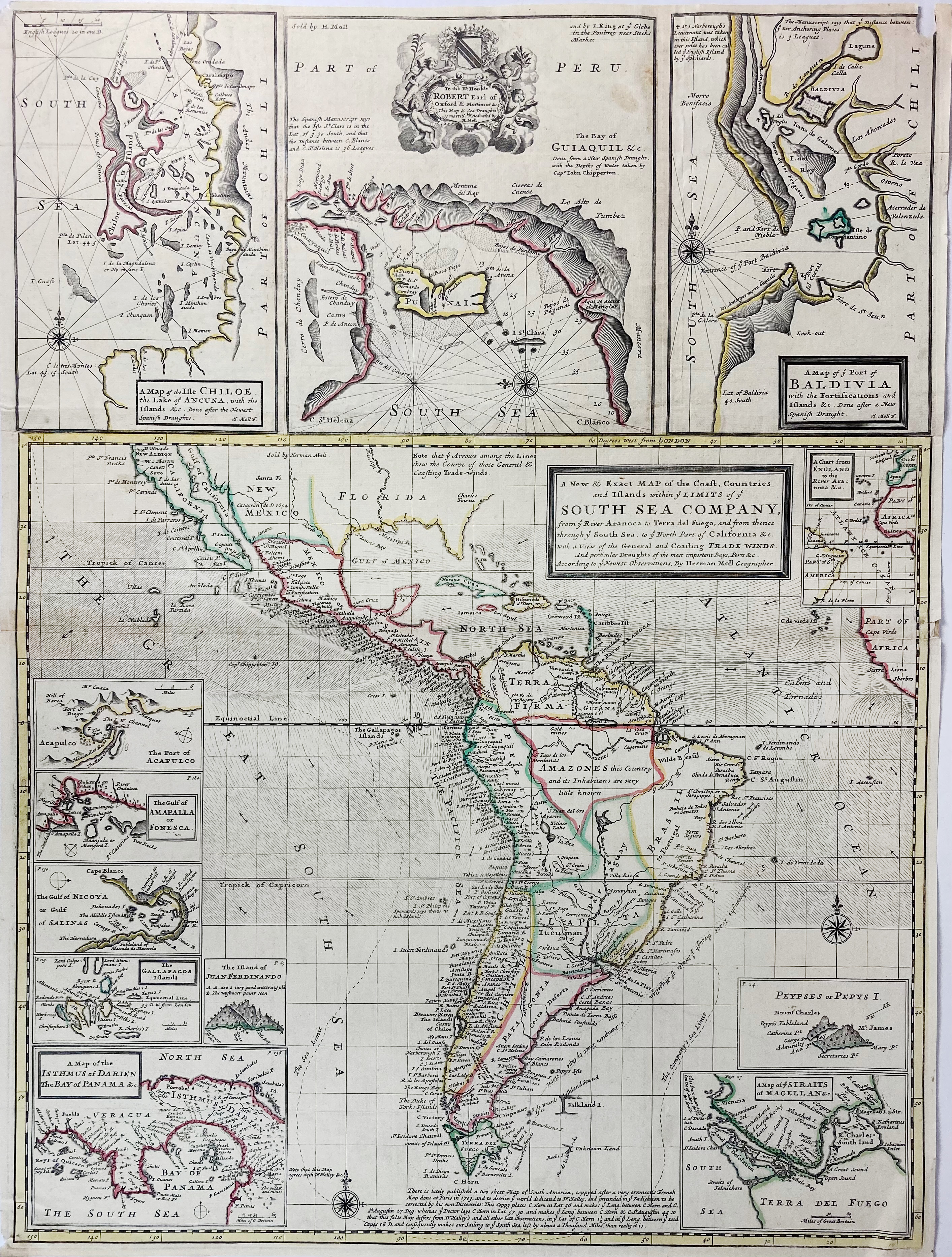
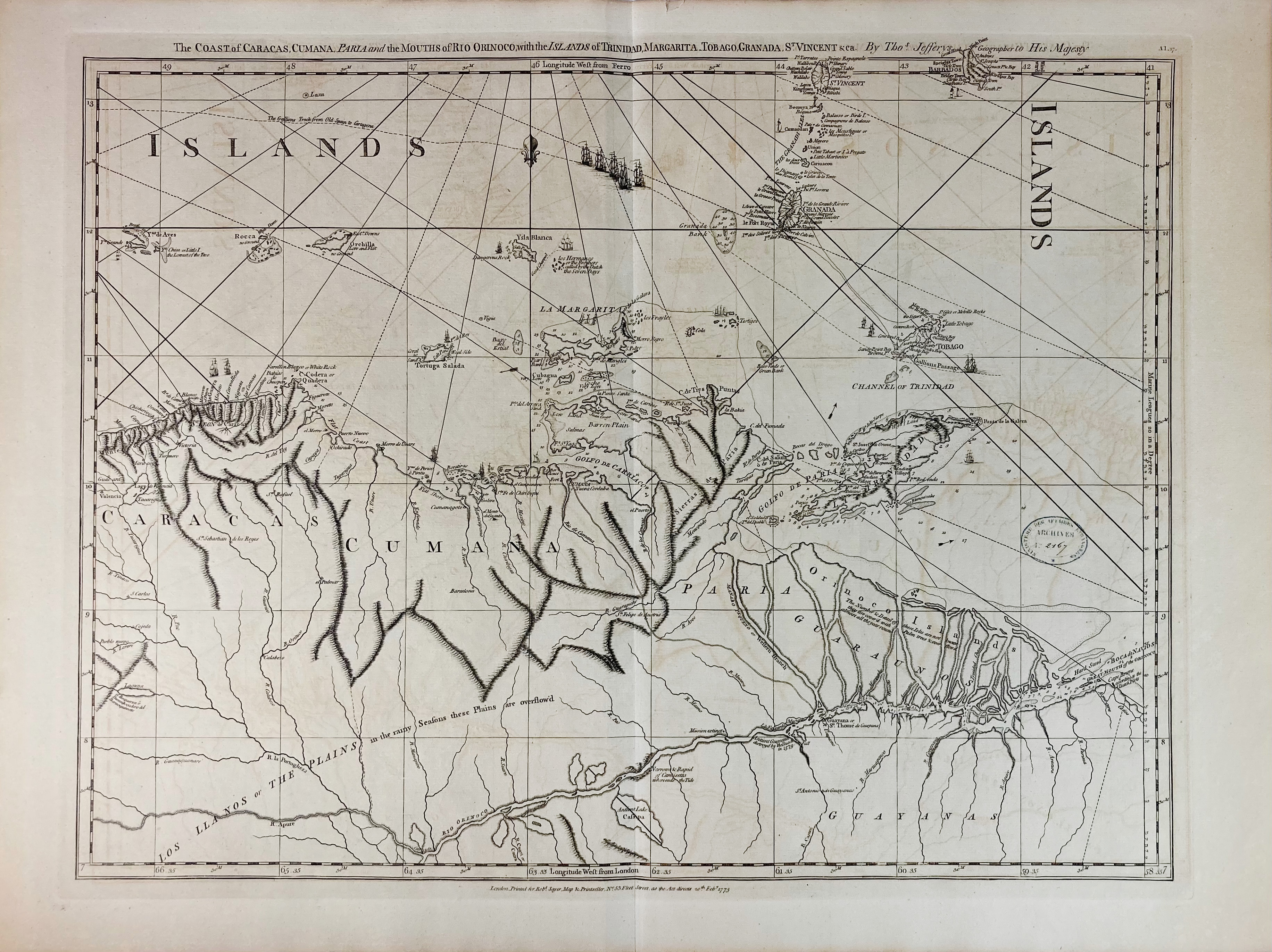
SOUTH AMERICA -- SOUTH SEA COMPANY -- "A NEW AND EXACT MAP OF THE COAST, Countries and Islands within ye Limits of ye South Sea Company, from ye River Aranoca (…) to ye North Part of California &c. (…)". (London), H. Moll & I. King, n.d. (1711/1720?). Engr. map w. 12 inset maps printed on 4 conjoined sheets, cold. by hand in outlines. Total size 665 x 498 mm. (Upper right corner (small piece of image gone) and outer right margin a bit dam. in the middle). -- Added: "THE COAST OF CARACAS, Cumana, Paria and the Mouths of Rio Orinoco, (…)". London, R. Sayer, 1773. Engr. chart by Th. Jefferys. 496 x 648 mm. -- (2).
Ad 1: Phillips 796 and 797 mentions 2 publishing dates, but does not give distinguishing features.€ 140
uitslag € 700
Terug