Kavel 531
531
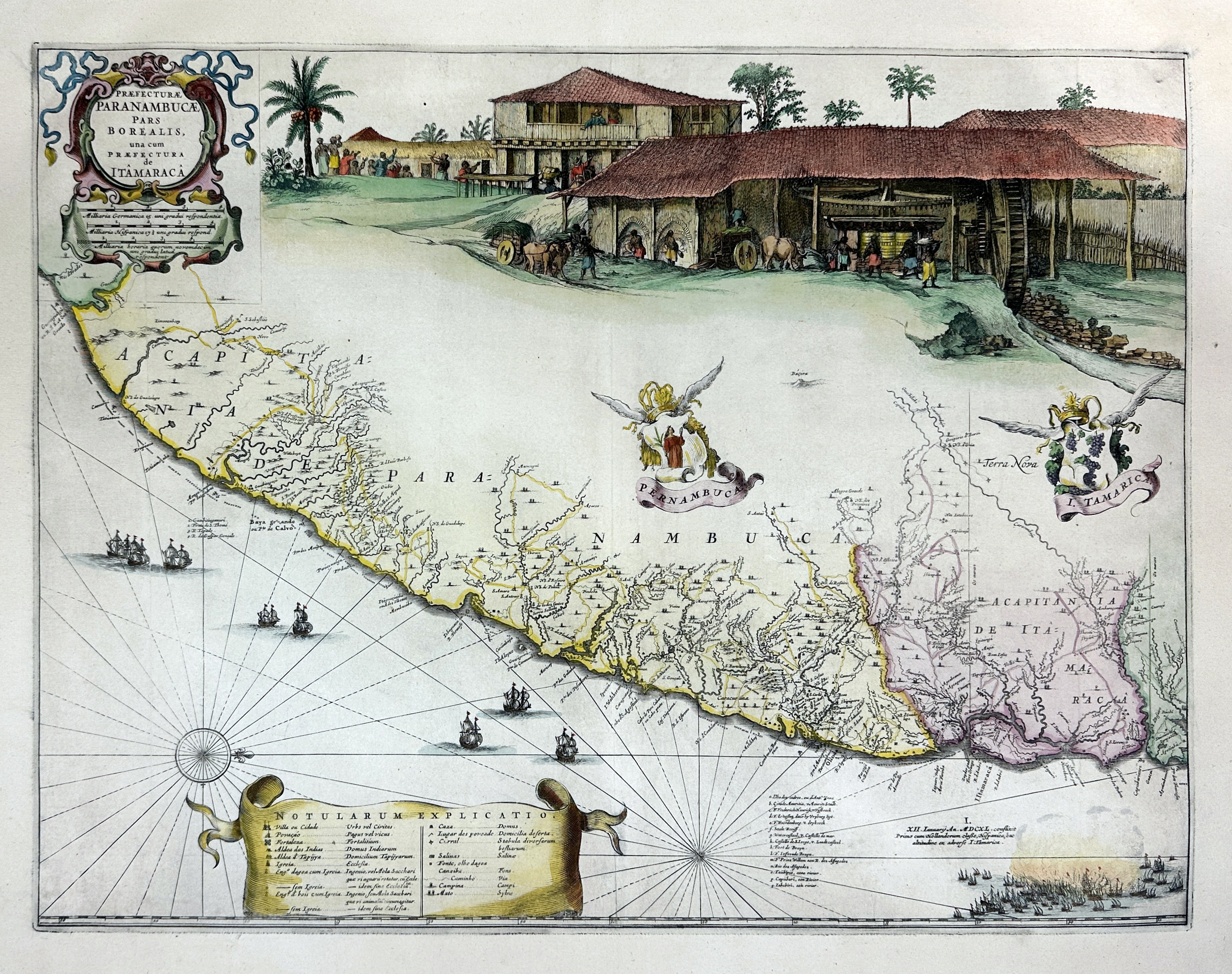
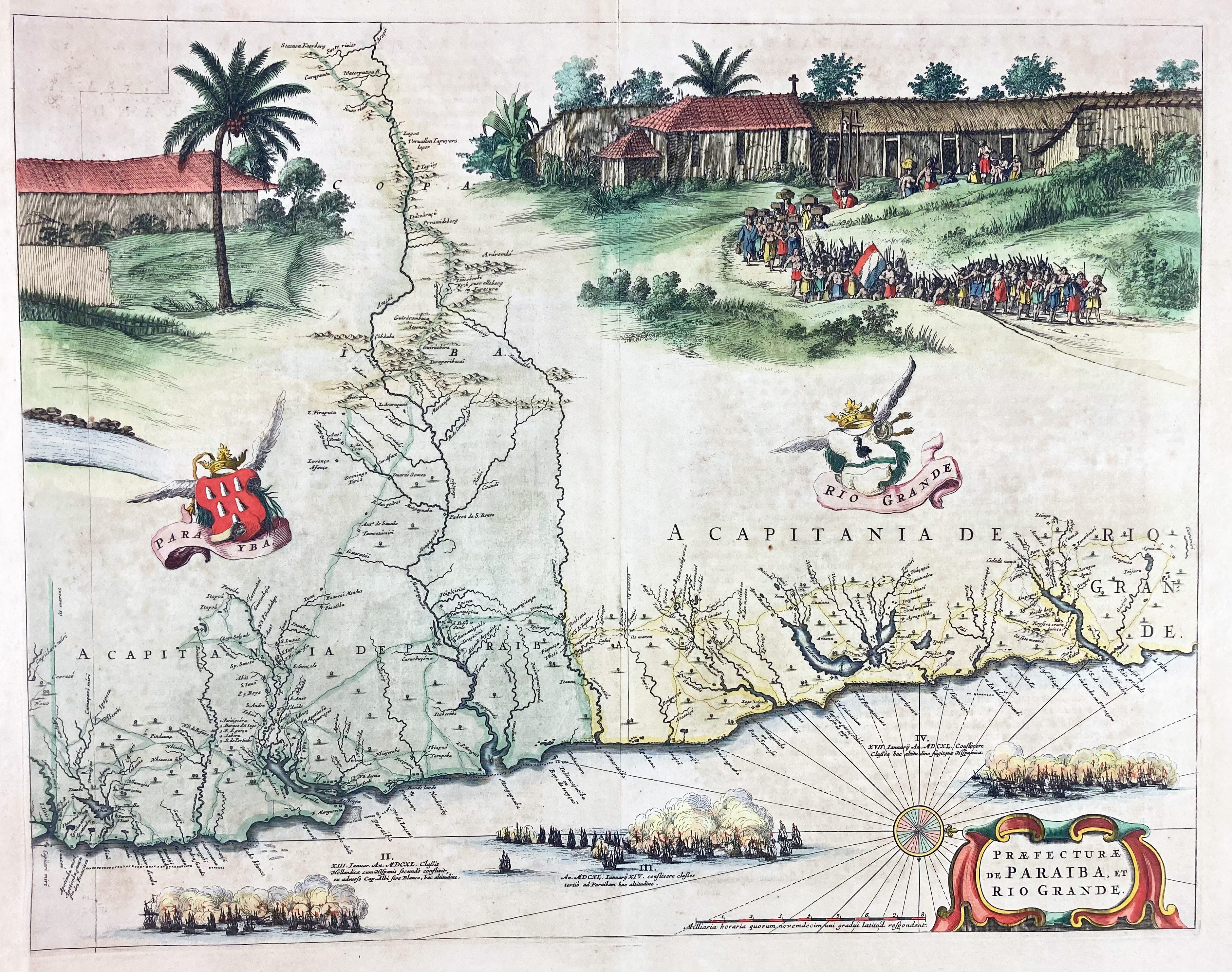
SOUTH AMERICA -- BRAZIL -- "PRÆFECTURÆ PERNAMBUCÆ pars borealis (…)" - "DE PARAIBA ET RIO GRANDE" - (Amst., J. Blaeu, 1662-70). 2 engr. maps of the Brazilian coastline, cold. by hand, consisting of 2 plates that overlap, but do not fit when conjoined. 425 x 544 and 425 x 540 mm. (2nd mentioned a bit browned/foxed, some folds & tears in upper & lower margins (does not reach image)).
Deriving from two different atlas editions on slightly differing laid paper (but in matching colours): first mentioned w. blank v° and second w. text in Latin on v°. With inset depicting a sugar cane factory w. slaves at work. At the bottom the various naval battles between the Spaniards and the Dutch are depicted (Jan. 12th-17th 1640). - V.d. Krogt II, 9850/2:2D and 9850/4:2D; cf. also the map of Marcgrave of 1647, published by Blaeu.€ 800
uitslag € 1500
Terug