Kavel 499
499
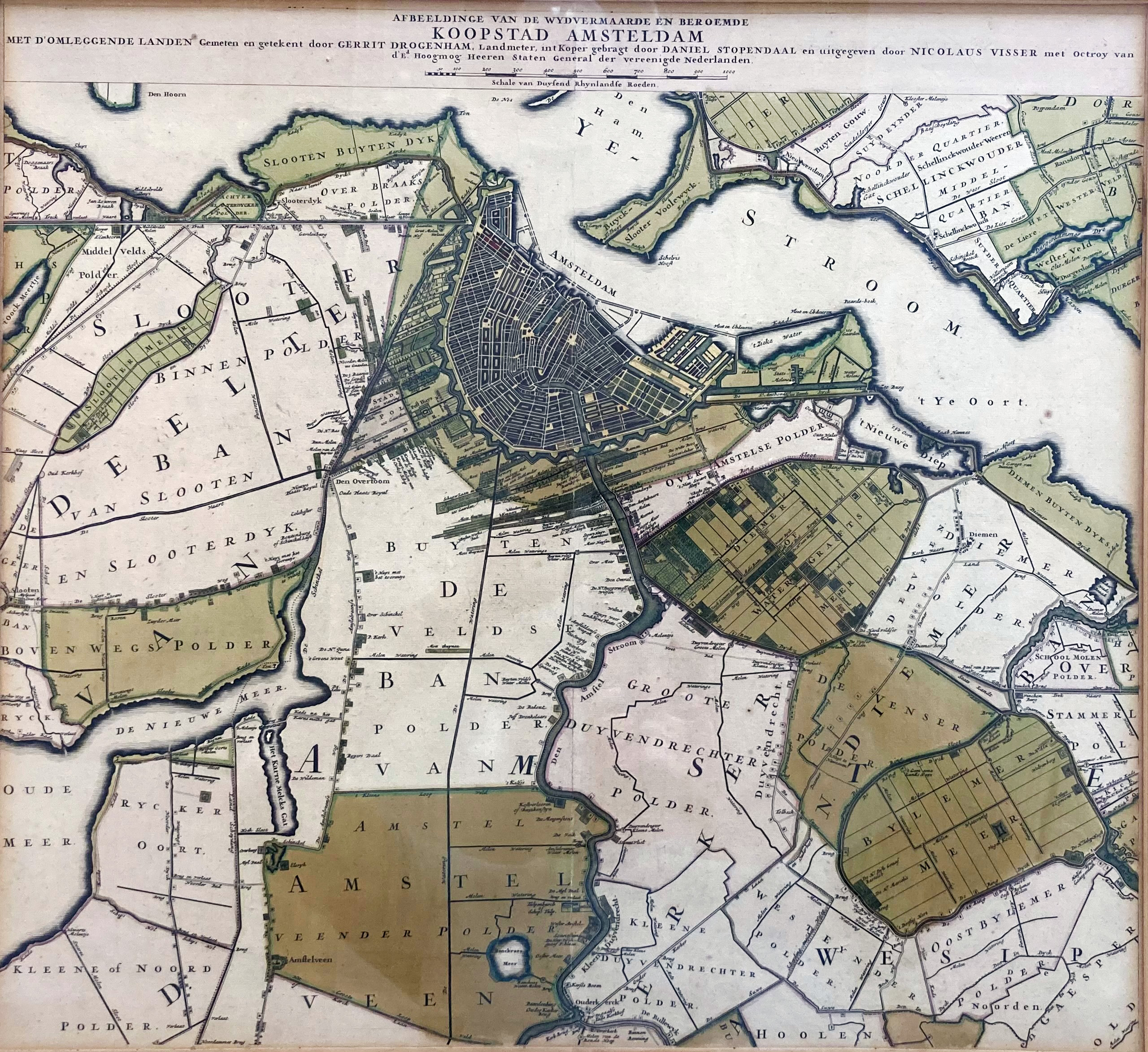
LOW COUNTRIES -- AMSTERDAM -- "AFBEELDINGE VAN DE WYDVERMAARDE EN BEROEMDE KOOPSTAD AMSTELDAM met d'omleggende landen". (Amst.), N. Visser, n.d. (±1705). Engr. map by D. Stoopendaal after G. Drogenham, partly cold. by hand. 525 x 570 mm. Framed, glazed and under passepartout. (Uninspected out of frame, a bit browned, but in v.g. condition).
Central part and 2nd state (of which 5 states exist) of a map which originally consisted of 7 parts. This central part - depicting the city of Amsterdam - could also be bought separately and - for that reason - had its own title. On the history of the publication of this map see Renkema, (a.o.), Polderkaarten 501.€ 700
uitslag € 600
Terug