Kavel 492
492
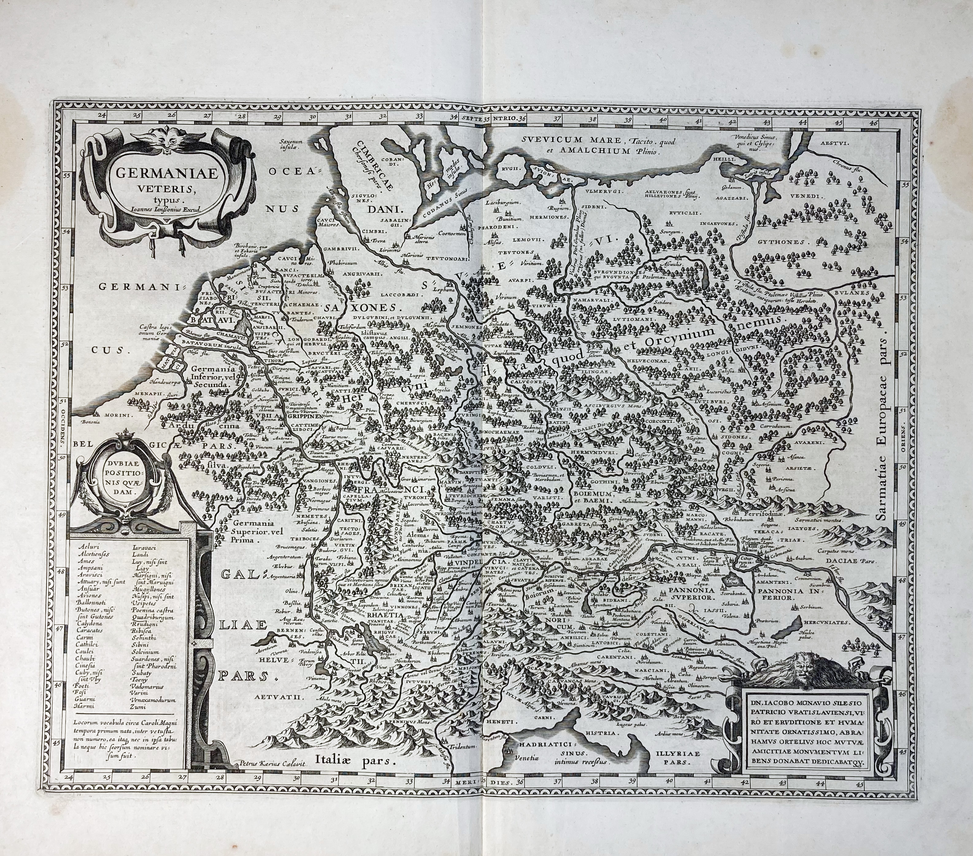
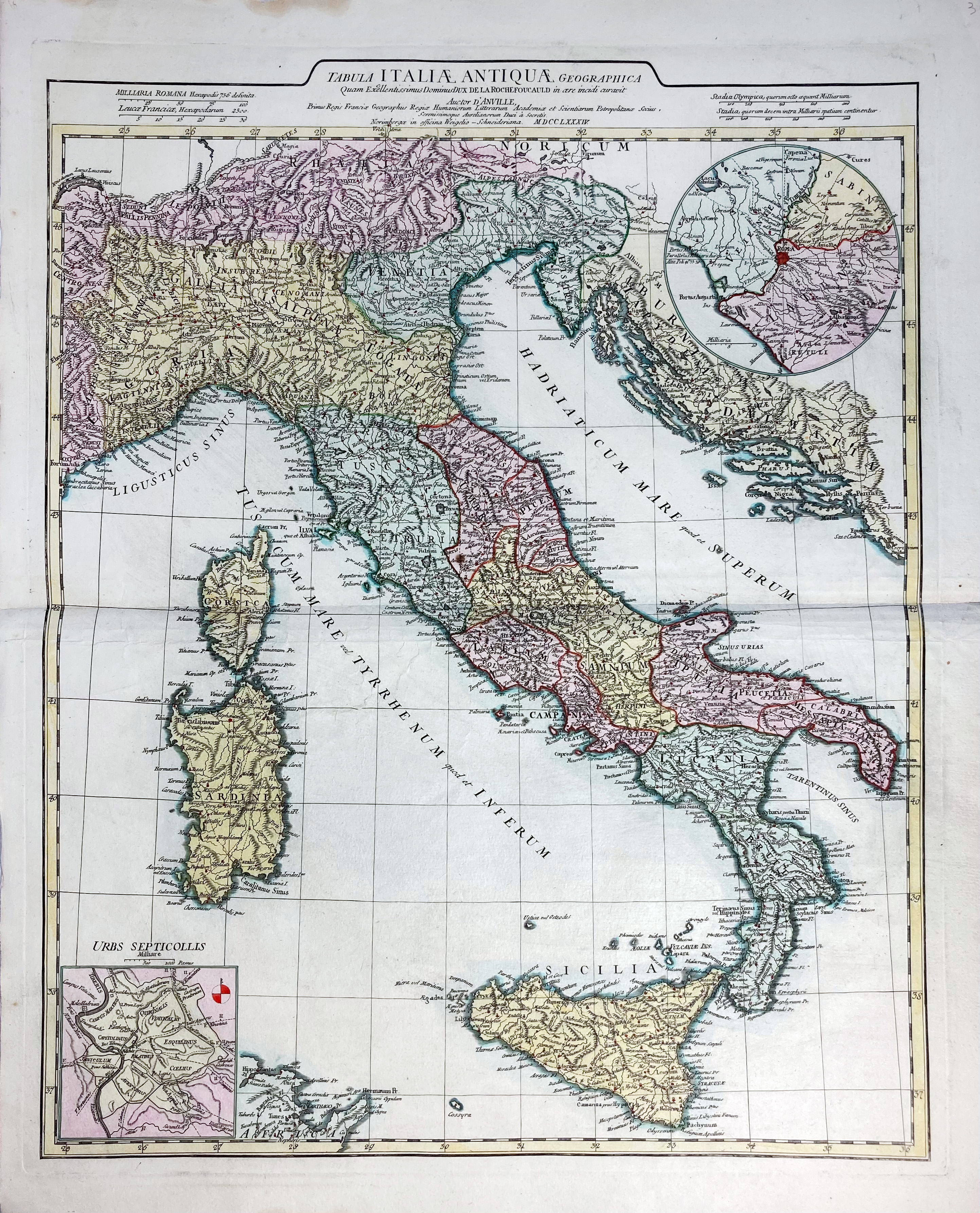
HISTORICAL MAPS -- "GERMANIÆ Veteris, typus". (Amst.), Janssonius (and/or Hondius), n.d. (c. 1633). Engr. map w. 3 fine cartouches. 393 x 486 mm. (Outer blank margins a bit stained). German text on v°. -- Added: "TABULA ITALIÆ ANTIQUÆ geographica". Nuremberg, Weigel-Schneider, 1784. Engr. map in cont. colouring w. 2 insets dep. (the vicinity of) ancient Rome. 640 x 517 mm. (Surface partly a bit rumpled, but in v.g. condition). -- (2).
€ 120
uitslag € 110
Terug