Kavel 481
481
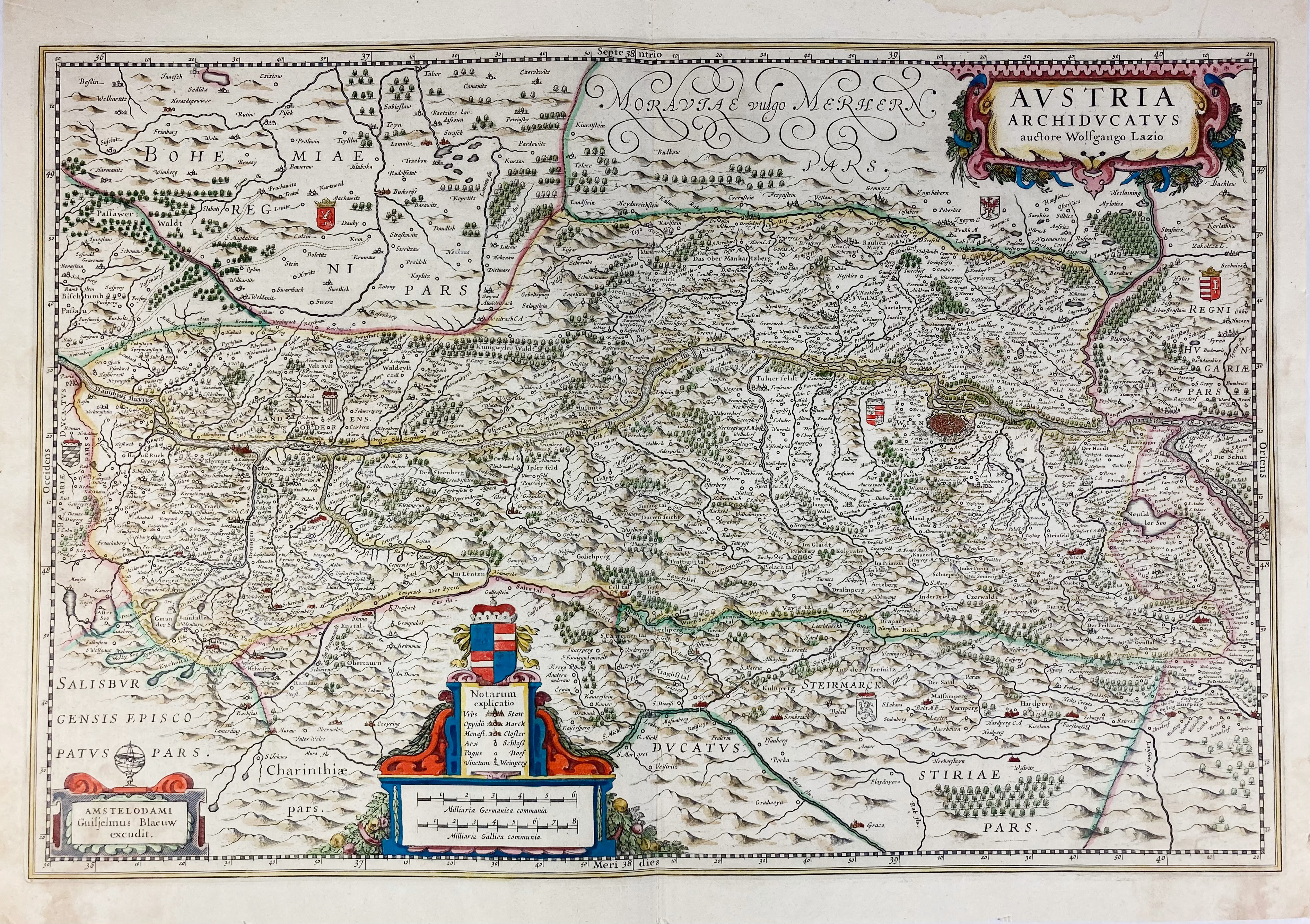
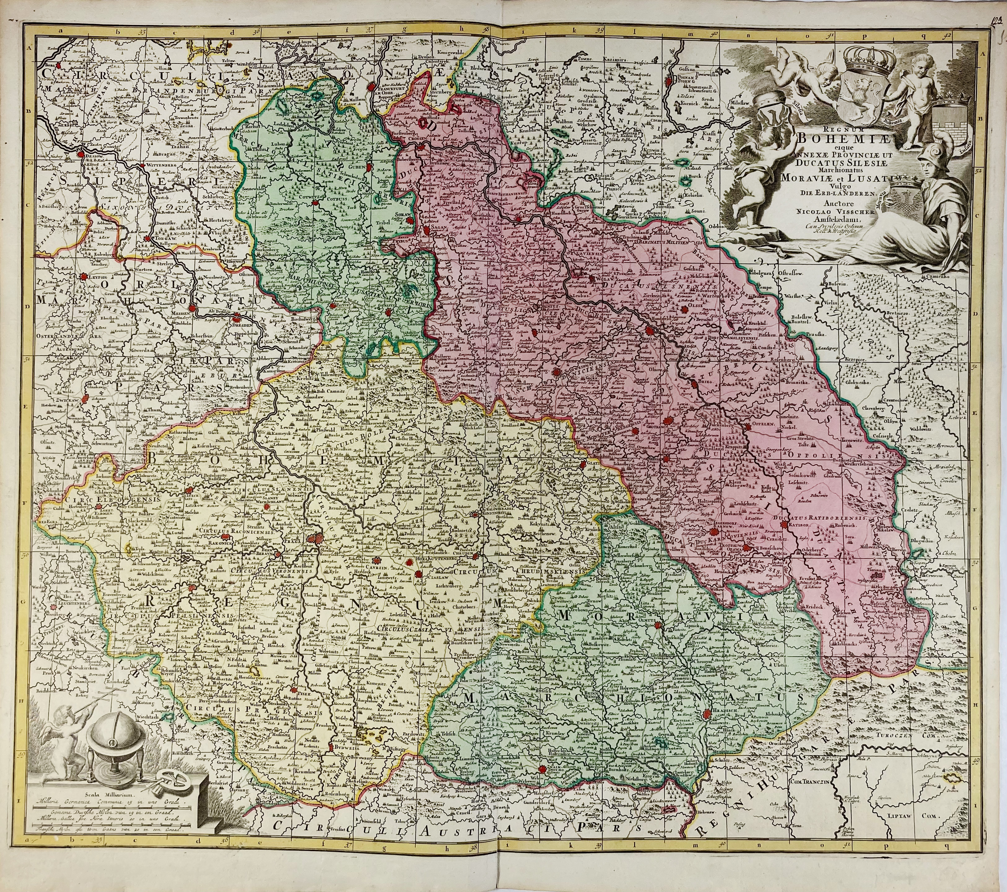
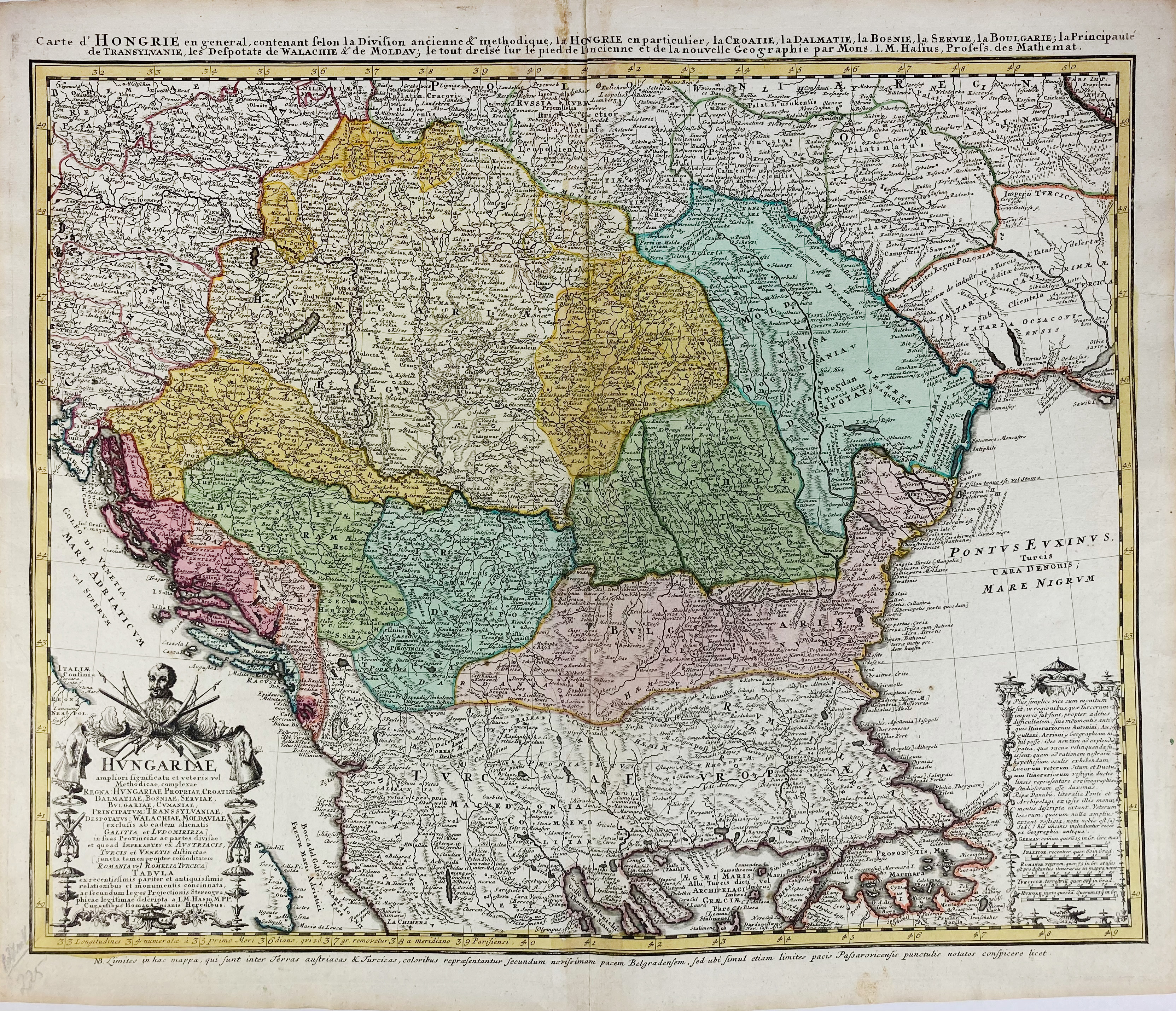
EUROPE -- "AUSTRIA Archiducatus". Amst., W.J. Blaeu, (1649-50). Engr. map after W. Laz in cont. colouring. 370 x 552 mm. (Margins trimmed and a bit stained, but in all a good copy). Dutch text on v°. V.d. Krogt II, 2710:2.2. -- Added: "REGNUM BOHEMIÆ eique Annexæ Provinciæ ut Ducatus Silesiæ (…)". Amst., N. Visscher, (c. 1700). Engr. map in cont. colouring. 505 x 590 mm. -- "HUNGARIÆ (…)/Carte de Hongrie (…)". Nürnberg, Heirs of J.B. Homann, 1744. Engr. map in cont. colouring w. armorial cartouche. 505 x 610 mm. (Upper part of central fold a bit browned). -- And 7 o. maps: Germany (5) and Switzerland (2). (10).
€ 300
uitslag € 320
Terug