Kavel 468
468
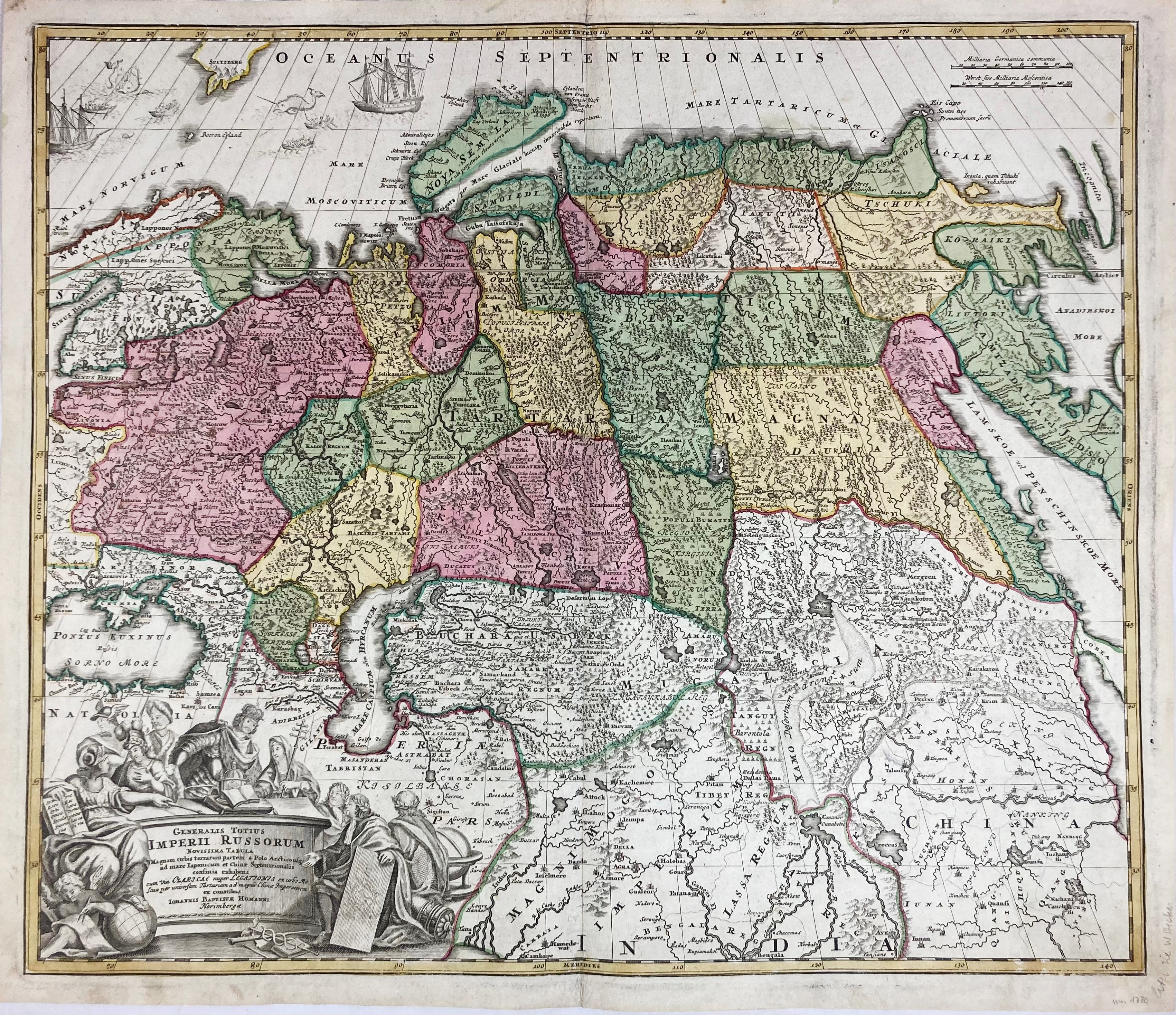
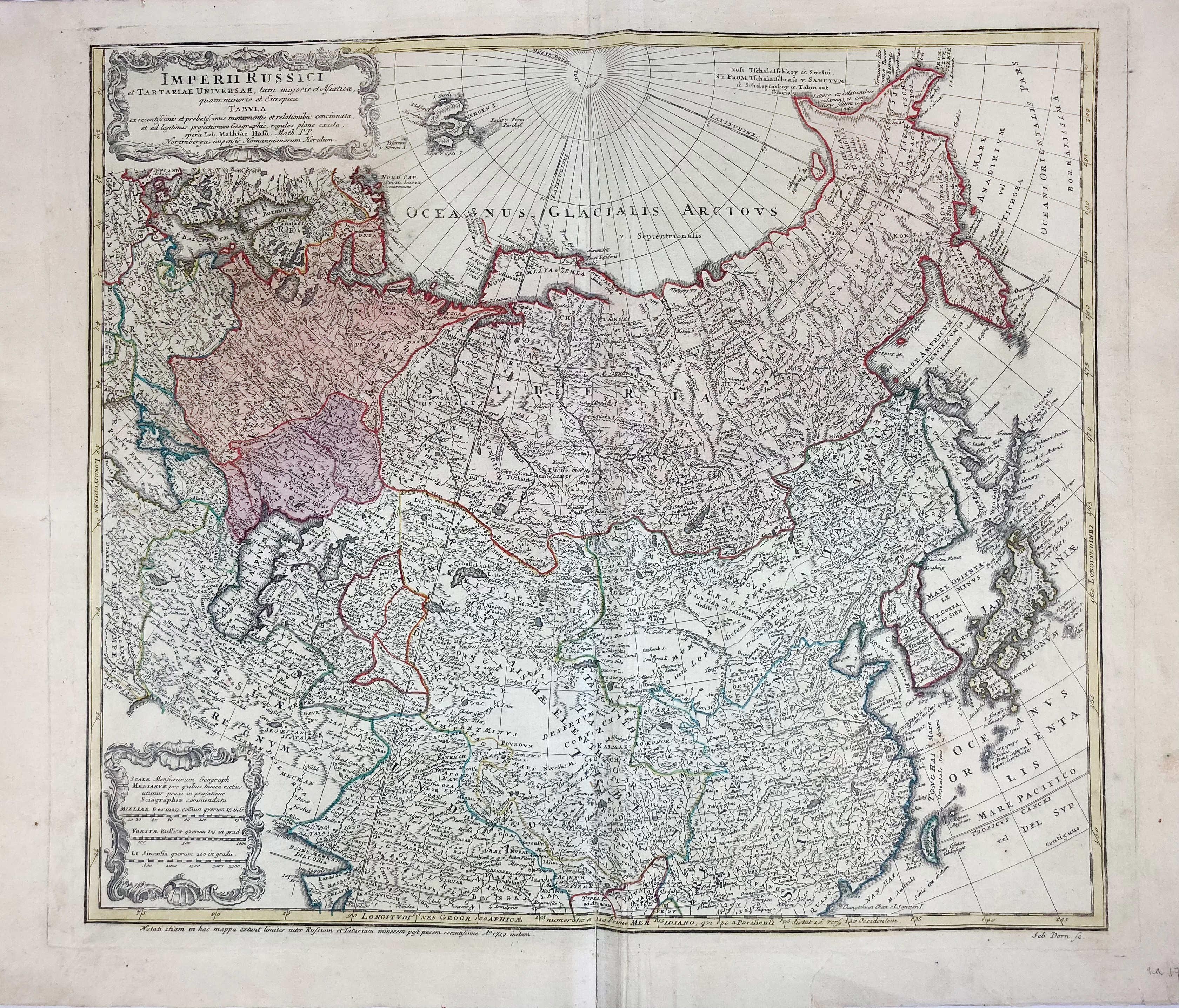
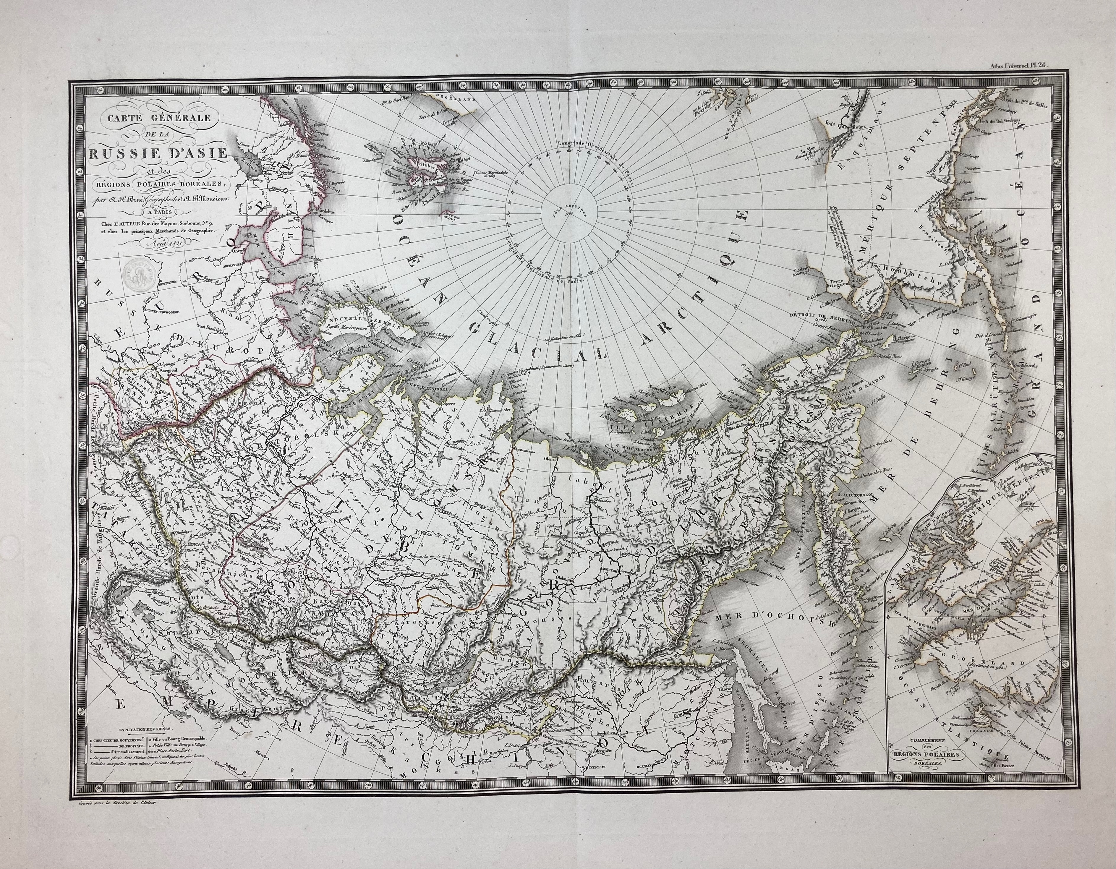
ASIA -- "GENERALIS TOTIUS IMPERII RUSSORUM Novissima Tabula (…)". Nürnberg, J.B. Homann, n.d. (c. 1715). Engr. map in cont. colouring. 483 x 565 mm. -- Added: "IMPERII RUSSICI et Tartariæ Universæ, (…)". Nuremberg, Heirs of Homann, 1739. Engr. map w. sparse cont. colouring. 490 x 580 mm. -- "CARTE GÉNÉRALE de la Russie d'Asie et des régions polaires boréales (…)". Paris, A.H. Brué, 1821. Engr. map from the 'Atlas Universel', cold. in outlines. 405 x 552 mm. -- And 4 o. of 'Asia'. (7).
€ 200
uitslag € 190
Terug