Kavel 1075
1075
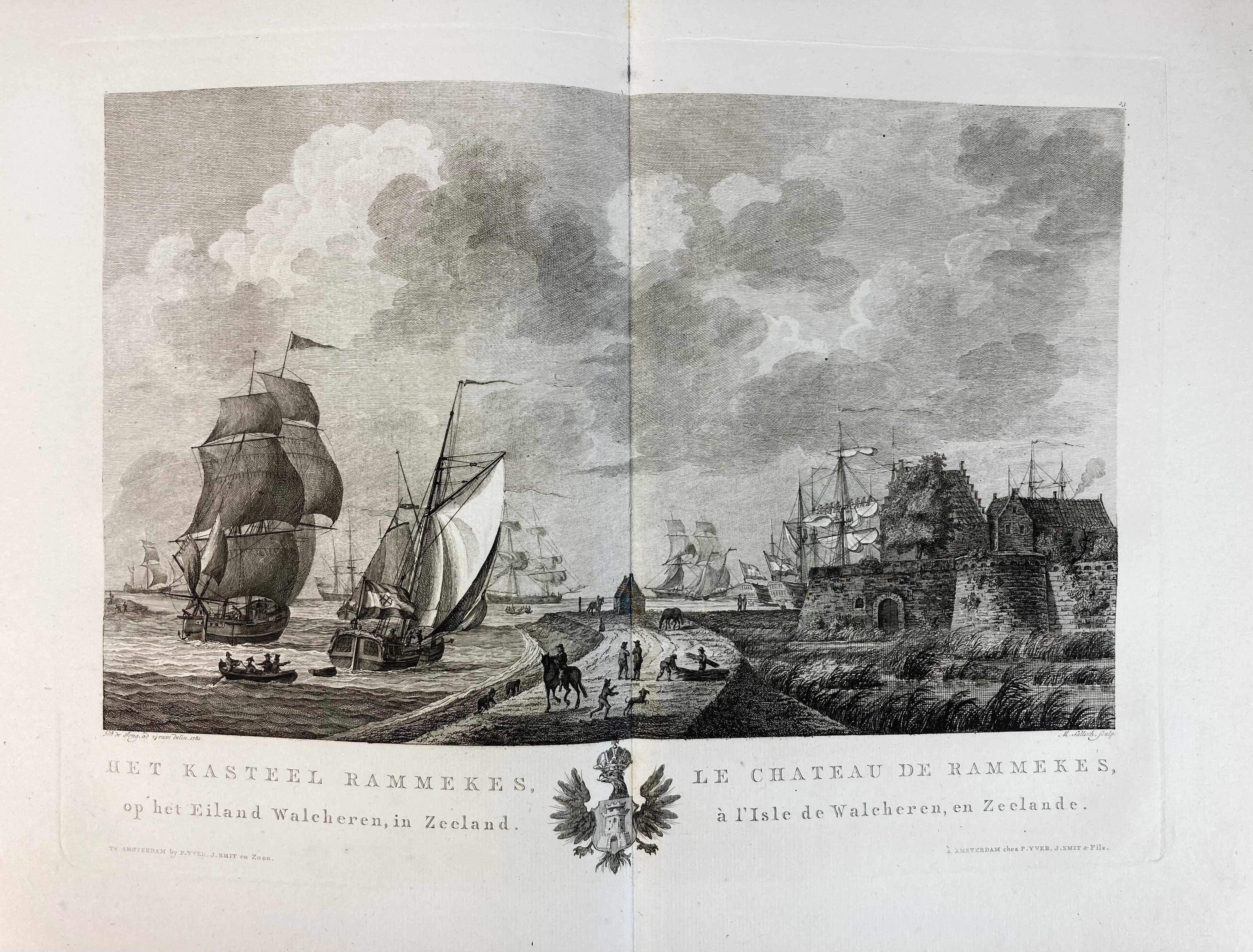
JONG, D. de. Atlas van alle de Zee-havens der Bataafsche Republiek. Amst., J. Allart, 1802. W. letterpress ti.-p. and 28 fine double-p. Dutch harbour after D. de Jong, etched/engr. by M. Sallieth. Fol. Cont. hcf., spine dec. and lettered in gilt. (Bind. restored, slightly foxed throughout, but a good copy w. ample margins).
Strong impressions and fine etchings (2nd state (of 3)) with engraved captions underneath in Dutch and French of the harbours of Rotterdam, Delft, Amsterdam, Enkhuizen, Hoorn, Texel, Dordrecht, Middelburg, Brouwershaven, etc. Each view also being embellished with it's own engraved coat of arms in the centre of the lower blank margin of the plate representing the city depicted. Below the title is the address 'Te Amsterdam by P. Yver, J. Smit en Zoon, en F.W. Greebe'. Although the book was published in 1802, the drawings by Dirk de Jong were already made around 1780/81. Image size: 210 x 340 mm., plate size: 290 x 395 mm. - De Groot & Vorstman, 181-2; NHSM, 319 (calls for 27 plates).€ 1000
uitslag € 950
Terug