Kavel 990
990
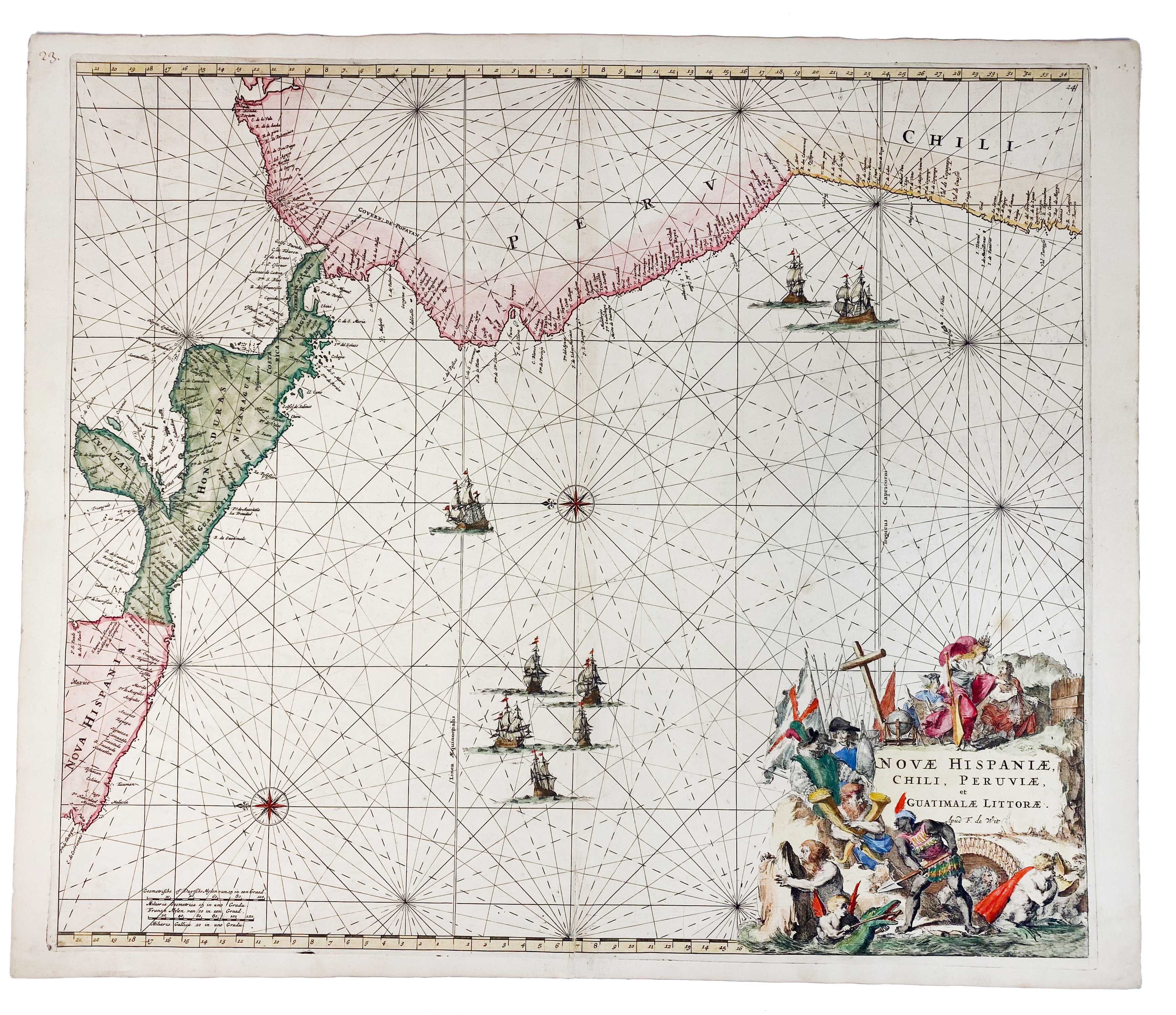
SEA CHARTS -- "NOVÆ HISPANIÆ, Chili, Peruviæ, et Guatimalæ Littoræ". (Amst.), F. de Wit, (c. 1688). Handcold. engr. chart. w. beautiful cartouche featuring Conquistadors, Incas, allegorical figures including Mercury and sea nymphs. 492 x 565 mm. (Split on fold at the bottom (skilfully repaired)).
Highly decorative chart of central America and north west South America, showing Yucatan south to Peru and Chile, as well as parts of Cuba, Hispaniola and Jamaica. Despite being known to Europeans as early as 1535 the Galapagos Islands are omitted. - Koeman III, Wit 16.€ 280
uitslag € 260
Terug