Kavel 1003
1003
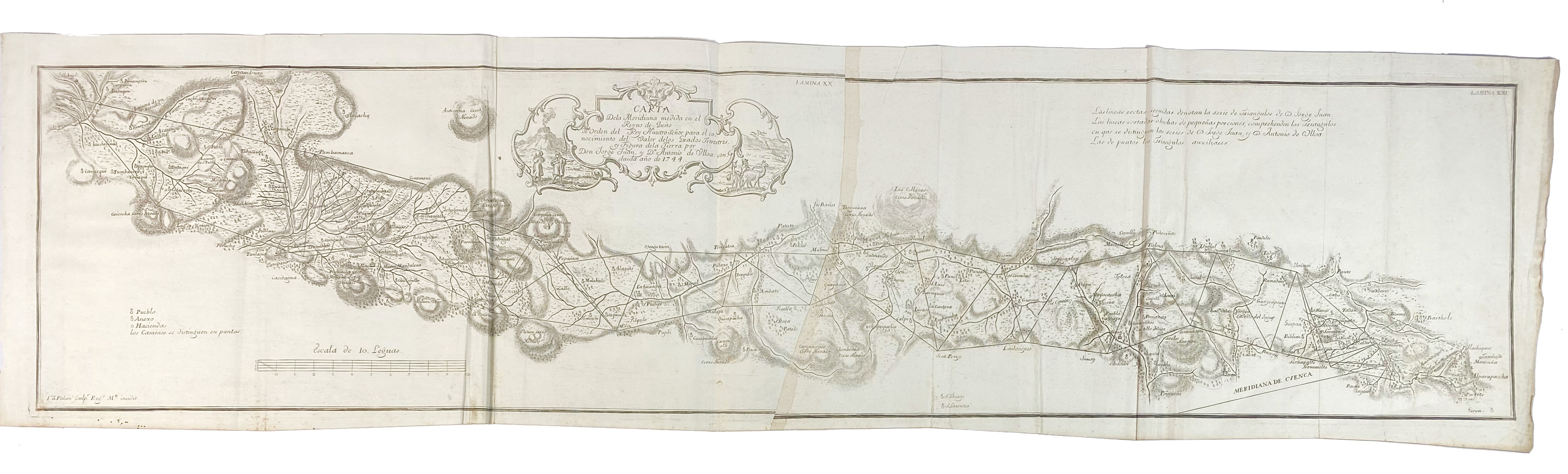
SOUTH AMERICA -- "CARTA DELA MERIDIANA MEDIDA en el Regno de Quito de Orden del Rey Nuestro Senor (…)". (Madrid, c. 1748). Plain engr. map on 2 sheets (joined as issued). 1012 x 230 mm. (Some creases due to misfolding, a bit browned on the joint (caused by glue), a few marg. foxing spots).
This rare map appeared in Antonio de Ulloa and Jorge Juan's 'Relacion Historica del Viaje a la America Meridional' and gives great topographical detail of the area to the east and west of Quito, Ecuador. A series of triangulation lines are depicted based on the measurements by de Ulloa and Juan. Numerous small towns, villages, rudimentary roads, and even volcanoes are identified. The decorative title cartouche features a native family with a volcano in the background and a llama herder.€ 200
uitslag € 180
Terug