Kavel 486
486
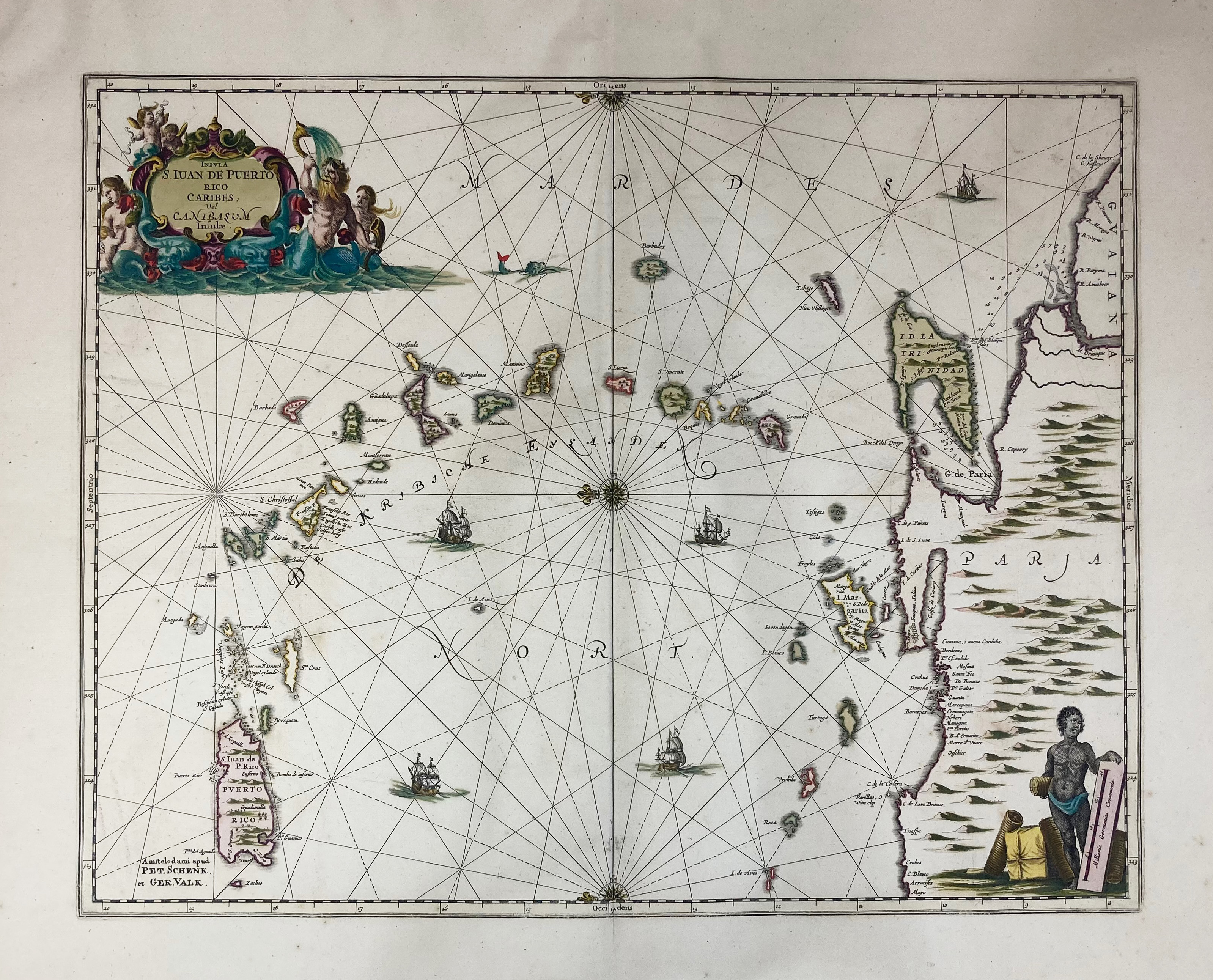
SOUTH AMERICA -- CARIBBEAN -- "INSULA S. IUAN DE PUERTO RICO Caribes; vel Canibasum Insulæ". Amst., P. Schenk & G. Valk, n.d. (c. 1700). Engr. map in cont. colouring. 410 x 520 mm.
Chart of the Windward Islands, from Puerto Rico to Trinidad and the Coast of Venezuela. Verso blank. In fine condition.€ 200
uitslag € 280
Terug