Kavel 474
474
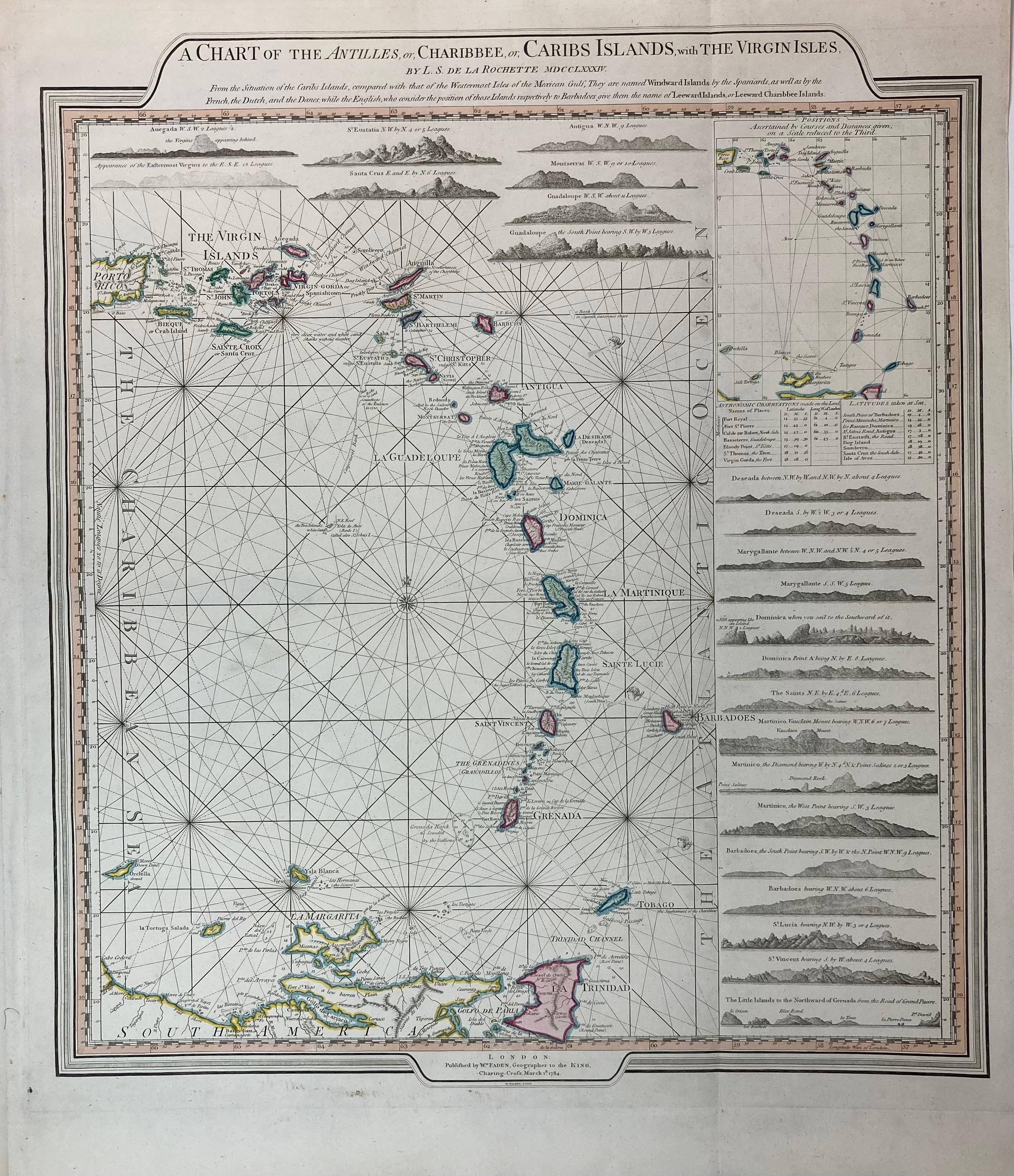
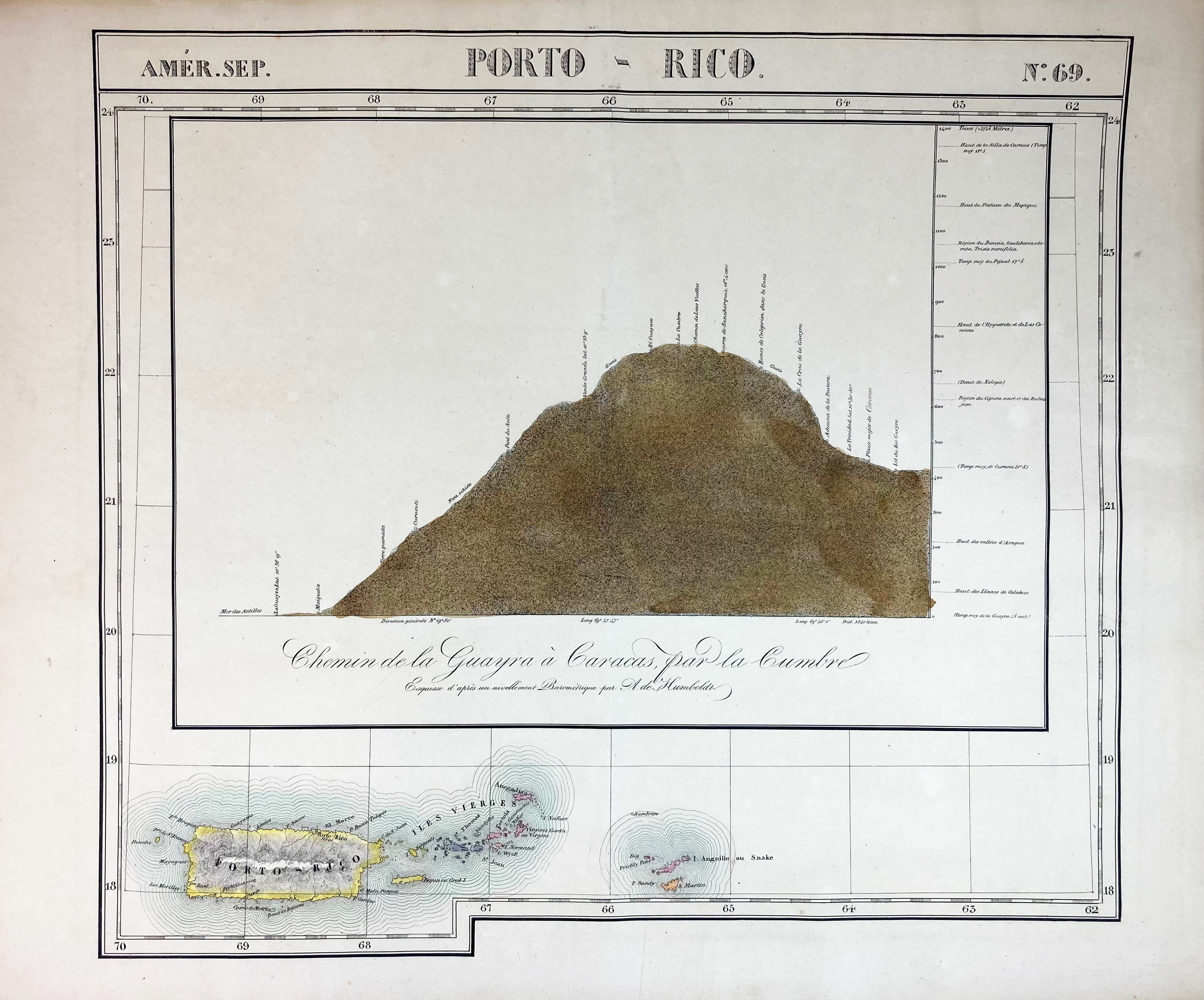
SOUTH AMERICA -- CARIBBEAN -- "A CHART OF THE ANTILLES, or, Charibbee, or, Caribs Islands, with the Virgin Isles. By L.S. de la Rochette". Lond., W. Faden, 1784. Engr. sea chart in cont. col. 535 x 485 mm. Hinged to mount & under passepartout. -- Added: "PORTO-RICO. Chemin de la Guayra a Caracas par la Cumbre. Esquisse d'après un nivellement Barométrique par A. de Humboldt". (Brussels, Vandermaelen, 1827). Cold. engr. profile view of Puerto Rico above map of the island. 480 x 530 mm. -- (2).
Detailed sea chart alongside profile views of the Antilles, from the Virgin Islands and Puerto Rico in the North, to Trinidad in the South. In very good condition.€ 200
uitslag € 240
Terug