Kavel 439
439
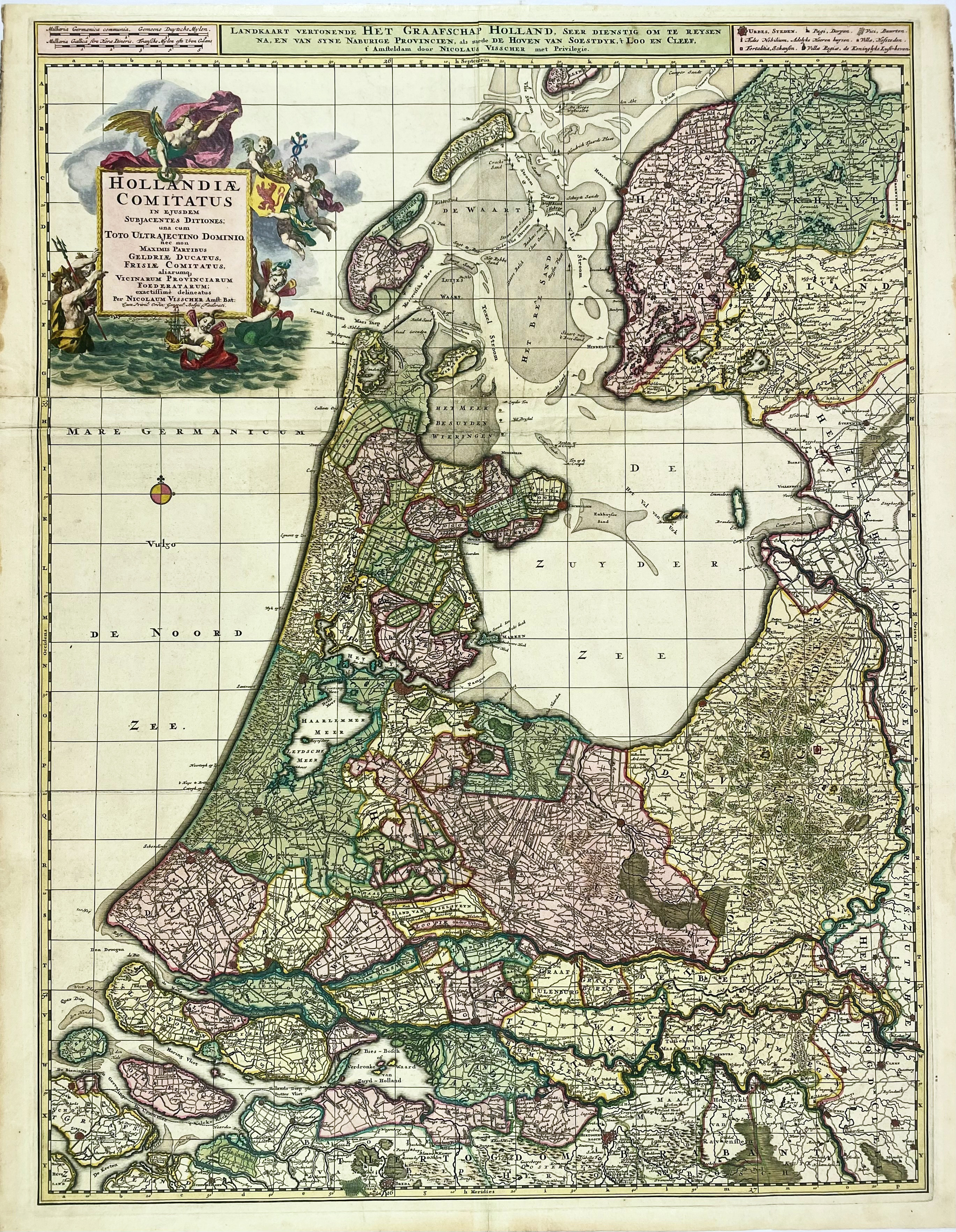
LOW COUNTRIES -- "HOLLANDIAE COMITATUS in ejusdem subjacentes Ditiones". Amst., N. Visscher, (1696). Engr.handcold. engr. map on 2 joined sheets, fine cartouche by G. Gouwen. 750 x 565 mm. (Strengthened/rep. on v° at intersection of folds, some marg. stains, sl. browned).
Nice map, also showing Utrecht, Gelderland and the larger part of Friesland. - Blonk/Van der Wijst 70.2.€ 150
uitslag € 160
Terug