Kavel 380
380
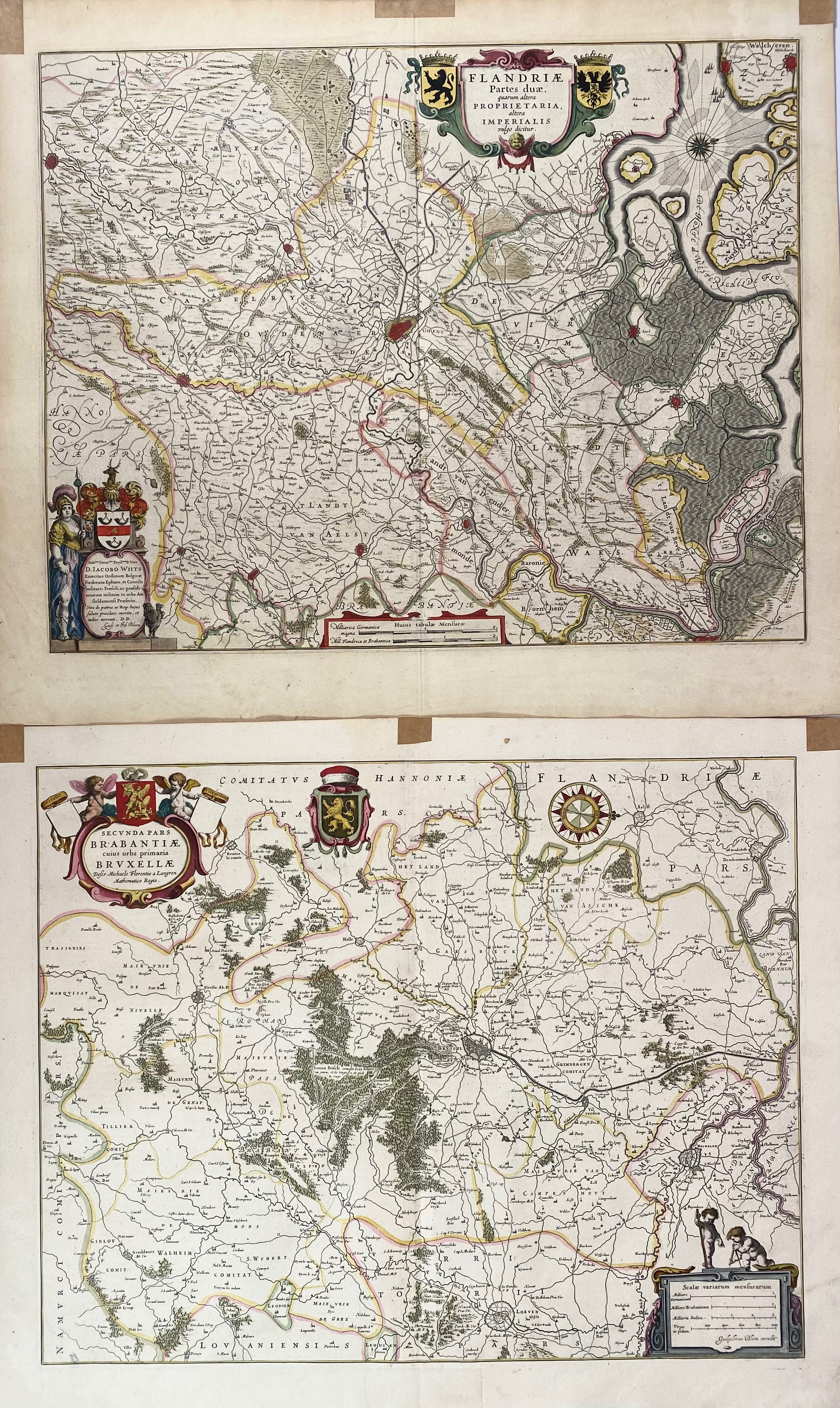
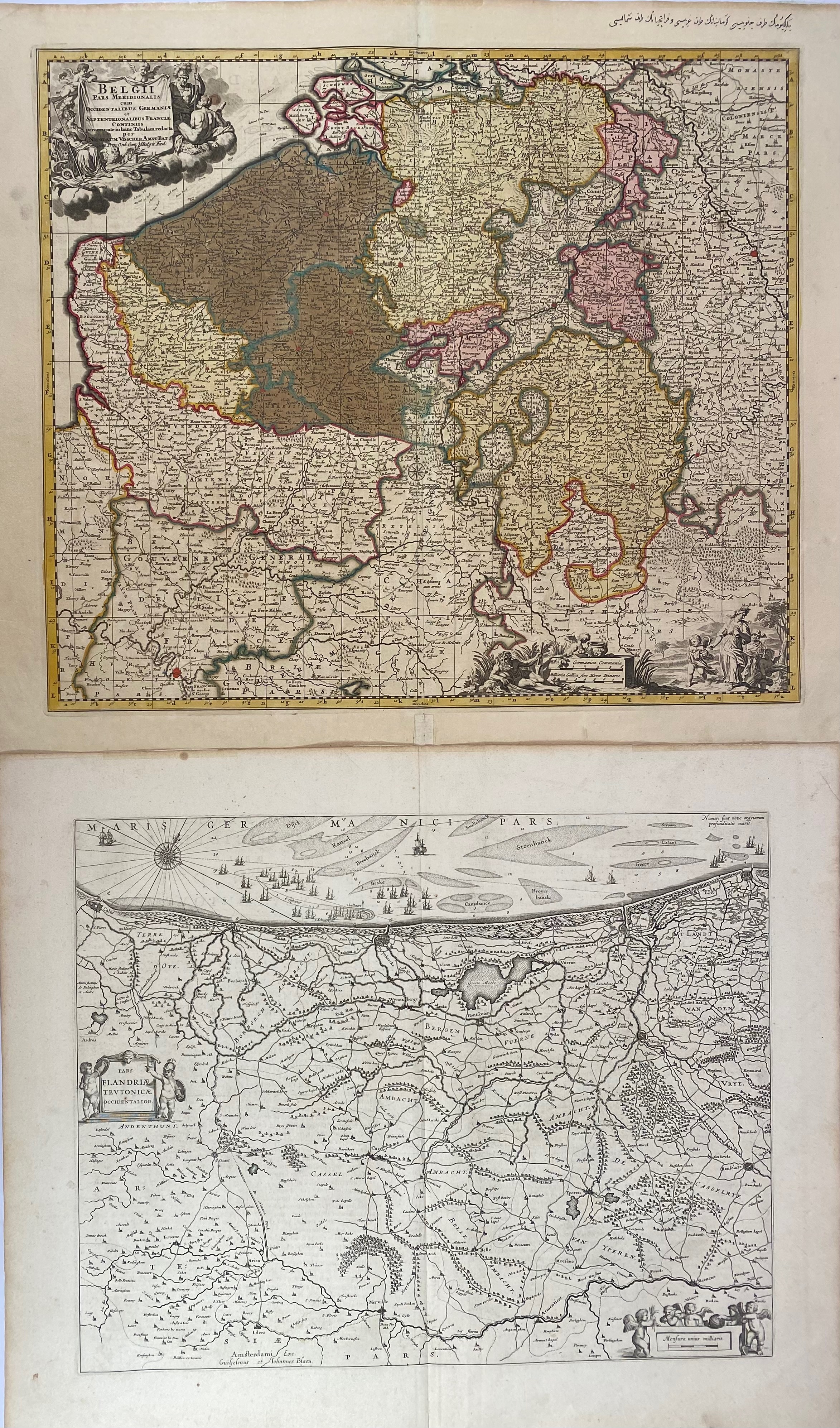
BELGIUM -- "SECUNDA PARS BRABANTIAE cuius urbs primaria Bruxellae". (Amst.), G. & J. Blaeu, (c. 1640). Engr. handcold. map. 415 x 525 mm. (Remnants of hinges in upper margin). -- "PARS FLANDRIAE TEUTONICAE OCCIDENTALIOR". (Amst.), G. & J. Blaeu, (c. 1640). Engr. plain map. 380 x 490 mm. -- "FLANDRIAE PARTES DUAE". (Amst.), G. & J. Blaeu, (c. 1645). Engr. handcold. map. 415 x 525 mm. (Remnants of hinges in upper margin, sl. yellowed). -- Added: "BELGII PARS MERIDIONALIS cum Occidentalibus Germaniae et Septentrionalibus Franciae Confiniis". (Amst., N. Visscher, c. 1680). Engr. handcold. map w. 'Table alphabetique/Naamwyser on v°. 475 x 535 mm. (Sm. marg. rep., Arabic writing in upper margin, marg. stains). -- (4).
Ad 1-3: French text on v°. Van der Krogt 3111:2, 3201:2, 3215:2.€ 150
uitslag € 190
Terug