Kavel 612
612
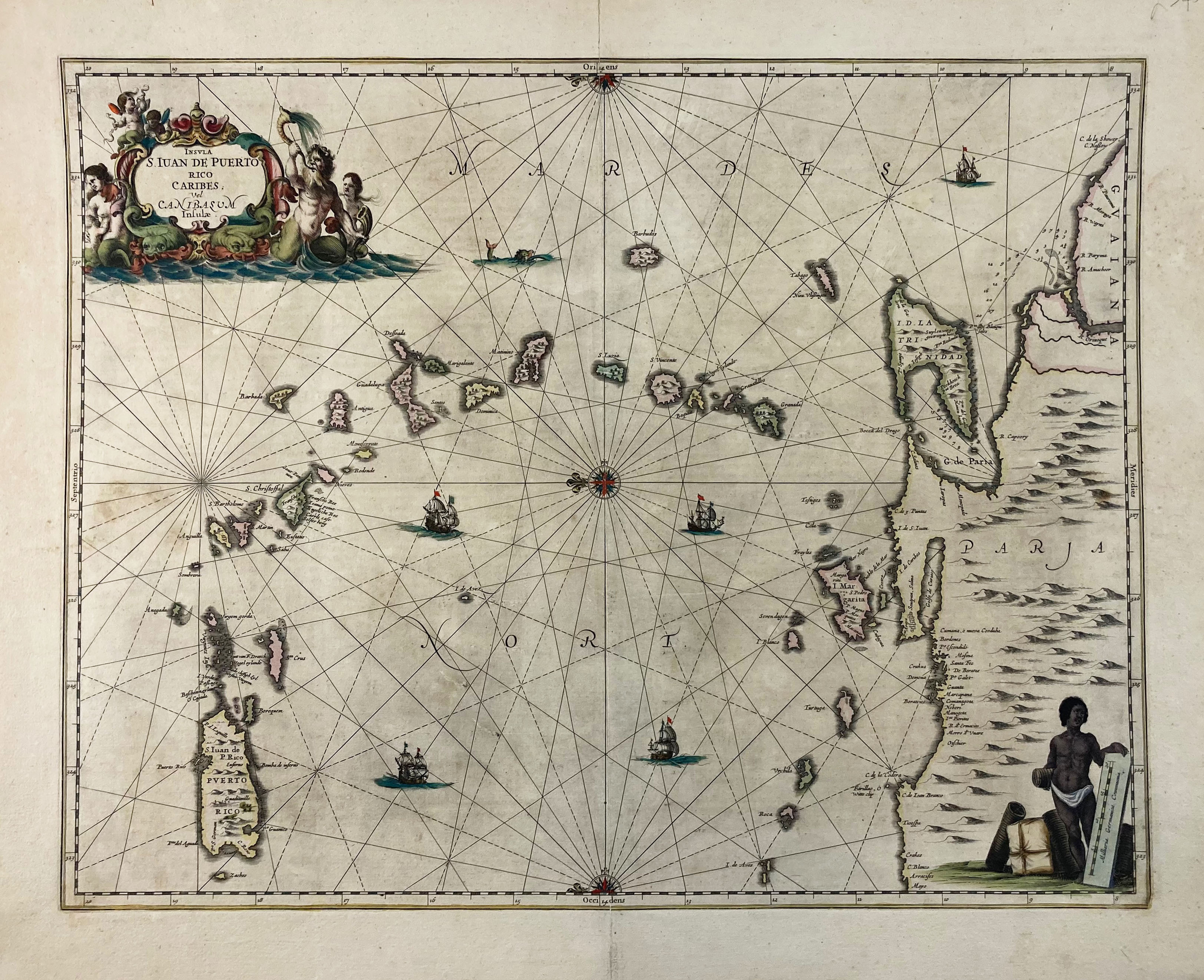
SOUTH AMERICA -- CARIBBEAN -- "INSULA S. IUAN DE PUERTO RICO Caribes; vel Canibasum Insulæ". (Amst., Janssonius, 1650-57). Cold. engr. map. 410 x 520 mm. (Repairs to central fold and upper margin on v°, a bit browned/foxed, but a good untrimmed map).
Chart of the Windward Islands, from Puerto Rico to Trinidad and the Coast of Venezuela. French text on v°. V.d. Krogt 9640:1.€ 200
uitslag € 450
Terug