Lot 423
423
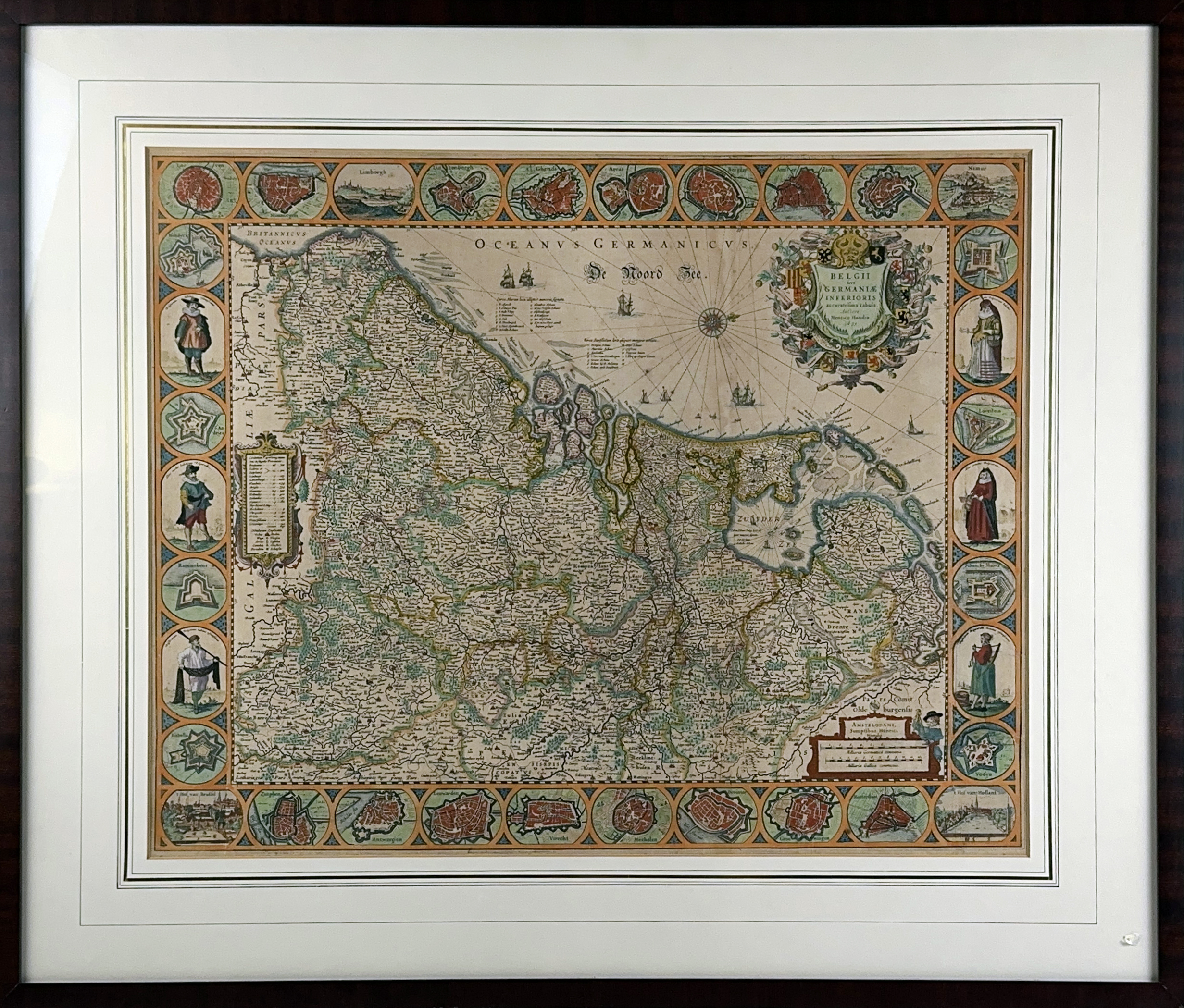
LOW COUNTRIES -- "BELGII SIVE GERMANIAE Inferioris accuratissima tabula". Amst., H. Hondius, 1631. Engr. map in cont. handcolouring, w. 3 cartouches, ships and a compass rose, and a decorative border with city plans and views i.a. Leuven, Luxemburg, Ghent, Arras, Middelburg, Zutphen, Antwerp, Mechelen, Deventer, & costumed figures in oval frames. 482 x 600 mm. Framed, glazed & under passepartout. (Uninspected out of frame, a bit browned).
Rare first state of the elegant Hondius map of 'Germania Inferioris' with decorative border, that was omitted in the later states. - Van der Heijden 92; Schilder VI, 57.1.€ 1200
result € 1300
Back