Lot 408
408
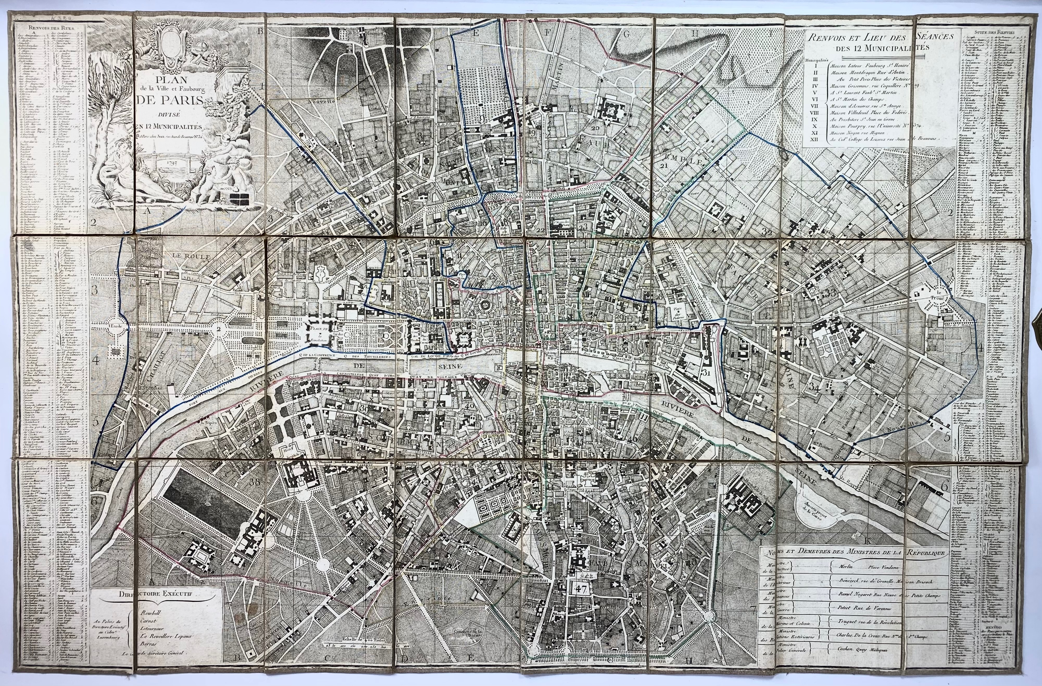
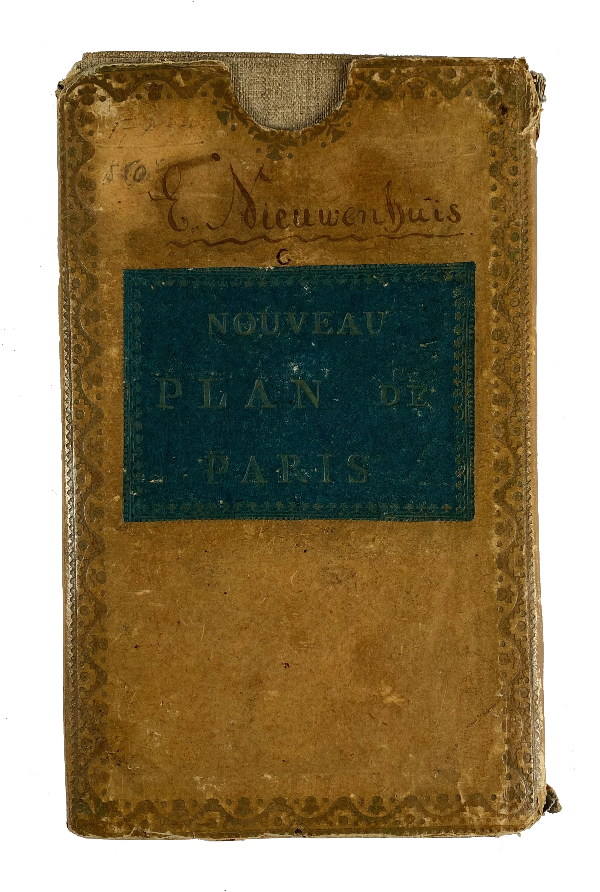
FRANCE -- PARIS -- "PLAN DE LA VILLE et Faubourg de Paris divisé en 12 municipalités". Par., Jean, 1797. Engr. map cold. in outlines w. cartouche, divided in 24 sections, mounted on linen. Total size: 638 x 976 mm. In or. gilt tooled slipcase with green title-label: "Nouveau plan de Paris'. (Slipcase a bit dam., a few faint stains).
An extraordinary map of pre-Haussmann Paris and the early Faubourgs (suburbs) issued in 1797, during the final days of the Directory and the French Revolution and just two years before rise of Napoleon Bonaparte. Covers Paris on both sides of the Seine from the Champ de Mars to Le Trone, extends north as far as Montmartre and south roughly to Port Royal.€ 280
result € 260
Back