Kavel 930
930
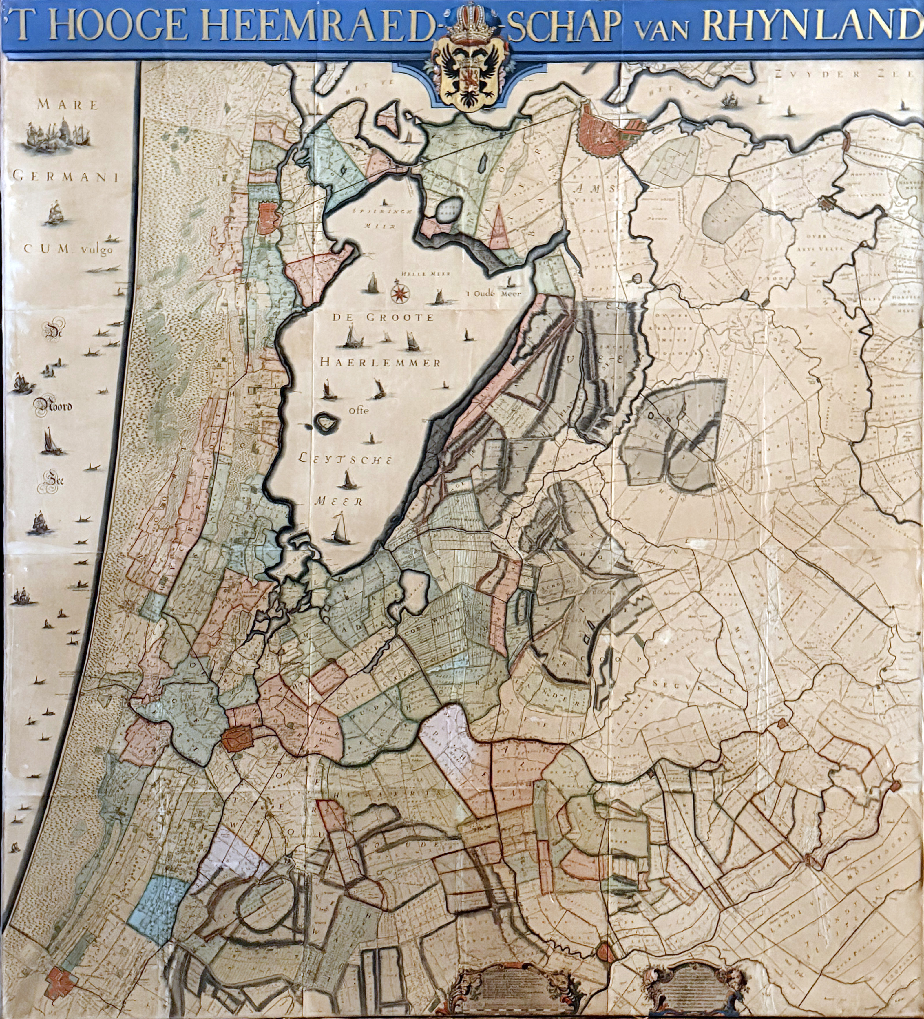
LOW COUNTRIES -- RIJNLAND -- (DOU, J.J. & S. v. BROECKHUYSEN). 't Hooge Heemraedschap van Rhynland. ((...) vernieuwd, geamplieerd en gecorrigeerd (d. M. Bolstra)). (Amst., I. Tirion, 1746). Wall map consisting of 15 conjoined sheets, cold. by hand and w. gilt lettered title. Total size 187 x 170 cm. Laid down on canvas stretcher, framed. (Browned, surface treated with a light layer of varnish (?), a bit discoloured/slightly chafed/dam. in places).
Third, corrected edition of this monumental, coloured and detailed polder map of Rijnland. The maps were engraved by David Coster after Melchior Bolstra's revision and augmentation of the second edition of 1687/88. - Donkersloot-De Vrij, 715 mentions the name of the publisher - Tirion - who can not be found on the maps themselves. She also mentions that the edition was limited to 650 copies only. Renkema 202.3; Koeman, Geschiedenis van de Kartografie van Nederland, p. 138. - NB Can only be picked up or sent via our courier service.€ 2400
uitslag € 0
Terug