Kavel 926
926
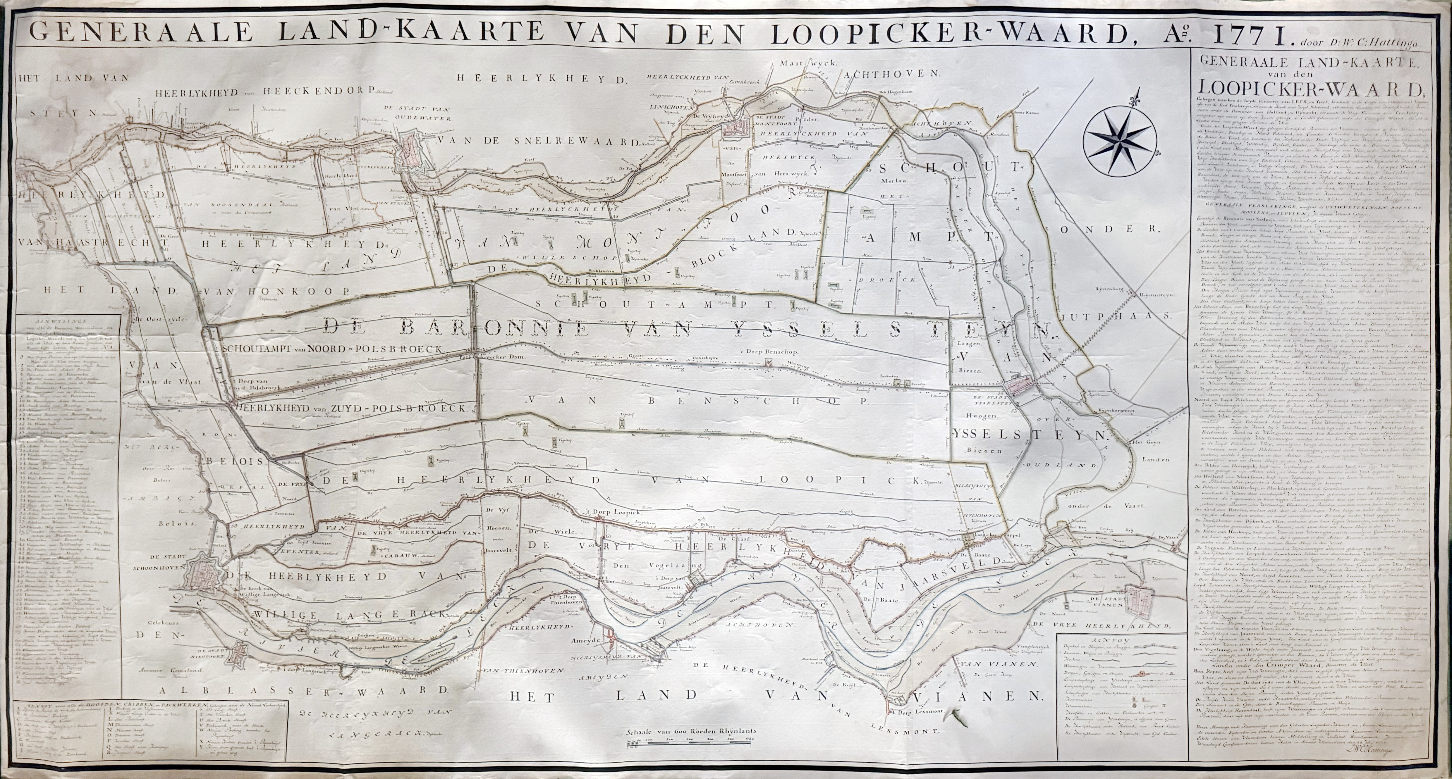
LOW COUNTRIES -- HATTINGA -- "GENERAALE LAND-KAARTE VAN DEN LOOPICKER-WAARD A° 1771". 1772. Manuscript map by D.W.C. Hattinga. 90,5 x 168 cm. On 3 conjoined sheets of paper w. green velvet trim along outer borders. (Left upper corner a bit stained, lower right outer margin a bit frayed, trim loose/a bit dam. in places, but in v.g. condition).
Fine and decorative manuscript map ('waterstaatkaart') - made in 3 copies only! - of the Lopikerwaard with ample "Aanwysinge van alle de Boesems, Watermolens, en Sluysen der Uytwateringen van den Lopicker-Waard" and detailed water management descriptions of the area. The Dutch surveyor-engineer David Willem Carel Hattinga (1730-1790), son of the physician & cartographer Willem Tiberius Hattinga (1700-1764), surveyed this map in September & October 1771. The scale of the map is “600 Roeden Rhynlants”(=ca. 1:16.000). - Cf. M. Donkersloot-de Vrij. In: Caert-Thresoor 15 (1996), p. 23; Koeman, Geschiedenis van de kartografie van Nederland, p. 155 and Fockema Andreae/ Van ’t Hoff pp. 71-72.€ 2000
uitslag € 2200
Terug