Kavel 992
992
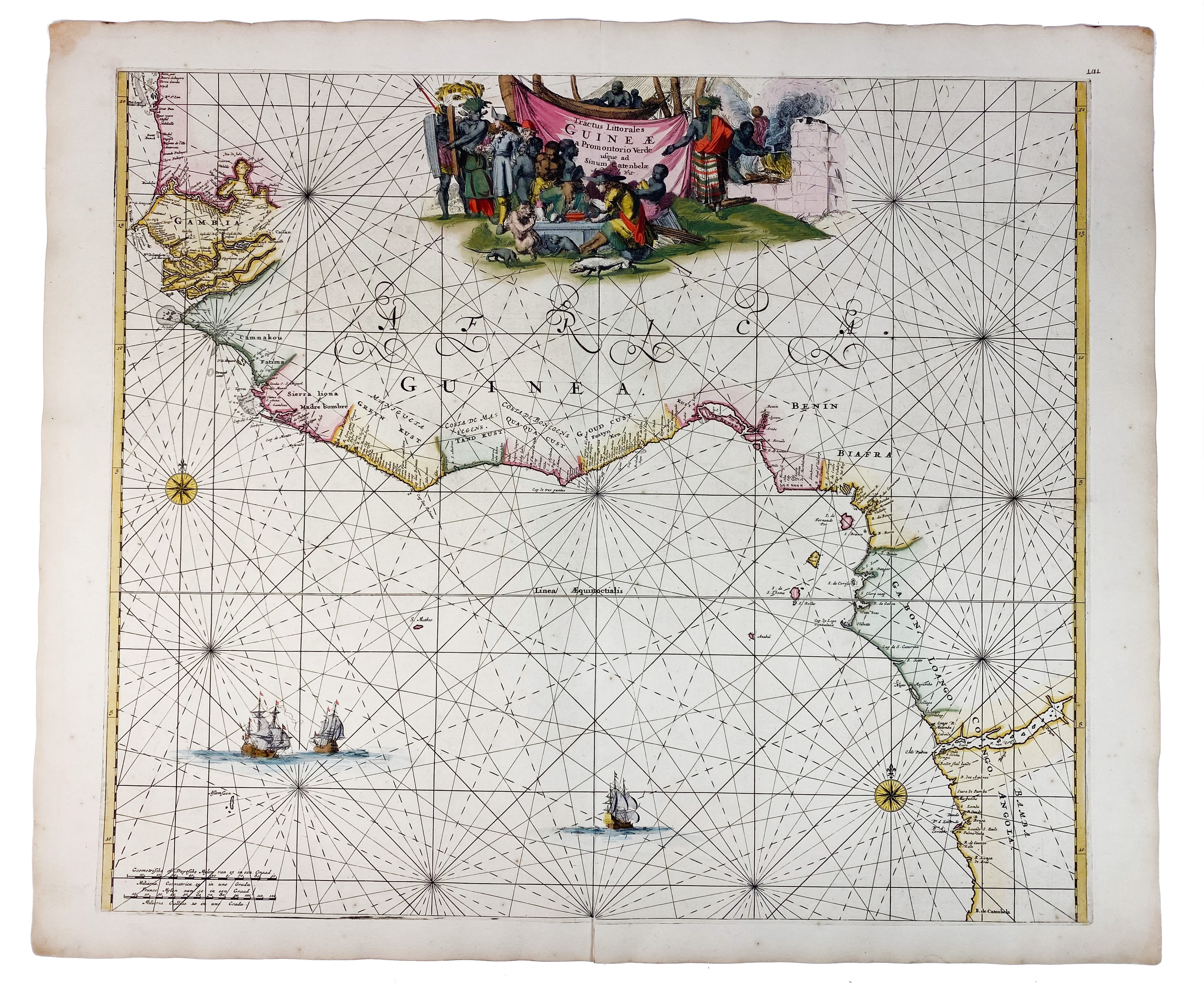
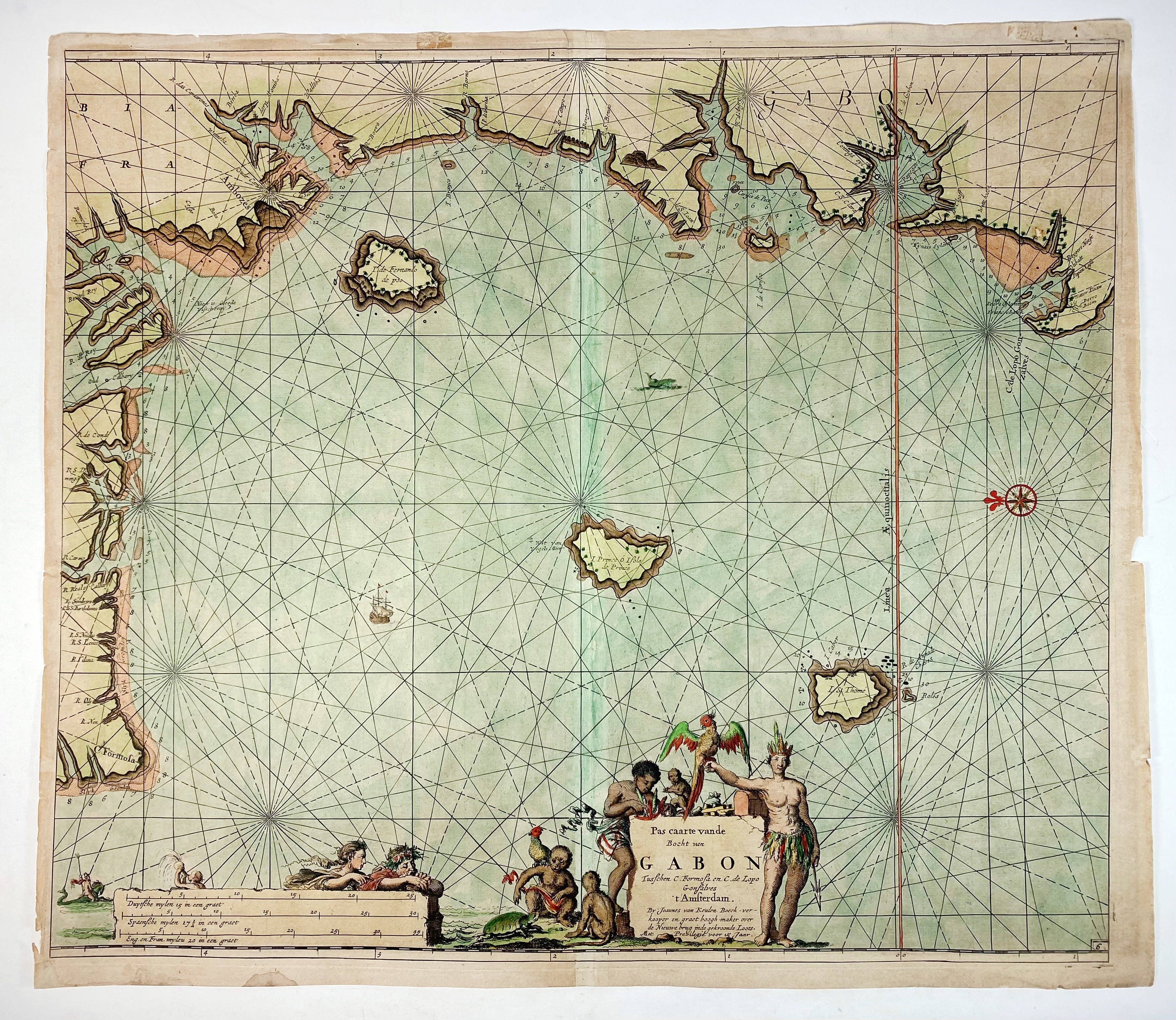
SEA CHARTS -- "TRACTUS LITTORALES Guineae a Promontorio Verde usqua ad Sinum Catenbelae." (Amst.), F. de Wit, (c. 1680). Handcold. engr. chart, w. large allegorical cartouche. 490 x 568 mm. (Fold split at the bottom). -- Added: "PAS CAARTE van de Bocht van Gabon". Amst., J. v. Keulen, (1683). Handcold. engr. map. 500 x 580 mm. (Small tears/dam./stains to margins, browned). -- (2).
Ad 1: Attractive chart of the west coast of Africa, from Angola northwards to the Gambia. - Verso blank.€ 180
uitslag € 140
Terug