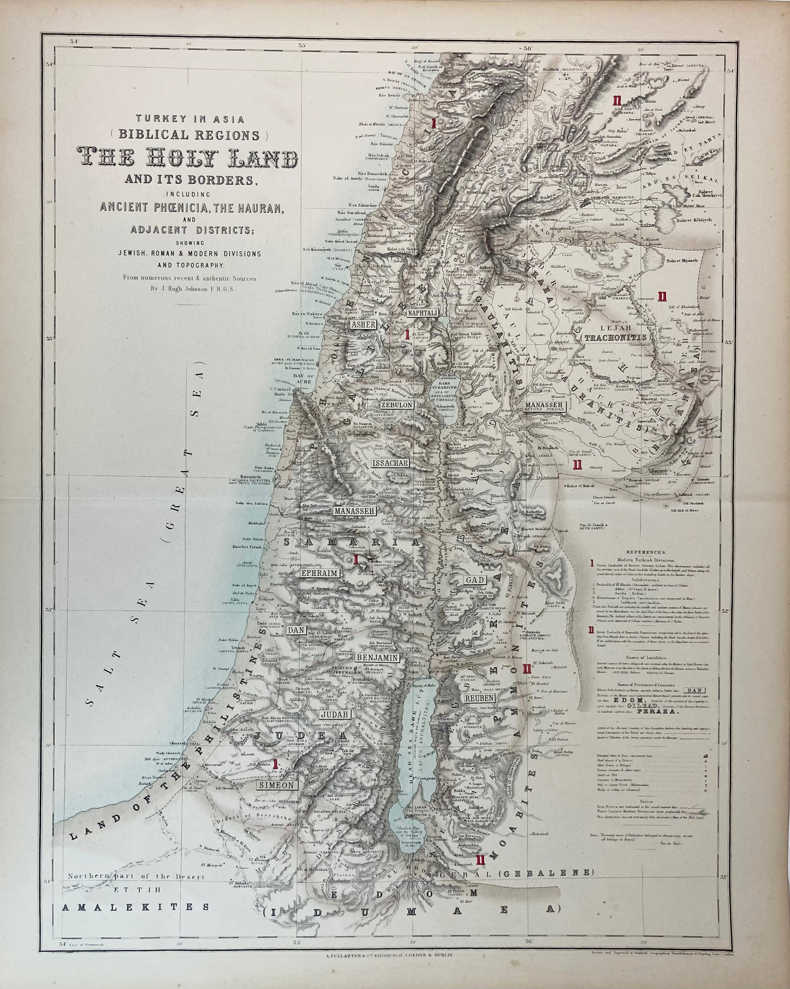
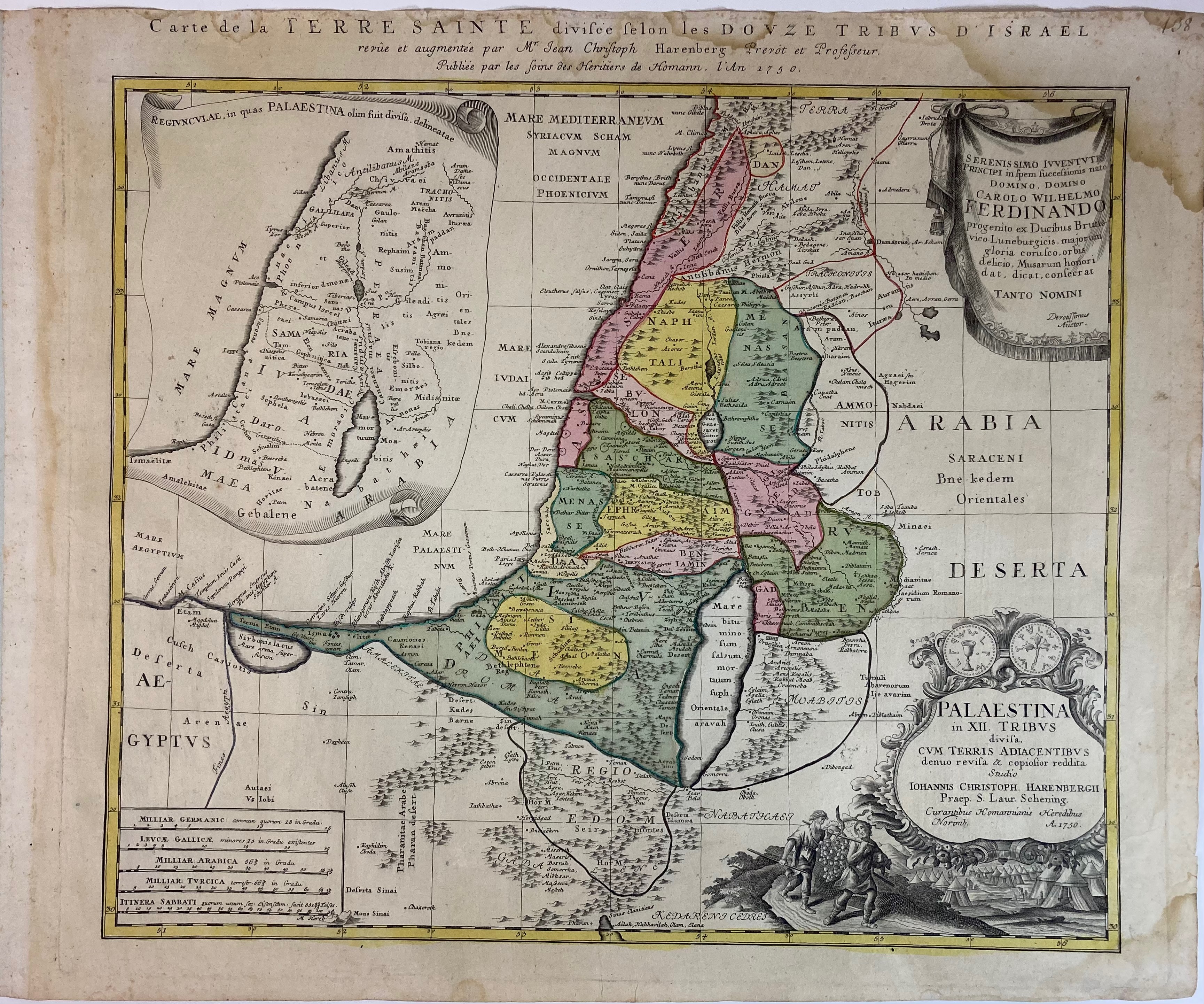
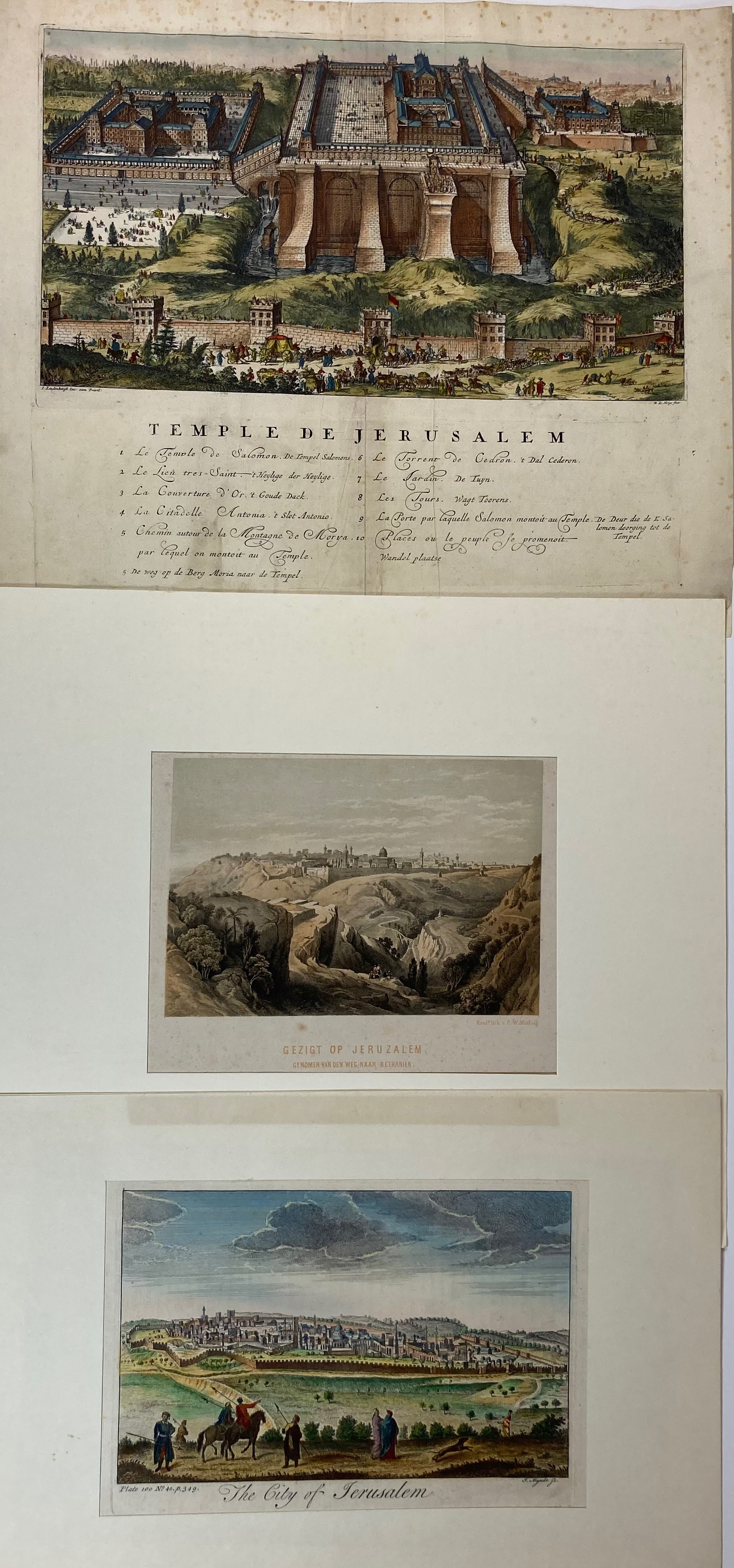
NEAR EAST/MIDDLE EAST -- "TURKEY IN ASIA (Biblical Regions) the Holy Land and its borders, incl. Ancient Phœnicia, the Hauran, and adjacent Districts: (…)". Edinb., (etc.), A. Fullarton, n.d. (1855). Steel-engr. map, w. sparse colouring. 535 x 410 mm. Central horizontal fold. -- Added: "CARTE DE LA TERRE SAINTE divisée selon les Douzes Tribus d'Israel, revûe et augm. p. J.Chr. Harenberg (…)". Nuremb., Homann Heirs, 1750. Engr. map. in cont. colouring. 507 x 577 mm. (Upper margin stained and cut close to plate edge). -- "THE CITY OF JERUSALEM". (18th c.). Engr. by J. Mynde., cold. by hand. 180 x 258 mm. -- "GEZIGT OP JERUSALEM, genomen van den weg naar Bethaniën". Tinted lithogr. by C.W. Mieling. 144 x 211 mm (image size). -- "TEMPLE DE JERUSALEM". (Amst., Lindenbergh, c. 1702). Engr. by R. de Hooghe, cold. by hand. 320 x 370 mm (incl. engr. caption). -- And 6 related prints. (11).
€ 300
uitslag € 240
Terug