Kavel 591
591
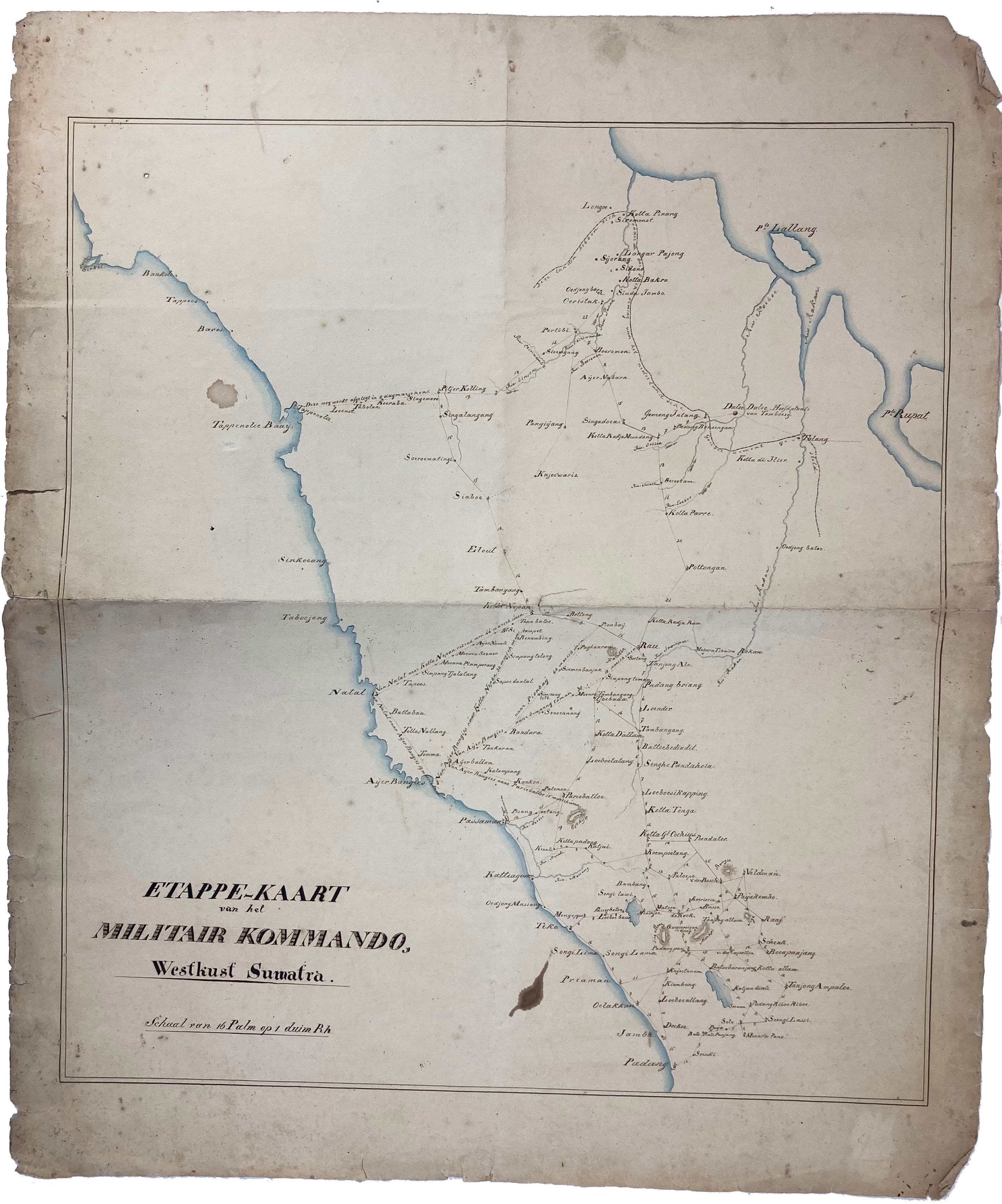
MALAY ARCHIPELAGO -- SUMATRA -- "ETAPPE-KAART van het Militair Kommando, Westkust Sumatra. Schaal van 16 Palm op 1 duim Rh". N.d. (1830's?). Anonymous manuscript map in ink and colour wash. 480 x 435 mm. (Margins a bit chipped/brittle, two small stains in image, but in good condition).
Detailed military map of Sumatra drawn by a member of the Dutch Military Command of the area between Padang and Kotta Pinang with i.a. information on the length of marches.€ 150
uitslag € 550
Terug