Kavel 578
578
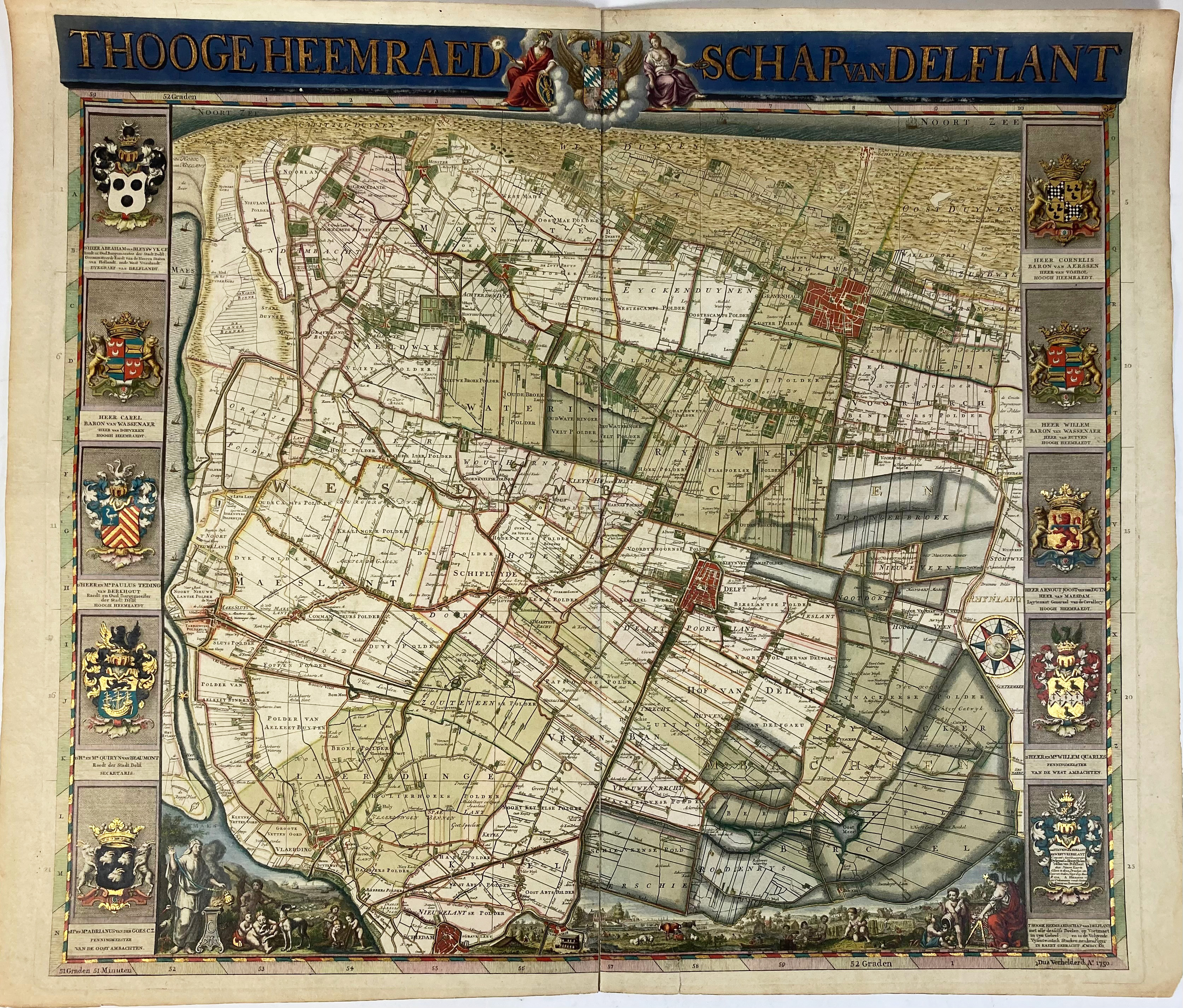
LOW COUNTRIES -- "THOOGE HEEMRAEDSCHAP van Delflant". N.pl., 1712-50. Engr. plain general map of polder district 'Delfland' by Van Anse, Doesburgh, (a.o.) after N. & J. Kruikius w. engr. title in top border and w. 5 fine engr. coats of arms by P. Haringh on each outer side, all in very handsome cont. colouring and richly heightened w. gold. 520 x 580 mm. (Central fold 'rep.' on v° w. adhesive tape, small tear running into image visible in lower right margin).
Fine map embellished with several allegorical figures and small views, representing lots of details on a scale 1:45,000. With fine compass-rose (with a globe in the centre!). Strong impression of the 2nd, augmented, edition from 1750 which was published by I. Tirion. - Donkersloot-de Vrij 806 note.€ 500
uitslag € 1100
Terug