Kavel 552
552
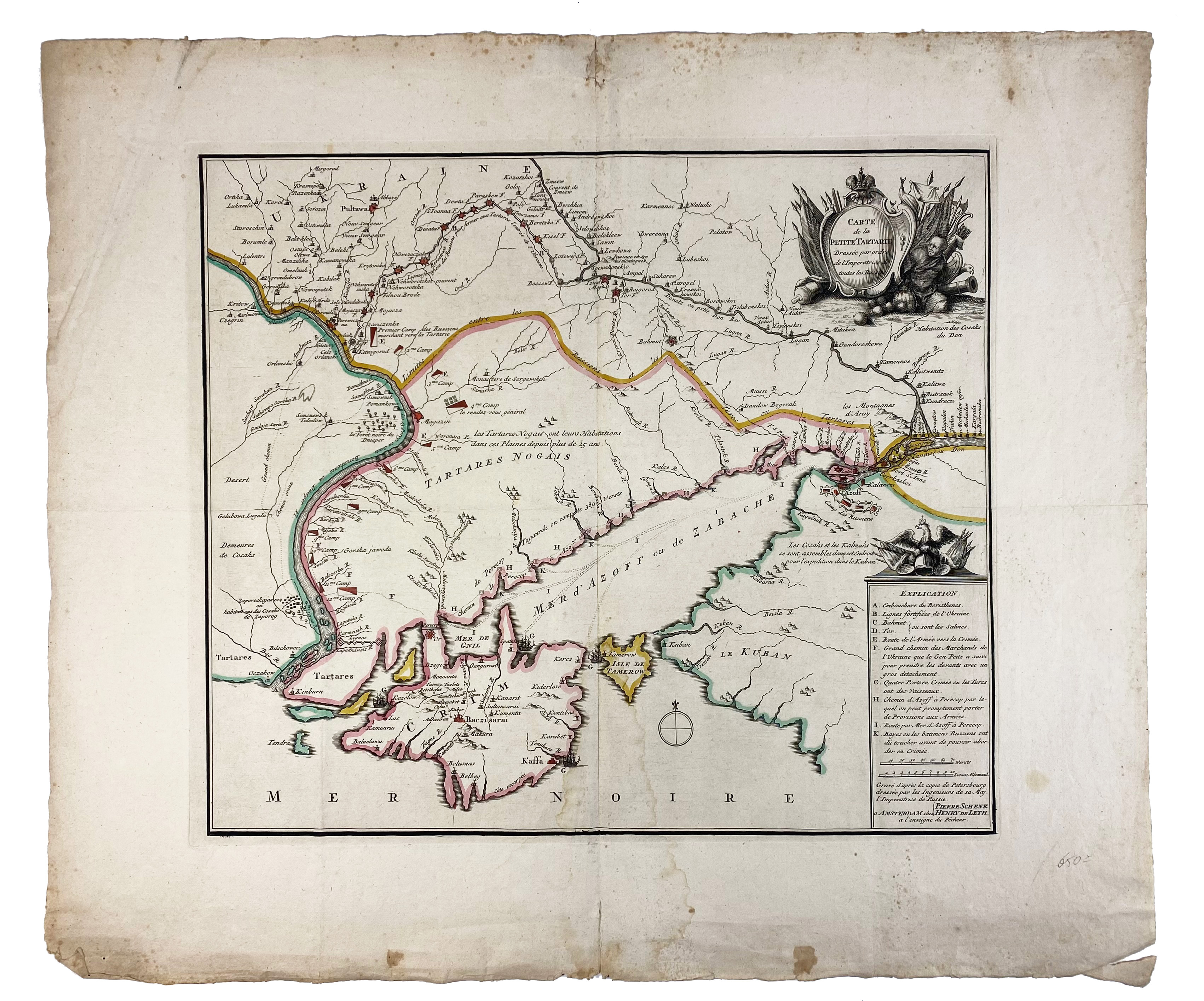
EASTERN EUROPE -- UKRAINE -- "CARTE DE LA PETITE TARTARIE Dressée par ordre de l'Imperatrice de toutes les Russies. Amst., P. Schenk, (c. 1785). Engr. map of the Southern/Eastern part of Ukraine, cold. in outlines. 420 x 483 mm. (Margins split/dam. at ends of fold, lower inner part faintly stained, margins a bit foxing, small rep. on v°, but margins are very ample). -- And 1 o. (a bit dam.). (2).
Very rare first edition of De Leth's map of the southern part of Ukraine, with detailed annotations regarding the Cosaks and an explanatory key. Based on a Russian map, this appears to have been drawn after Russia's annexation of the Crimean Khanate in 1783.€ 160
uitslag € 300
Terug