Kavel 527
527
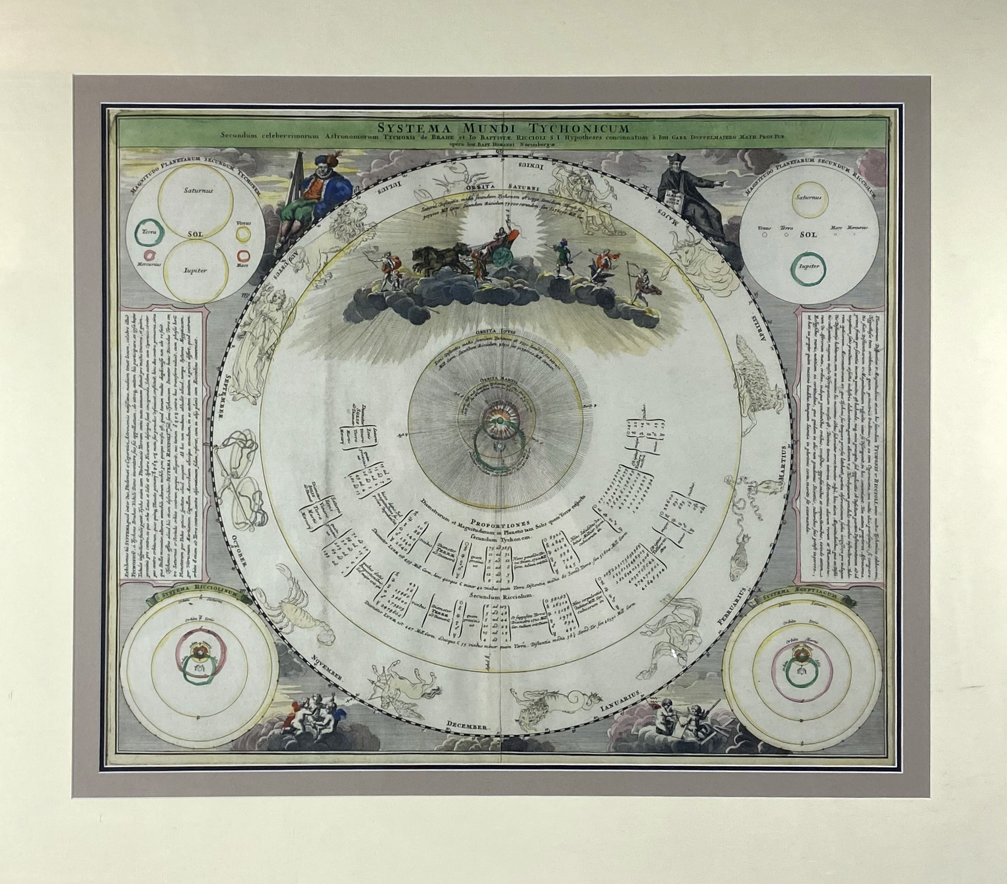
CELESTIAL CHART -- "SYSTEMA MUNDI TYCHONICUM". Nuremburg, J.B. Homann, (c. 1740). Engr. celestial map, cold. by hand. 490 x 580 mm. Framed and glazed between 2 glass plates. (Some marg. stains (visible on v°), uninspected out of frame, but in fine condition).
The map represents the Tychonic system of the World, that Tycho Brahe introduced in 1577 in order to maintain the central position of Earth and to give an exact description of the celestial motions. From the 'Atlas Coelestis' by Doppelmayr.€ 300
uitslag € 320
Terug