Kavel 521
521
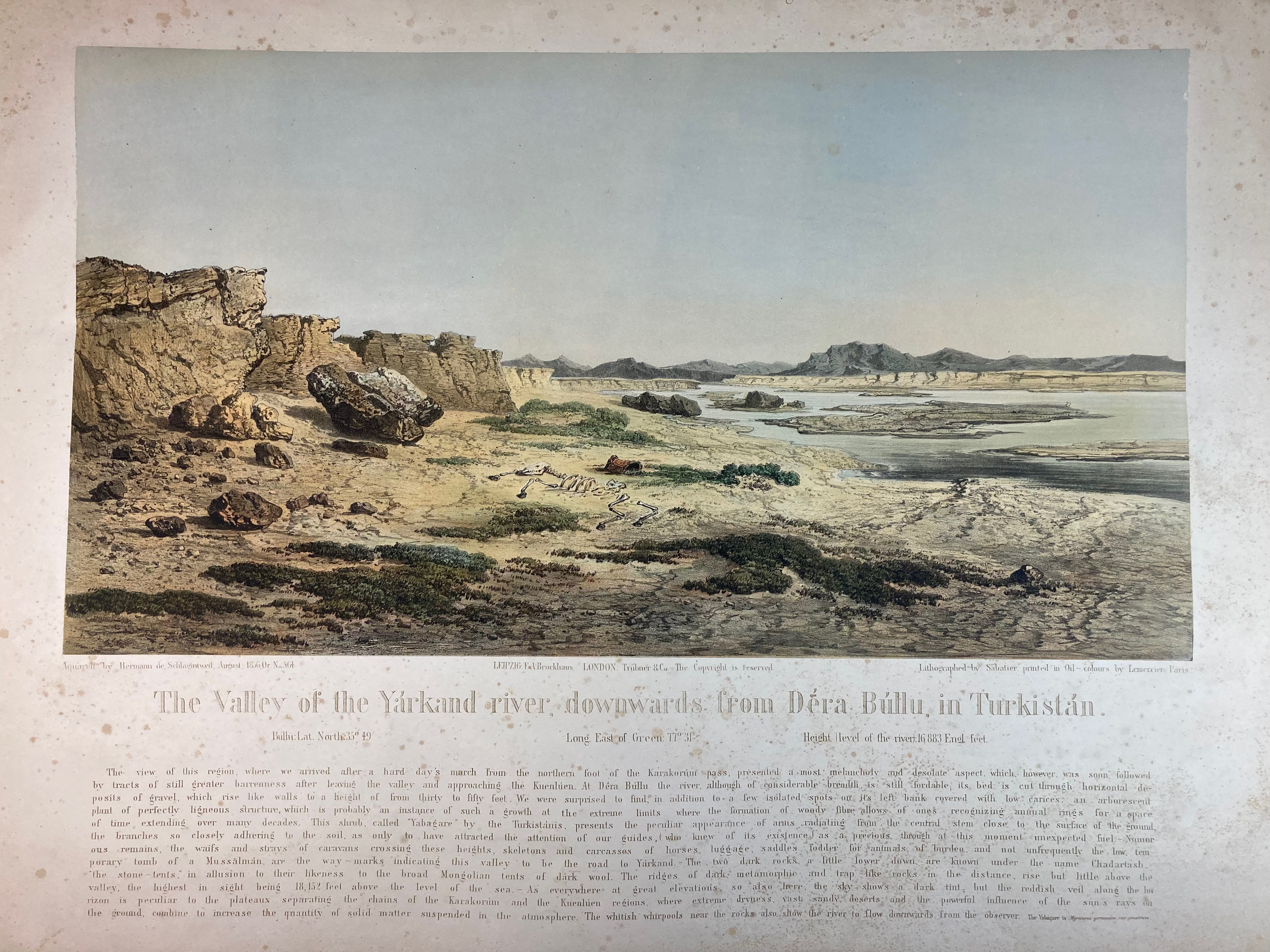
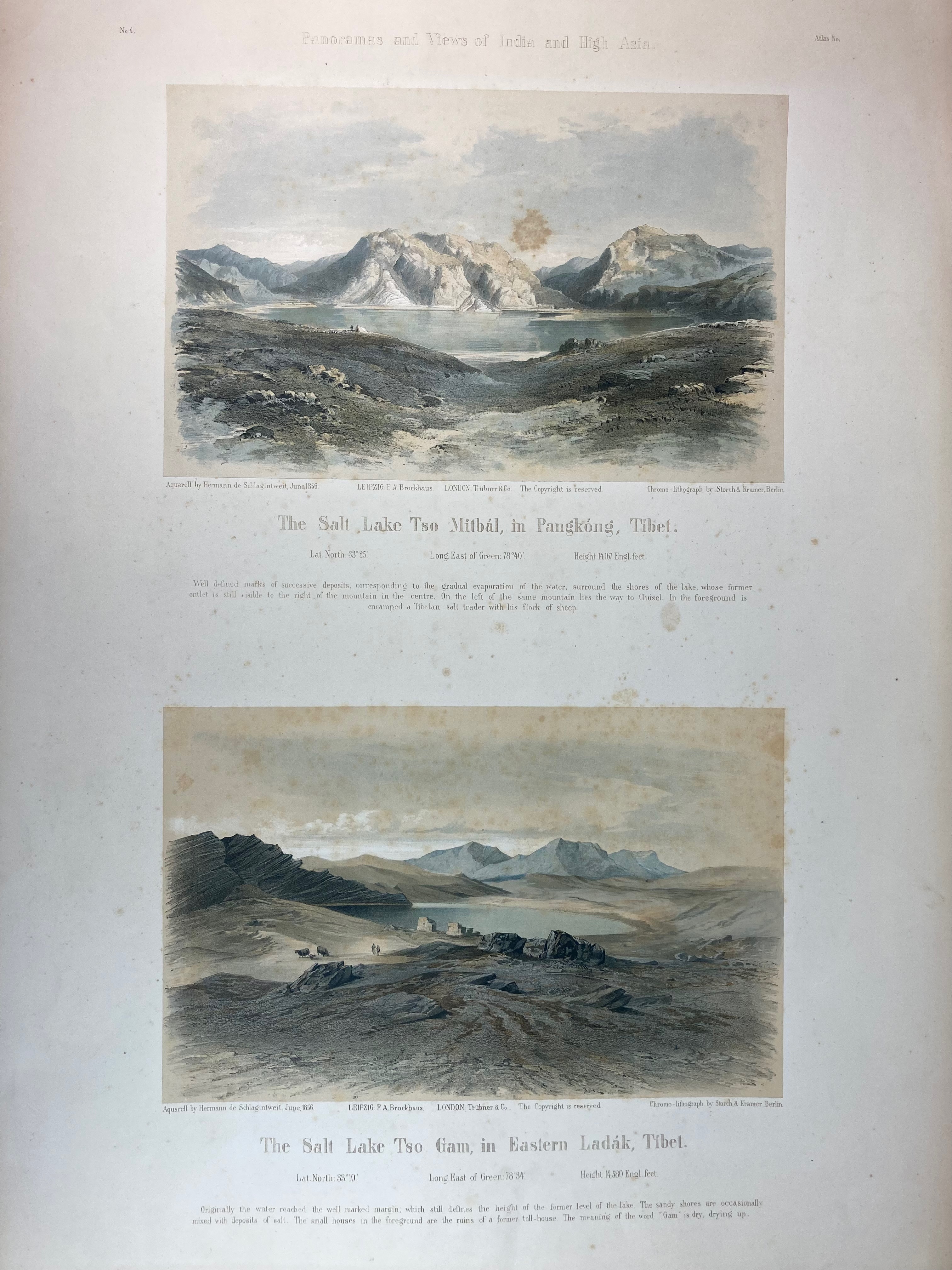
ASIA -- TIBET -- "VALLEY OF THE YÁRKAND Tiver, The, downwards from Déra Búllu, in Turkistan." - "SALT LAKE TSO MITBÁL, The, in Pangkóng, Tibet/The salt lake Tso Gam, in Eastern Ladák, Tibet." - Lpz./London, Brockhaus/Trübner & Co., 1860's. 3 chromo-lithogr. views on 2 lge-fol. plates, w. captions in English. 240 x 380 and 345 x 625 mm (image sizes). (Margins split/chipped in places, a bit browned/foxed). -- Added: 6 o. maps of parts of Asia (incl. Bhutan), i.a.deriving from 'Atlas universel de geographie physique, politique, statistique et mineralogique, (…), dressé par Ph. Vandermaelen'. (1827). -- (8).
Ad 1: Rare plates, taken from: A. Hermann & R. Schlagintweit. 'Results of a scientific mission to India and high Asia: undertaken between the years MDCCCLIV and MDCCCLVIII, by order of the court of directors of the Honorable East India Company. With an atlas of panoramas, views and maps'. Leipzig & London, F.A. Brockhaus/Trübner & Co., 1861-66.€ 200
uitslag € 160
Terug