Kavel 506

506
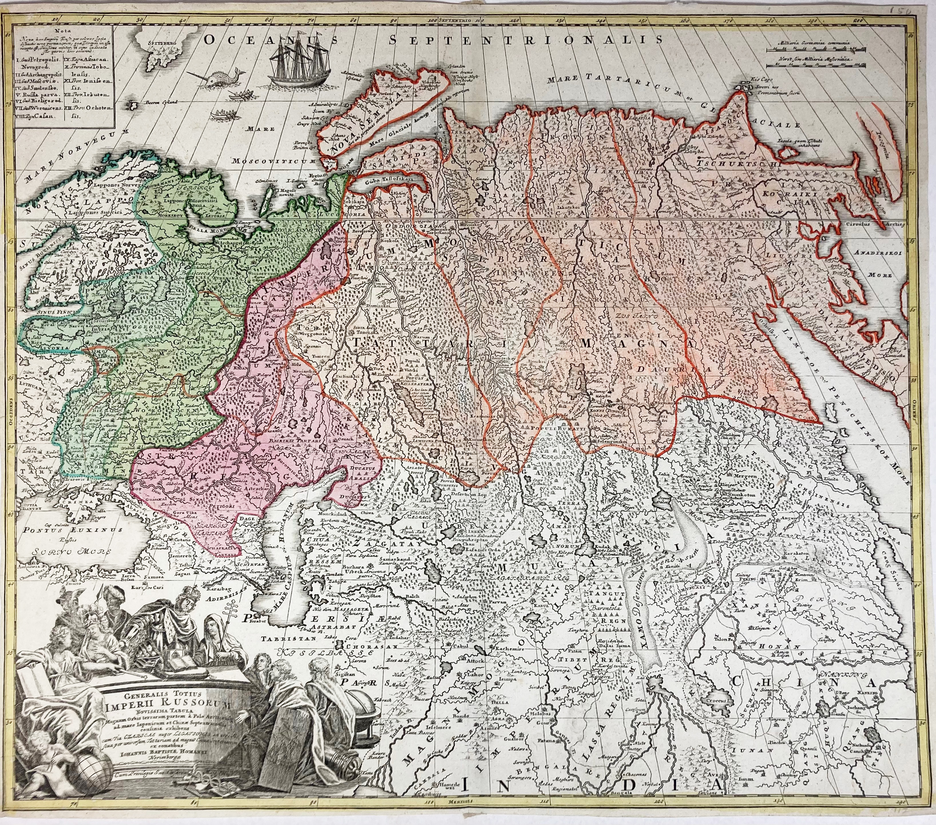
ASIA -- "GENERALIS TOTIUS IMPERII RUSSORUM Novissima Tabula (…)". Nürnberg, J.B. Homann, n.d. (c. 1715). Engr. map in cont. colouring. 483 x 565 mm. (Margins short). -- Added: "BRITISH EMPIRE Throughout the World Exhibited in One View". Edinb., (etc.), A. Fullarton & Co., (c. 1860). Engr. cold. world map representing the British Empire (possessions cold. red), inhabitants depicted in 2 wide bands at the top and bottom engr. by A. Thom. 426 x 525 mm. -- And 6 o. maps. (8).
€ 160
uitslag € 260
Terug