Kavel 494
494
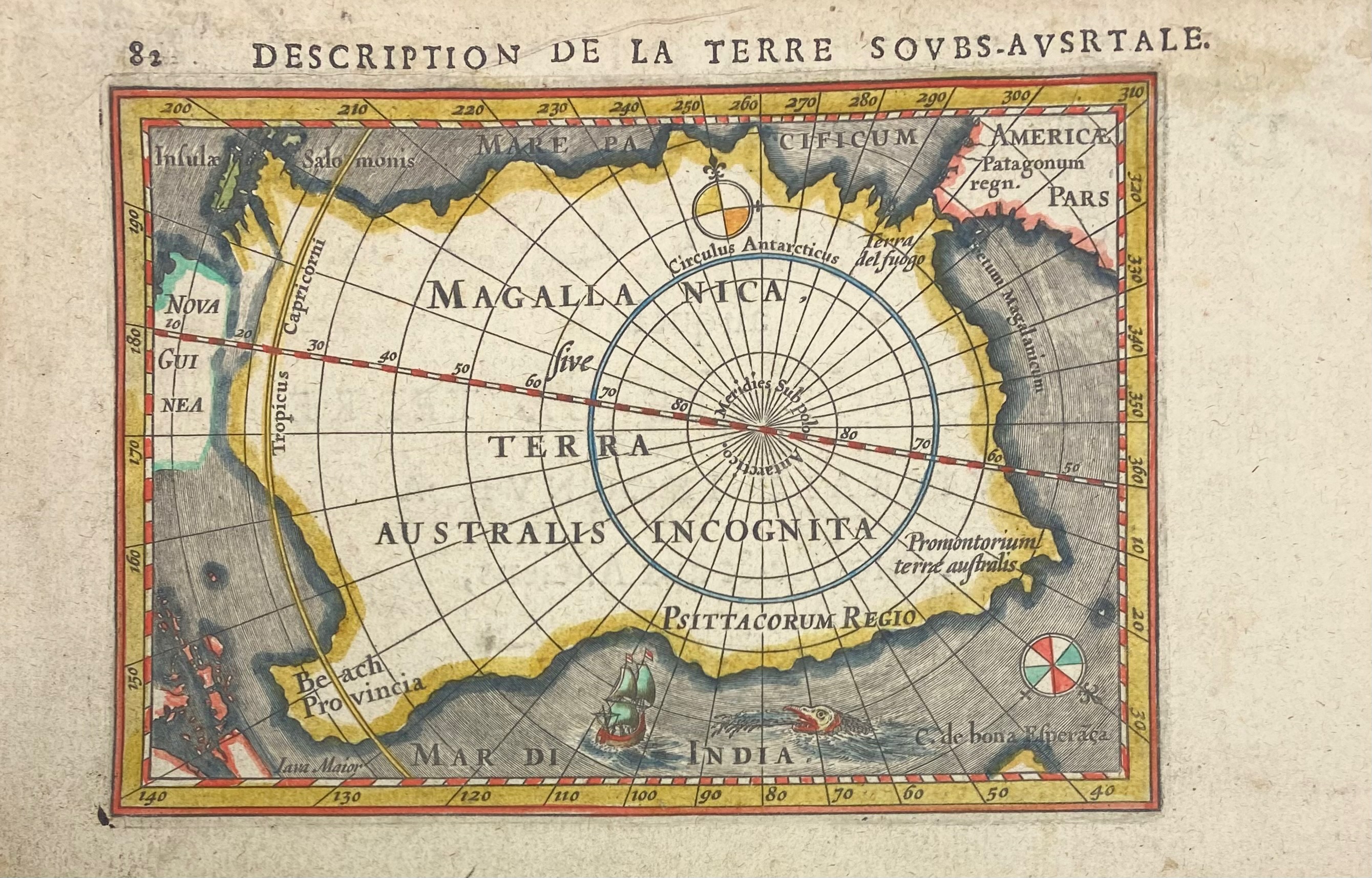
ANTARCTICA -- "DESCRIPTION de la Terre Soubs-Australe" (sic!). Amst., J. Hondius, (1618). Engr. map, cold. by hand, with title in French on v°. 97 x 135 mm. (paper size 117 x 180 mm.). (Hinges from previous mount present on v°).
Engraved map of the South Polar unknown lands, with sailing ship, sea monster and two compass roses. This was one of the first maps to focus on the South Pole. From Bertius' "La Geographie Racourcie". - V.d. Krogt IIIA, 342:11 (plate 10, p. 451) (0030:342).€ 400
uitslag € 450
Terug