Kavel 695
695
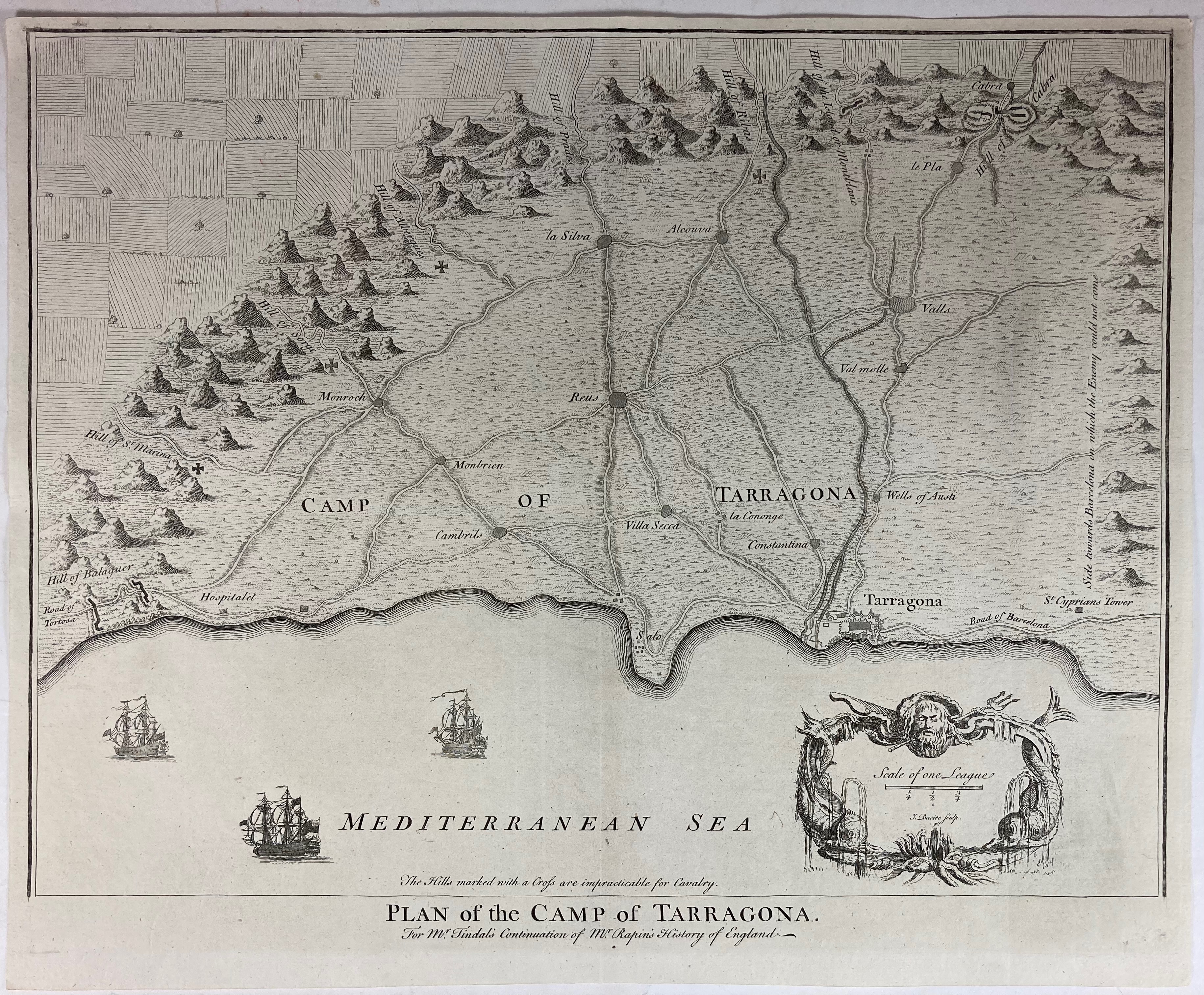
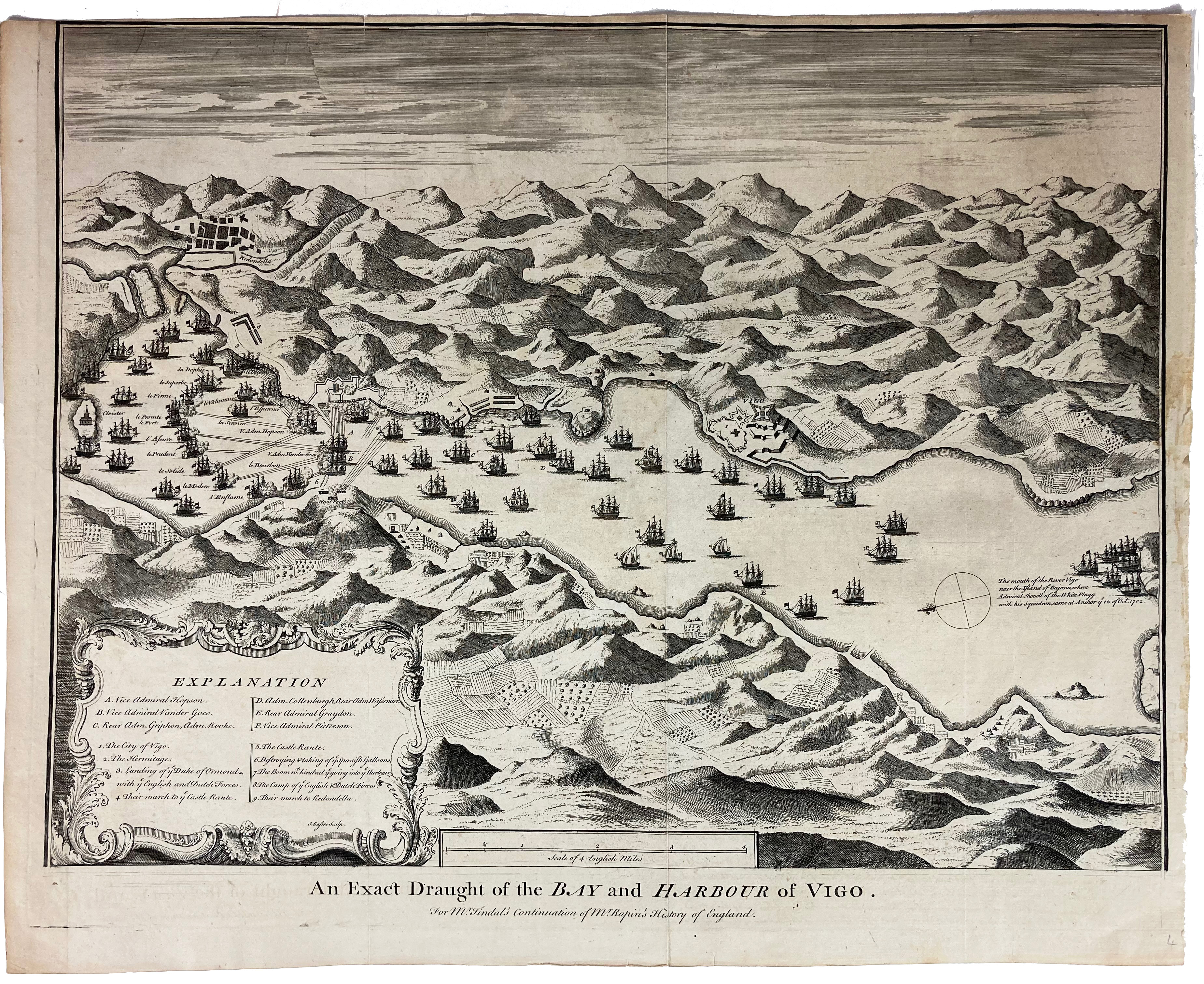
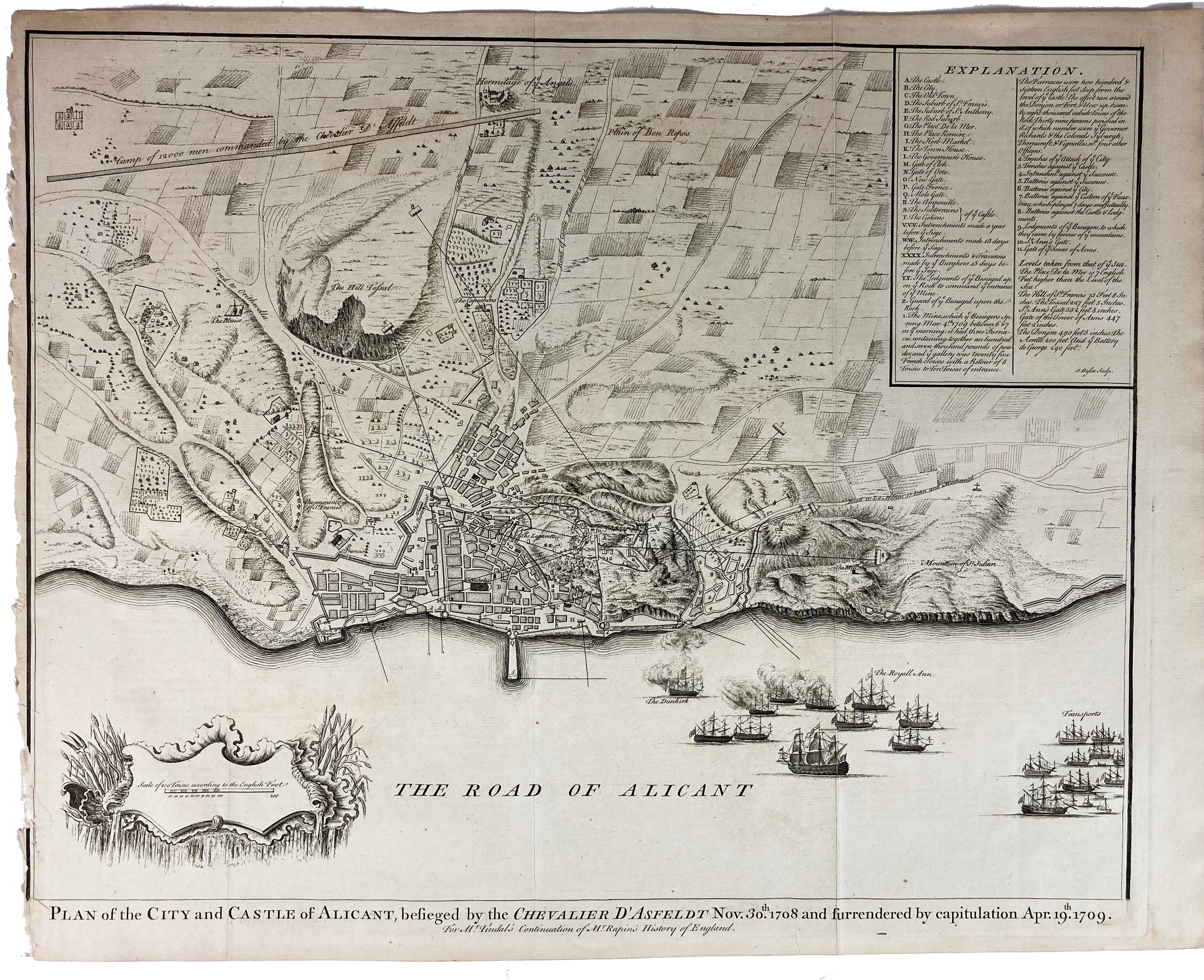
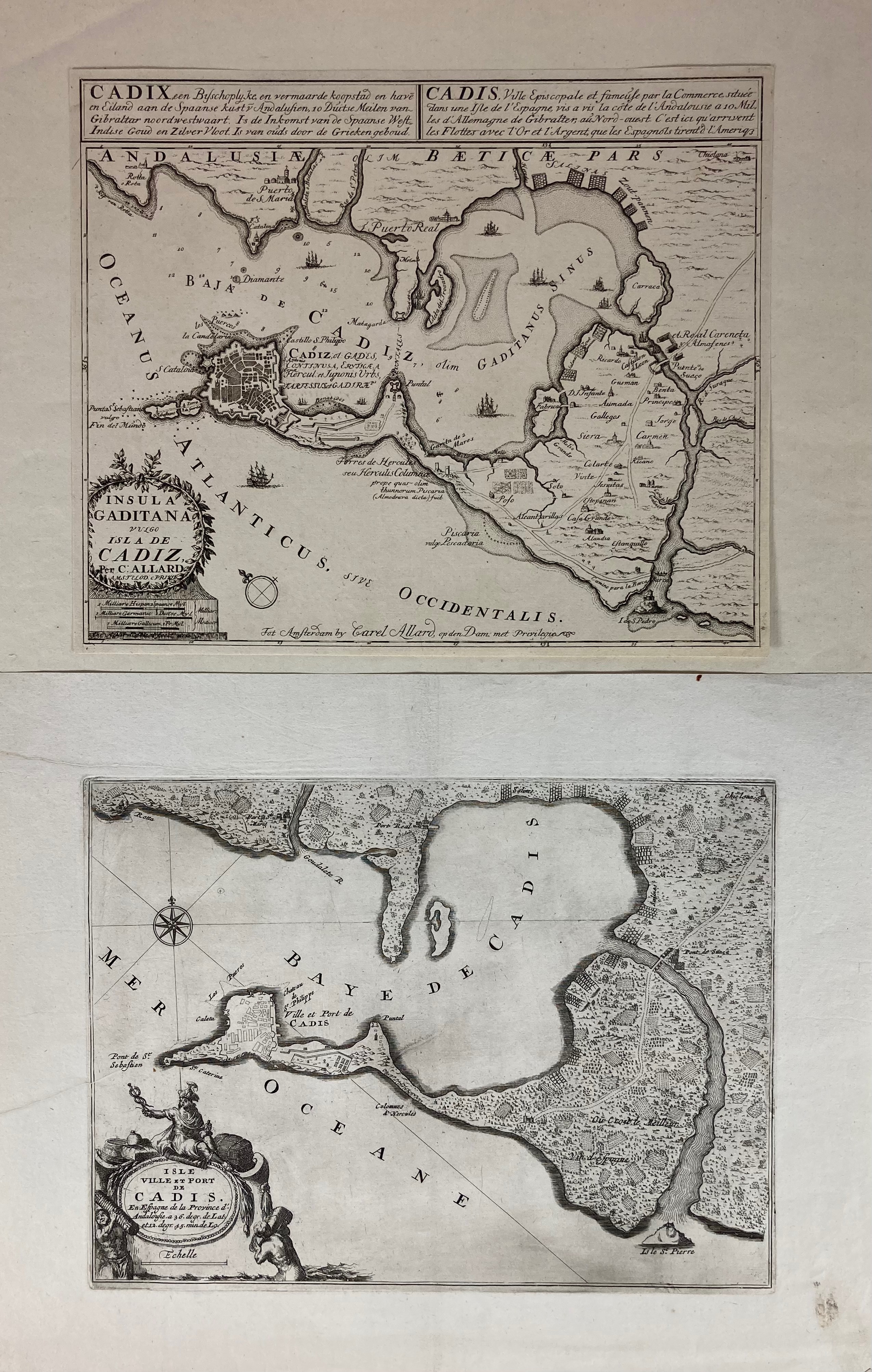
SPAIN -- "PLAN OF THE CAMP OF TARRAGONA" - "AN EXACT DRAUGHT of the Bay and Harbour of Vigo" - "PLAN OF THE CITY AND CASTLE OF ALICANT, besieged by the Chevalier D'Asfeldt, (…)" - (London, 1745). 3 engr. maps by J. Bassire, taken from the atlas to 'Tindal’s Continuation of Mr. Rapin's History of England'. 390 x 475 mm each. (The last of the three mentioned w. a defective lower left margin). -- Added: "INSULA GADITANA vulgo Isla de Cadiz". Amst., C. Allard, n.d. (c. 1700). Engr. map of Cadiz and surroundings. 237 x 282 (paper size). (Margins cropped to plate size). -- And 2 o. (6).
€ 180
uitslag € 140
Terug