Kavel 667
667
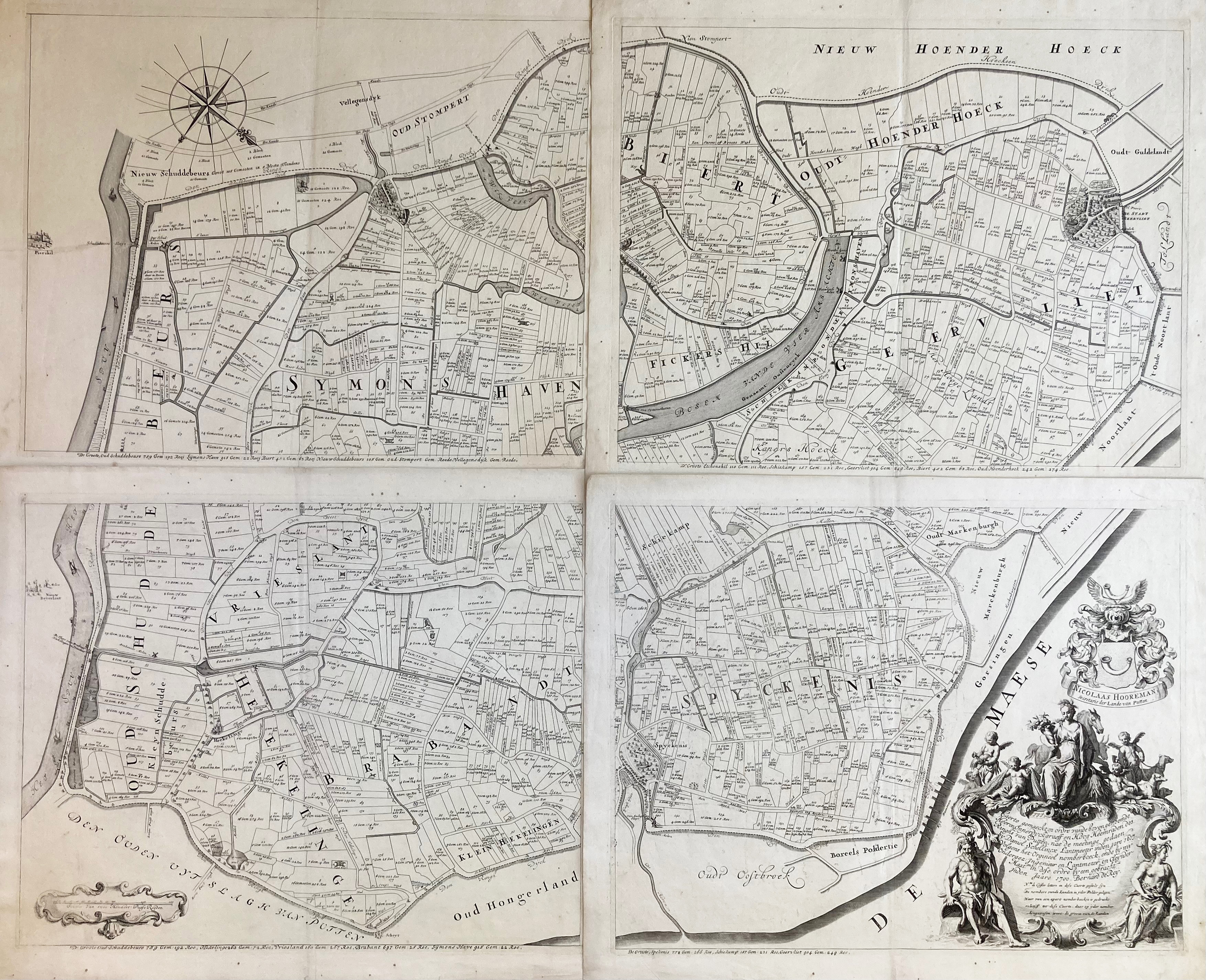
LOW COUNTRIES -- "CAERTE (…) DES RINGHS VAN PUTTEN, nae de meetinge gedaen by D. Schellincx Lantmeter inden jare 1617. Volgens het Origineel nomberboeck ende by my (…) B. de Roij". N.pl., n.d. (between 1701 and 1774). 'Polder map', consisting of 4 engr. maps by G. v.d. Gouwen & (Gerard?) Hoet, which form - conjoined - a large wall map of 98 x 126 cm. W. elaborate cartouche in the lower right corner, scale indicator, coat of arms of N. Hooreman and compass rose. (Each individual plate w. vertical fold which is hardly noticeable).
In very good condition. Donkersloot-de Vrij 280 distinguishes 3 editions (1701, 1738 and 1774), without however giving features to identify the different editions.€ 200
uitslag € 0
Terug