Kavel 633

633
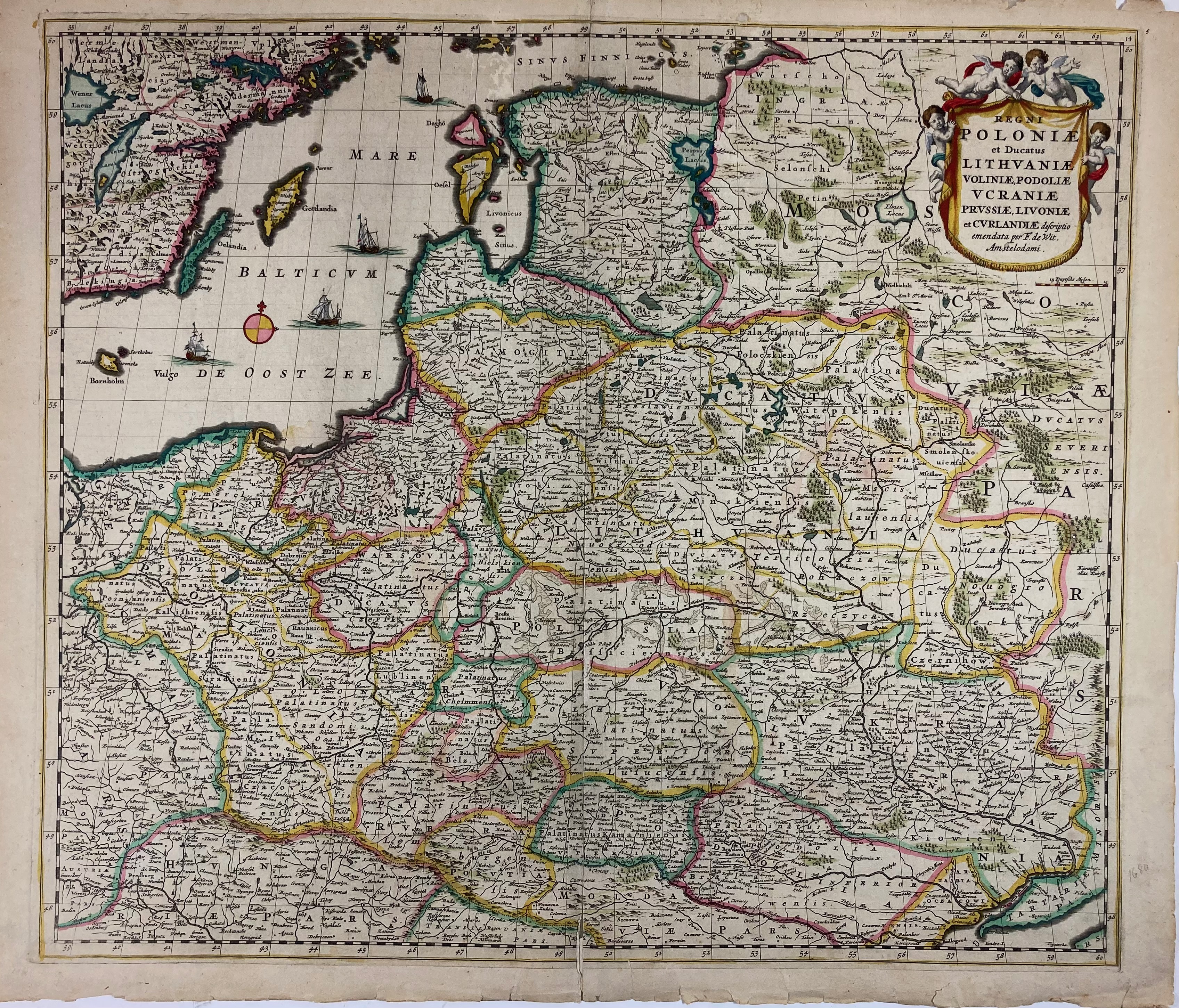
EASTERN EUROPE -- POLAND -- "REGNI POLONIÆ et Ducatus Lithuaniæ, Voliniæ, Podoliæ, Ucraniæ, Prussiæ, Livoniæ et Curlandiæ descriptio". Amst., F. de Wit, (c. 1680). Engr. map of Poland in cont. colouring. 490 x 561 mm. (Margins a bit frayed, some rep. in places, unobtrusive skimming by silver fish in upper part). -- Added: the same map published by De Wit, but uncoloured. -- (2).
€ 300
uitslag € 650
Terug